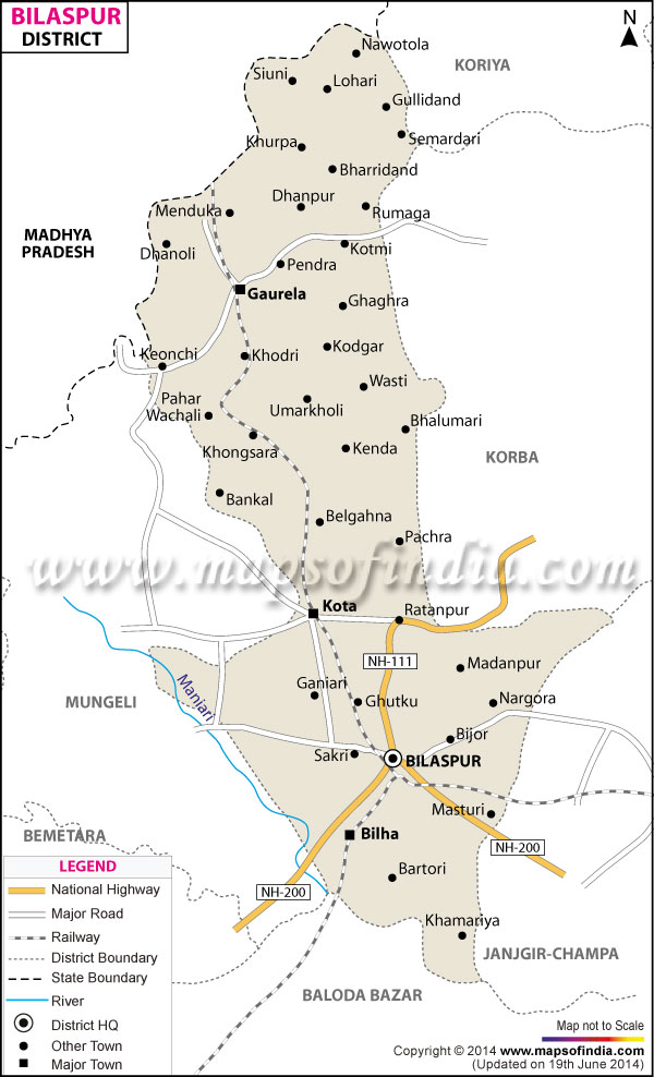
Bilaspur district is located in the eastern part of
Chhattisgarh. It is situated within latitude 21°47' to 23°8' and longitude 81°14' to 83°15'.The total area of Bilaspur is approximately 6,377 Sq km.
Recently, the district is being divided into New Bilaspur, Korba and Janjgir-Champa.
The total population of Bilaspur is 16, 948,83, among which 8,59,027 is male and 8,35,856 is female, according to the 2001 census. The density of the population in Bilaspur is 266 per sq km.
The tourist spots of Bilaspur that are important for their natural beauty or historical significance are:
- Ratanpur
- Mallhar
- Talagram
- Kabir
- Kuthaghat
- Khadia Dam
- Belpan
Last Updated on : February 19, 2026
