|
|||||||||||
 | |||||||||||
|
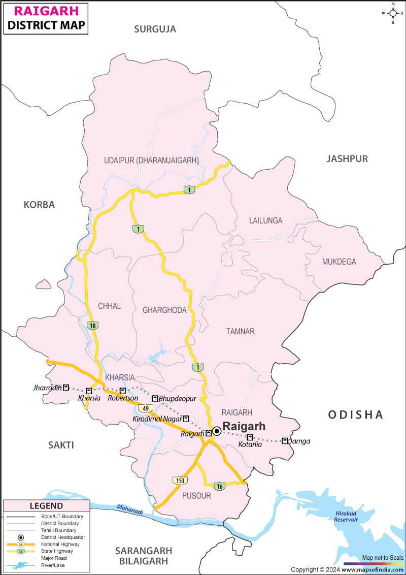
| *Map showing the National Highway, Major roads, other Roads, District Headquarter, Town, etc in the Raigarh District, Chhattisgarh | Disclaimer |
Raigarh is a major district in the state of Chhattisgarh in India. The headquarters of the district is located in the city of Raigarh. The Raigarh District Map offers useful information on the district.
The district is made up of various former princely states of Raigarh, Sarangarh and Dharamjaigarh.
Like other parts of the state, the climate of Raigarh district in Chhattisgarh is mostly dry. The summer season is mostly warm and dry while the winter season is cool and pleasant. The ideal time for traveling to Raigarh is during the autumn and winter seasons when the weather is fine.
Raigarh district is a popular tourist spot. Raigarh district road map offers information about the location of the tourist spots as well as major road networks in and across the district. A number of sightseeing tours are offered by the local tourist board and the travel agencies.
Accommodation is easily available in Raigarh at reasonable rates. There are a number of hotels in Raigarh which offer comfortable lodging facilities and services. Most of the hotels can be reached conveniently without any hassles.
The nearest airport is located in the city of Bilaspur. Raigarh is also an important station on the South East Central Railway line and is linked with places like Bhilai, Raipur, Nagpur, Kolhapur Pune, and Mumbai . Road network is also well-developed.
Last Updated on : January 14, 2026