






About
Talking about the district of Chikmagalur. The path starts long before we get to the other side. There are hills replacing roads; the temperature drops; a scent unlike any other permeates the land. Mist carries as it would seem to have a destination of itself, in passing between the trees. Mountains appear, disappear and reappear behind veils of cloud. The embrace of Karnataka's Western Ghats is where Chikmagalur is to be found, not as a piece of paper but as a living, breathing show.
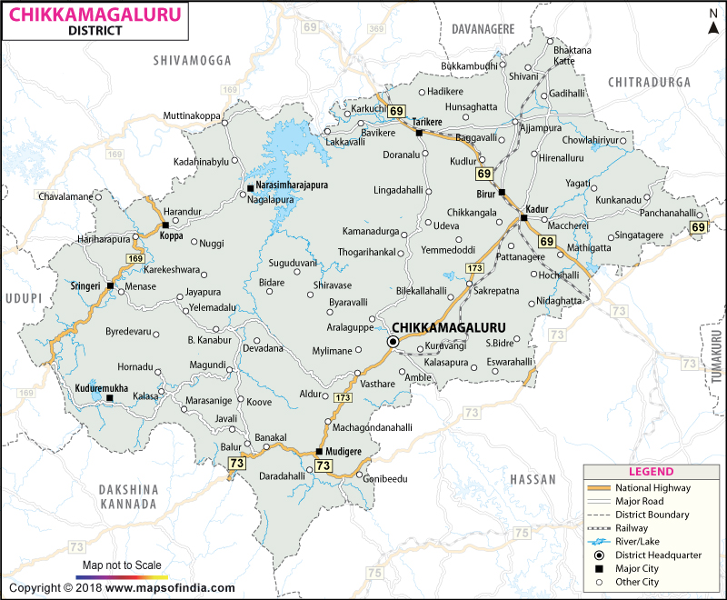
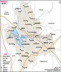
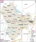
The area of the district is approximately 7,201 sq. km. which lies in a cherished position in the South-West part of Karnataka. Numbers however have difficulty capturing their essence. In these secret valleys, rivers are born. Ancient hills are covered with forests. The peaks stretch upwards to meet the endlessly chattering clouds. Every contour, peak and valley on the Chikmagalur district map is a stroke in the painter's canvas, painting an extraordinary picture.
History & Culture
History is living and dynamic in Chikmagalur. It flows through the courtyards of temples. Resounds from rocks with age. It floats on mountain passes, where legends still live.
Before the advent of modern division, strong empires ruled over this territory. The Kadambas arrived. The Gangas followed. The Chalukyas were the makers of the political landscape. Then there were the Hoysalas who could write poetry with stones. The few remains of each era were spread across, as seen on the Chikmagalur district map, and together they created the cultural legacy of each era.
If there's one story to beat all others, it's Baba Budan's. So quiet and insignificant was it that no one in the seventeenth century could foresee its impact. The celebrated Sufi saint brought seven coffee beans back when he came back from the Holy Land of Arabia. The beans were discovered in the mountains today, known as Baba Budangiri. From this simple start came an agricultural revolution. The hills as seen on the Chikmagalur district map were the birthplace of Indian coffee, not only for the future of Chikmagalur district but also for the destiny of the Indian people and Indian Coffee.
The district becomes a theatre of colour and a celebration during the festivals. On the day of Ugadi, the home is given a fresh beginning with optimism. Dussehara comes in great majesty. The festival of Deepavali lights up the very small and large towns and villages, and the fairs take place to unite the people and celebrate as a community with great devotion and cheer.
The story of the food is a story in itself. Rice, coconut, spices and locally produced food add a variety of flavours, reflecting the district's rich agricultural output. Or, always there on the sidelines, waiting patiently, packets of coffee, each with all the history of centuries. This is a culture not put behind glass. It lives.
Economy
Factories are a crucial part of the economies in many areas. Alongside mountains, they are constructed in Chikmagalur. The economic narrative of the district starts at the foot of the slopes, where the clouds meet, and at the rolling slopes of the fertile valleys. It was a beginning in nature and a result of generations of efforts, resulting in prosperity.
The best symbol of this good fortune is coffee. The plantation is seen after the plantation across the highlands, depicted on the Chikmagalur district map which heads towards the far ridges. Humid fragrance fills the air and whole hillsides are adorned with fine white flowers during the flowering season. The harvest season is quite other kind of energy. Employees roam the estates, baskets brimming with cherries, and the district's most iconic heritage product starts its journey to markets around the globe.
Coffee creates jobs in large numbers. Thousands of people depend on the cultivation, harvesting, processing, transportation, and export of these goods. But this is just one part of the much larger economic story of coffee. On the plantation, pepper vines are found growing on the plantation trees. Cardamom grows in sunlit areas. Arecanut plantations flourish. The agricultural base continues with shimmering paddy fields with corn and horticultural crops, adding to the other diversity. The green patches one can refer to from a Chikmagalur district map, which represent the fertile ground, help keep agriculture vital in rural areas.
Another foundation to support economic stability is provided by the Government such as schools for children and hospitals form a part of the public health infrastructure. Development projects extend even into the most distant settlements and are supervised by administrative institutions. The Government services have resulted in opportunities and have enhanced the quality of life across the Chikmagalur district.
The Public Sector has been instrumental in the transformation, too. Economic resilience is improved by irrigation projects, forest management and infrastructure development programmes. In particular, the Bhadra Reservoir Project provided a major boost to the agricultural potential of neighbouring areas, allowing for a more reliable and sustainable agricultural production.
The expansion of the Services Sector goes on at the same time. One of its most promising recent bright spots is tourism. Each year, visitors come to view the mountains, the waterfalls, the forests and the coffee estates. They provide support to hotels and homestays, transport, restaurants and many more businesses.
Other education and healthcare activities have been increasing steadily as well. Banks, retail stores and professionals add additional impetus to the local economy. Coffee curing, food processing, and handicrafts are also small industries that create additional economic activities.
Tourism
But, if it were only beautiful, it wouldn't draw visitors to Chikmagalur. Beauty doesn't account for the fascination this district holds for the imagination. There's more here. An intangible – no one can really describe it. The feeling that each mountain has a tale to tell, each forest a secret, and each meandering path will reveal a discovery just around the corner.
The sight and view of Mullayanagiri often gets travellers speechless. But when one is at its peak, then statistics become nothing more than figures. Clouds drift below. The valleys continue to roll out to the horizon. The world seems vast and intimate, all at once. In the Chikmagalur district map, Mullayanagiri's name could be a geographical feature but when it comes to its feel, it is like a throne designed after its own design of the sky.
Water contributes to a lot of the area's character. The falls of Hebbe are plunging through thick vegetation with great force, sparkling under the nearby forests. Jhari Falls plunges in the midst of coffee estates, all like a painter's scene. In the monsoon, countless small cascades sprout up all over the hills, where entire valleys become celebrations of movement and sound.
Bhadra Wildlife Sanctuary is for those fond of wild animals. In this region, forests cover wide lands, and provide shelter to tiger, leopard, elephant, gaur, deer and hundreds of various bird species. A safari trip through these landscapes is not only about sightseeing, but also a journey with untamed nature. The areas that are protected on this Chikmagalur district map are some of the important ecological tracts in Karnataka.
However, mountain and forest-based tourism is not the only type of tourism in Chikmagalur. Sringeri is a completely different town. Along the calming banks of the river Tunga stands the Sharada Peetham built by Adi Shankaracharya. Birds are incorporated in the temple bells. Authorities show up and ask the devotees to move in silence. The air is serene and as if it can be felt. With the help of the Chikmagalur district map, one can understand by visiting places that spirituality is integrally connected to nature.
One of the most unique destinations in the district has become a coffee tourism destination. Visitors can wake up in the deep and dense mist above the plantation estate and walk among rows of coffee plants and see centuries-old cultivation techniques. Tourism is done not as an observer, but as a participant here. This diversity is the magic of Chikmagalur.
Demographics
The real essence of Chikmagalur is its people, who live beyond the mountains and forests. The population of the district as of the 2011 Census was 1,137,961. They live in busy towns, out of the way villages, plantation villages and hill communities across the country. When summed up, they make up a social panorama which could be helpful to analyse using a Chikmagalur district map.
Schooling has been significant to the growth of the District. Chikmagalur's literacy rate is around 79.25%, and there are marked improvements in educational attainment levels. Individual aspirations and collective development are fostered in the nurturing of future generations, which continues to take place in schools, colleges, or training institutions.
In addition to making daily life more beautiful, language can make it more interesting. Kannada is the main language and the district is the cultural nerve centre of Karnataka. But the sounds from across the markets, the villages and neighbourhoods can cross multiple languages. Spoken by other communities, Urdu, Tulu, Konkani, Telugu and Tamil are languages spoken for centuries due to migration, trade and exchange in culture.
Administration
The colourful setting has an impressively clear structure of administration that helps ensure governance over this widespread territory.
Chikmagalur district has been divided into seven taluks namely, Chikmagaluru, Kadur, Tarikere, Koppa, Mudigere, Narasimharajapura and Sringeri. Taluks have their own sets of distinctive features and influences in contributing to the overall character of the district and its growth.
In the district there are approximately 1117 villages. The statistical units of these villages are a lot more than that. They are a legacy of centuries of farming, of local life patterns and government. They are at the heart of the district's economy and culture, with their coffee estates, river valleys and forests.
Isolated communities are connected with nearby villages. Essential services are provided by public institutions. Development Programs seek a goal of growth whilst maintaining the environment's safety. The Chikmagalur district map, apart from displaying the regular geography of the region, assists the administrative system that works relentlessly to contribute to the continued development of the district.
FAQs
Q1: What is the population of Chikmagalur district?
The population is 1,137,961.
Q2: What is the literacy rate of Chikmagalur district?
The literacy rate is about 79.25%.
Q3: How many taluks are in Chikmagalur district?
The district has seven taluks.
Q4: How many villages are in Chikmagalur district?
The district has about 1,117 villages.
Q5: What is Chikmagalur district famous for?
It is famous for coffee plantations.
Q6: Which is the highest peak in Karnataka?
Mullayanagiri is the highest peak in Karnataka.
Q7: Which language is mainly spoken in Chikmagalur district?
Kannada is the primary language.
Last Updated on : July 31, 2026
