






About
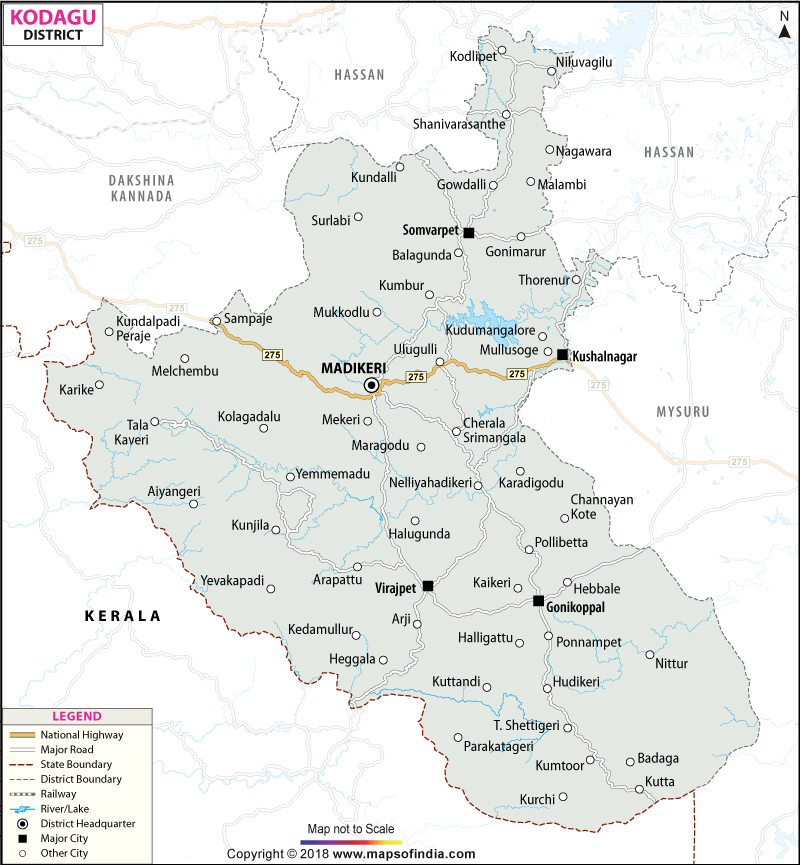
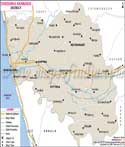
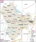
Kodagu is located in the southwestern part of Karnataka. It is the administrative district and is historically known as Coorg. The district is located on the eastern slope of the UNESCO’s world heritage site, Western Ghats and is surrounded by the Dakshina Kannada in the northwest, Hassan to the north, Mysore to the east and Kerala in the south. Dense tropical evergreen forests, vast plantation fields of coffee and spices, waterfalls and prominent hill ranges like the Brahmagiri, Pushpagiri are found here. The highest point of the district is Thadiandamol and it is a region with a special geographical and socio-cultural status in the southern part of India due to its environmental richness and uniqueness of the cultural identity. The kodava community found here is famous for the varied customs, marital traditions and tasty cuisine like pandi curry. There are various sightseeing places including the Abbey Falls, Talakaveri and Dubare. The warmth of people here is what is going to stay with anyone who visits the place. With all these qualities Kodagu has earned a distinct name for itself among all the districts of Karnataka.
History & Culture
Kodagu has a long history, which has been documented over a long period of time. Various dynasties ruled it such as Kadambas, Gangas, Cholas, Hoysalas and Vijayanagaras. The political character of the region underwent a radical change in the early 17th century AD with the rule of Veeraraja.
After the Anglo–Mysore wars the British East India Company made Chitale a protector of the kingdom and the last Haleri ruler Chikka Veerarajendra was ousted in 1834. Kodagu was annexed by the British as the Coorg Province and was directly administered by the British. It became a sovereign 'Part C' State after the independence of India in 1947 but got amalgamated with Mysore State as a district on November 1, 1956. The district has contributed to the development of Karnataka state since the time of its inclusion.
Different communities like the Kodava, Arebhashe Gowdas, Kodava Heggades, Iri, Kuruba, and Yerava, are found in this district. Contrary to the normal Hindu practice, Kodava rituals do not call upon the participation of the Brahmin priests, but through the elders of the community. In their traditional clothing, the warrior spirit is seen in the Men's wear: The Kupya is a collarless black coat with a red/gold sash (Chele) around the waist, and they wear a traditional dagger (Peeche Kathi).For Women: The Kodava Saree is bound in pleats gathered towards the back and neatly pinned over the right shoulder. Sports in general are integrated into the culture, particularly field hockey.
What drives the people here is their love for nature and humanity. Cultural traditions of the place have instilled in the people a sense of brotherhood and they continue to uphold it.
Kodava Family Hockey Tournament is held annually and is one of the world's largest field hockey tournaments with hundreds of teams made up of families. Kodagu has also produced gallant officers for the Indian Armed Forces, including Field Marshal K. M. Cariappa, the Indian Army's first Commander-in-Chief and General K. S. Thimayya.
Economy
Primary activities of the economy of Kodagu are agriculture and agro-forestry, plantation crops and eco-tourism in addition to public administration and services. Much of the land area is used for agriculture. Paddy fields are found here and cultivation of paddy crops has been carried out for the longest time. Coffee and chillies are found in the surrounding hills. It is one of the richest districts in rural terms per capita in Karnataka. Kodagu has a primary engine, namely the Agriculture & Plantation Sector. Kodagu is renowned as the hub of the Indian coffee industry, contributing about 35% of India's coffee production and more than 50% of Karnataka's coffee, a testament to its status as the epicenter of the industry.
Coffee varieties: These are cultivated both extensively, Robusta (predominant crops in the lower altitudes like Virajpet, Ponnampet etc) and Arabica (cultivated in High altitudes like Somwarpet, Madikeri, etc).
Intercrops & Spices: Black pepper is inter-cropped with shade trees in the coffee estates. Some of the high-value agricultural produce of importance are cardamom, ginger, arecanut, rubber and Coorg oranges.
The services sector has experienced rapid growth in the last 20 years. Hospitality & Eco-Tourism: Kodagu was the pioneer of the Homestay movement in the southern part of India. There are thousands of homestays, plantation retreats and eco resorts that offer direct and indirect jobs. Trade, Transportation & Banking: Logistics associated with the distribution of coffee, timber and retail are a big part of urban service-based jobs.
The government and public sector are important anchors for jobs because of the absence of harmful industrial estates (not to affect the delicate ecology of the Western Ghats at the expense of employment). Not having too many high-polluting industrial estates, the government and public sector are important job anchors as they manage the large national parks, Wildlife Sanctuaries, and Reserve forests.
Agricultural scientists and extension are deployed at the Coffee Board of India, research and extension centers, and regional trial stations (e.g., Central Coffee Research Institute facilities). The supply of steady capital inflow into the regional economy is provided by Defense Personnel & Civil Administration, which includes civil services, public education, healthcare institutions and remittance from active and retired Armed Forces members.
Tourism
Kodagu is one of the largest and most popular tourist destinations for nature lovers, trekkers, pilgrims, culture lovers, etc. Primary Tourist Attractions: Talakaveri & Bhagamandala: Talakaveri is the source of River Kaveri in the Brahmagiri Hill range. Here thousands gather on Kaveri Sankramana to see the holy water gushing out of the spring.
Raja's Seat (Madikeri): A tempus-temporal garden of brick and mortar, where the King of Kodagu used to enjoy the sunset on the rolling hills, in summer.
The Madikeri Fort and museum complex comprises the District Secretariat, the old palace, and the museum situated inside the St. Mark’s church, which was built by the later Mudduraja and was rebuilt by Tipu Sultan and the British in the late 17th century.
The Omkareshwara Temple is built in a unique style of a Gothic/Indo-Saracenic structure built in 1820 by the king Lingarajendra II. It has a central dome and minarets at the corners which showcases a distinct Hindu style of architecture.
Abbey Falls and Mallalli Falls are two major torueists spots which attract large number of people.
Nisargadhama Island is an island formed out of the river bed (64 acres) in the Kaveri River at Kushalnagar. It has splendid assesible bridges, deer parks and bamboo groves. In the district, another popular trekking site is Mandalpatti peak. It offers a panoramic view of the surrounding Western Ghat and it can be reached by traversing via off-road jeeps.
Demographics
Kodagu is the least populated district in Karnataka with a total population of 554519 and district has a balanced gender ratio with 274,608 males (49.52%) and 279,911 females (50.48%) or a favourable sex ratio of 1,019 females per 1,000 males. The village population (85.39%) and settlements of agricultural areas are the major forms of settlements in Kodagu whereas administrative centres of the town are the urban settlements (14.61%).
82.61% is the literacy rate in the district and it is better than the national records which shows a lesser percentage. Kannada is the official language of the state used in education, public administration while Kodava Takk is the indigenous mother tongue and is widely spoken among the Kodava community.
Arebhashe, Tulu, Malayalam, Tamil, Konkani, and Urdu are the other languages spoken here. This has been a result of historical migration, trade and the close proximity of the adjacent coastal Karnataka and Kerala.
Administration
Kodagu district is part of the administrative jurisdiction of a division namely Mysuru (DCM) of Karnataka state and is administered by a Deputy Commissioner and District Magistrate, Madikeri, in the district. The district is very hilly and for efficient civil administration, revenue collection and law enforcement, the district is structurally divided into five taluks (tehsils): Madikeri, Virajpet, Somwarpet, Ponnampet and Kushalnagar, the latter two taluks created by bifurcation of bigger tehsils, which brought public services closer to the villagers.
The local administration is a combination of urban and rural administration at the level of self-governance. The urban areas are under the control of the Madikeri City Municipal Council and the Town Panchayats in big towns like Kushalnagar, Somwarpet and Virajpet. The rural hinterland consists of 17 revenue circles (hoblis) consisting of 104 Grama Panchayats, which manage local infrastructure, welfare programmes and civic requirements in Kodagu's 291 official revenue villages. Moreover, special administration is ensured by separate forest divisions for the management of a large number of protected wildlife sanctuaries and reserve forests of the district.
| Facts of Kodagu District | |
|---|---|
| Official Name | Kodagu |
| Location | Karnataka |
| Area (km2) | 4102 |
| Population | 5,54,519 |
| Language | Kannada |
FAQs
Q1: How many gram panchayats are there in Kodagu district?
There are 104 gram panchayats in Kodagu district.
Q2: What is the population of Kodagu district?
The population of Kodagu district is 5,54,519.
Q3: What is the district famous for?
The Kodagu district is famous for world-famous coffee plantations, natural beauty, valour, and the Indian hockey team’s birthplace, and being the source of the river Kaveri.
Q4: What is the official language spoken here?
Kannada is the official language and the local language is Kodava Takk.
Q5: What is the literacy rate of Kodagu district?
The literacy rate of the district is 82.61%.
Q6: Name the major rivers in Kodagu?
Kaveri with its tributaries Kannika, Lakshmana Tirtha, Harangi, and Hemavati.
Q7: Where is the administrative headquarters located?
The administrative headquarter is at Madikeri.
Q8: Name the communities found here?
Kodava, Arebhashe Gowdas, Kodava Heggades, Iri, Kuruba, and Yerava communities.
Last Updated on : August 03, 2026
