





About
There are districts that present themselves via figures and there are districts that turn up like a narrative on a sea breeze. Udupi is definitely a part of the latter. Some districts come in the guise of figures and some districts come like a story on a windy day at sea. Udupi is definitely a part of the latter. Located in the western-most part of Karnataka facing the Arabian sea, the Udupi district is one such place that allows nature, spirituality and tradition to go hand-in-hand without coming to any harm. The district got its name from the traditional town of Udupi, where India's revered temple of Sri Krishna is located, and which is closely related to the philosopher-saint Madhvacharya.
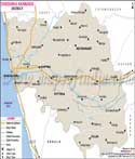
The geography of the district of Udupi is most unique as is seen from the Udupi district map. To the west is a long coastline with beaches and fishing settlements and to the east are the forested hills, waterfalls and mountain passes. Rivers pass through fertile river plains towards the sea, making it a wonderfully natural landscape.
It was separated as an independent district on 25 August 1997, after being split out of Dakshina Kannada district apart from Udupi still continuing to be a major district in Karnataka. This map is not just for the locations of towns and villages; it is for the domain of Udupi, renowned for its education, religion, marine beauty, and cultural richness. Every corner of the district tells a story – both ancient and ever-changing – from temple bells that ring at dawn to fishing boats bringing in the evening tide.
History & Culture
The history of Udupi dates back to many centuries and involves many dynastic rulers, trade with seekers through sea and spiritual movements. There is historical evidence and old inscriptions that relate to the ruling family Alupas of the coastal region of Karnataka which is one of the first ruling families of the region. The area eventually became a part of the Kadambas, Chalukyas, Hoysalas and the Vijayanagara rulers. Those left their signature in the capriciously architectural, administrative and culinary traditions.
The cultural identity of the district is however incomplete without Madhvacharya, a 13th-century philosopher, who introduced the Dvaita school of Vedanta. His vision of the Sri Krishna Temple made Udupi one of the greatest centres of Hindu learning and religion in South India. People from all over India come to the town to fulfil their spiritual needs even now. These religious sites are highlighted in the Udupi district map and have been a significant part of the identity of the region for centuries.
The district also adds to the culture with festivals. The events of Krishna Janmashtami, Makara Sankranti, Deepavali and Navaratri are celebrated with great enthusiasm and the Paryaya festival of Udupi is an exceptional festival. In this particular occasion, the administration of Sri Krishna Temple is transferred from one monastery to another, a process that has been carried on for centuries, through a rotation of the eight monasteries set up by Madhvacharya.
The district is also famed for its food. The speciality of Udupi has made its food internationally famous due to the presence in it of vegetarian dishes, subtle flavours and innovations in culinary arts. This region has been the birthplace of a number of cooks and entrepreneurs of restaurants throughout India. In the meantime, coastal communities provide seafood customs, which mirror the district's coastal closeness. Coastal communities provide seafood traditions reflecting the district's insular closeness, meanwhile.
When one reads the Udupi district map, it is evident that the cultural practices vary with slight nuances between the villages, settlements from inland and the hilly ones. But they are united by a commonality that is best observed. Another review of the Udupi map emphasises pilgrimage routes as well as heritage sites and villages where traditions survive in today's times. The Udupi district map is thus more than a geographical reference map; it reflects a civilisation which was formed by the faith, art and community.
Economy
It is a remarkably diverse and strong economy supported by Agriculture, Fisheries, Education, Tourism, Commerce and Public Institutions in Udupi. The district's economy is robust from the coastal resources and from its more entrepreneurial traditions, which have helped it to navigate the transition to development.
The Government Sector is important in terms of district administration, education, healthcare and public works programmes, as well as rural programmes. There are large employment opportunities in government offices, schools, colleges and healthcare centres. Even though economic growth has improved in urban areas, investments in infrastructure and avenues in public welfare schemes continue to drive economic expansion in urban and rural areas.
The Public Sector has significant contributions to make via key institutions in the district. Kaiga is one of the most important parts of the District's economic zone. Other employers, like public utilities, transportation services and state-supported educational institutions, also contribute to employment and regional development.
Although the District is diversifying, agriculture continues to play an important role. Most of the fertile lowlands are planted with paddy and coconut, arecanut, cashew and various horticultural crops which make a contribution to the income of the rural people. The district experiences a very high monsoon rainfall and fertile soil which has led farmers to adapt to these conditions for a long time. The agricultural areas are spread out in the Udupi district map, with divisions helpful for referring to the valleys of the dams and the coastal plains.
In recent decades, the Services Sector has grown at a rapid pace. There is also a demand for educational institute related affairs such as schools and colleges in one way or the other, along with housing, retail services, healthcare and transportation.
Other significant sectors such as banking, information technology services, healthcare, tourism and small-scale entrepreneurship have also played a prominent role. Themes of economic dispersion from sea level commercial centres to the inland educational hubs can be seen by taking a look at the Udupi district map. This is further reflected in the connectivity with regard to trade, tourism and the development of the service sector in the Udupi district as seen in the district map.
Tourism
Experience Udupi's tourist attractions where sightseeing is replaced by a road trip through a series of living postcards. All of the roads appear to be either to the sea or to a temple, or to a waterfall or a mist-veiled hill.
Belonging to a different complex is Malpe Beach, known for its popular coastal sides and scenery. Golden sands along the Arabian Sea, with fishing boats gently rocking in the sea. Views to sunset and water-based activities are highlights on the beach. It is here that visitors can head towards St Mary's Island, famous for its unique basalt rock formations, which form as a direct result of earlier volcanic activity.
Another estuary gem is Kaup Beach—home of an historic lighthouse. With a view of the wide sweep of the shoreline, sea and surrounding countryside on offer, climbing the lighthouse is a reward to the visitors. It is often one of the district's most popular seaside attractions, as this is revealed through the Udupi district map.
It is a wonderful waterfall of Kudlu Theertha, which one can't see outside the dense jungle. Barkana waterfall, as one of the highest waterfalls in Karnataka, where a rich biodiversity of the Western Ghats is present, is equally interesting.
Maravanthe beach is considered one of the most scenic coastlines of India. In this place, the Arabian Sea is parallel to the Highway with the Souparnika River on the other side which makes this a rare and striking landscape. This interesting geographical pattern can be seen in the Udupi district map.
Agumbe, also known as the ‘Cherrapunji of the South', is prestigious for its lack of shortage of rainfall, rainforests, and spectacular sunsets. It is also known for its significant contribution to biodiversity and conservation research as well. Similarly, on studying the Udupi district map again, one would wonder about how remarkably diversified it is, housed within rather small district boundaries.
Demographics
Census of India 2011 gives the population as 1177361 in the Udupi district. While not one of Karnataka's populous districts, it is known to have strong social parameters and a high quality of living.
The literacy rate was around 86.24 per cent which is much higher than the national literacy rate of the time. The district has historically always been a district known for education; there are many schools, colleges and professional institutions throughout the district.
Kannada is the major language of the district. But linguistic diversity can make for a rich life. Other languages are also spoken by different communities and settlements like Tulu, Konkani, Beary and Urdu which highlights the history of migration, trade and cultural interaction that has taken place over the centuries.
The Udupi district map shows the distribution pattern of the settlements, demarcating the coastal, rural and hilly areas with a demographical pattern influenced by geographical, occupational and historical development factors.
Administration
The district of Udupi is divided into three Taluks, namely Udupi, Karkala and Kundapura.
Around 233 revenue villages are present in the district which are divided into coastal belts, agricultural plains and uplands. Local governance takes place through municipalities, town panchayats and gram panchayats, covering urban and rural populations, and assisting their administration. The nature of the Udupi District map, however, makes it a staple resource for administrations, planning and citizens to learn about the territory, transport and settlements of the district.
Udupi has a defined administrative structure, in addition to which it has an effective system of local autonomy. The administrative system for urban areas is handled by municipal and town panchayats and for rural areas by gram panchayats which look after local development, sanitation, water supply and welfare services of the community. This decentralised organisation keeps governance very much in touch with the needs of people throughout the district.
FAQs
Q1: What is the population of Udupi district?
The population is 1,177,361 according to Census 2011.
Q2: How many tehsils are in Udupi district?
There are three tehsils.
Q3: How many villages are in Udupi district?
The district has about 233 revenue villages.
Q4: What is Udupi district famous for?
It is famous for the Sri Krishna Temple and Udupi cuisine.
Q5: When was Udupi district formed?
It was formed on 25 August 1997.
Q6: What is the literacy rate of Udupi district?
The literacy rate is about 86.24 per cent.
Q7: Which languages are commonly spoken in Udupi district?
Kannada, Tulu, Konkani, Beary and Urdu are commonly spoken.
Last Updated on : August 03, 2026
