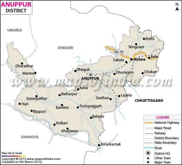
| Facts of Anuppur District |
|---|
| State | Madhya Pradesh |
| District | Anuppur |
| District HQ | Anuppur |
| Population (2011) | 749237 |
| Growth | 12.30% |
| Sex Ratio | 976 |
| Literacy | 67.88 |
| Area (km2) | 3747 |
| Density (/km2) | 200 |
| Tehsils | Anuppur, Jaithari, Kotma, Pushprajgarh |
| Lok Sabha Constituencies | Shahdol |
| Assembly Constituencies | Kotma, Anuppur (ST), Pushprajgarh (ST) |
| Languages | Bagheli, Hindi |
| Rivers | Narmada, Sone, Kewai |
| Lat-Long | 23.079732,81.802597 |
| Travel Destinations | Narmada Mandir, Mai Ka Bagiya, Sonmuda, Bhrigumandal, Kabir Chabutra, Jwaleshwar Mahadev Temple, Kapildhara Waterfall, Dudhdhara Waterfall, Shambhudhara, Durgadhara Waterfall, Sarvodya Jain Temple, Ganesh Temple etc. |
| Government Colleges/Universities | Indira Gandhi National Tribal University, Govt. Tulsi Degree College, Government M.M College (Kotma), Government Degree College (Pushprajgarh), Govt. Degree College (Jaihari), Govt. Polytechnic College etc. |
