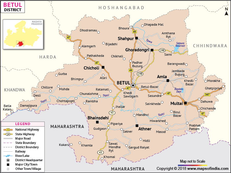
Betul is one of the southern districts of Madhya Pradesh
. Badnur is the head quarter of the district.
The total area of Betul is 10043 sq. km.
As per the 2001 census, the total population of Betul is 13,95,175. The number of males is 7,09,956 whereas the females number to 6,85,219.
Agriculture happens to be a major occupation of the people of this district as the climate is very favorable for agricultural activities.
Last Updated on : February 19, 2026
As per the 2001 census, the total population of Betul is 13,95,175. The number of males is 7,09,956 whereas the females number to 6,85,219.
Agriculture happens to be a major occupation of the people of this district as the climate is very favorable for agricultural activities.
| Facts of Betul District | |
|---|---|
| State | Madhya Pradesh |
| District | Betul |
| District HQ | Betul |
| Population (2011) | 1575362 |
| Growth | 12.92% |
| Sex Ratio | 971 |
| Literacy | 68.9 |
| Area (km2) | 10043 |
| Density (/km2) | 157 |
| Tehsils | Betul, Multai, Bhainsdehi, Shahapur, Amla, Athner |
| Lok Sabha Constituencies | Betul-Harda-Harsud |
| Assembly Constituencies | Multai, Amla (SC), Ghoradongri (ST), Bhainsdehi (ST) |
| Languages | Hindi |
| Rivers | Tapti, Ganjal, Morand, Tawa |
| Lat-Long | 21.911197,77.903953 |
| Travel Destinations | Balajipuram Temple, GOV Dev baba temple, Shri Rukmani Balaji Temple, Lord Hanuman Temple, Navagraha, Saint Shirdi Sai Baba etc. |
| Government Colleges/Universities | Dr Bhimrao Ambedkar Govt Degree College (Amla), J H Govt PG College, Govt College (Bhaisdehi), Govt College (Sarni), Govt College (Athner), Govt Girls College, Govt College (Multai), Govt College (Shahpur) etc. |
Last Updated on : February 19, 2026
