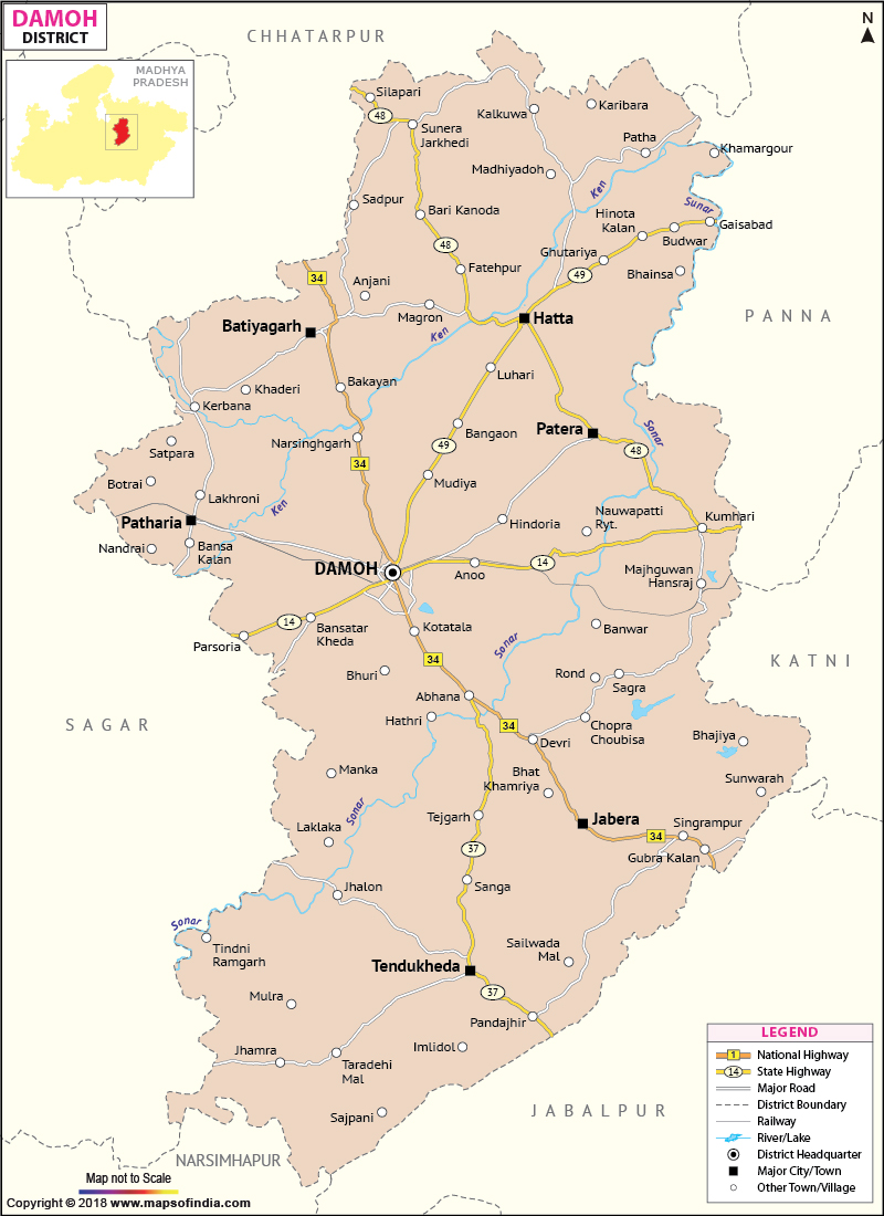
Damoh is geographically located at 23.09' North latitude and 79.03' East longitude.
Damoh has an area of 7,3,06 sq. km. The total population according to 2001 census is 897,944.
The tourist places of Damoh are
Last Updated on : January 14, 2026
Damoh has an area of 7,3,06 sq. km. The total population according to 2001 census is 897,944.
The tourist places of Damoh are
- Jatashankar
- Giri Darshan
- Nohleshwar Temple
- Nidan Kund
- The Fort of Singaurgarh
- Sad-Bhawna Shikha
| Facts of Damoh District | |
|---|---|
| State | Madhya Pradesh |
| District | Damoh |
| District HQ | Damoh |
| Population (2011) | 1264219 |
| Growth | 16.63% |
| Sex Ratio | 910 |
| Literacy | 69.73 |
| Area (km2) | 7306 |
| Density (/km2) | 173 |
| Tehsils | Batiyagarh, Damoh, Hatta, Jabera, Patera, Patharia, Tendukheda |
| Lok Sabha Constituencies | Damoh |
| Assembly Constituencies | Pathariya, Damoh, Jabera, Hatta (SC) |
| Languages | Hindi |
| Rivers | ----- |
| Lat-Long | 21.891606,80.79326 |
| Travel Destinations | Jatashankar Temple, Nohleshwar Temple, Giri Darshan, Fort Of Singaurgarh, Nidan Kund, Nazara, Sad-Bhawna Shikha etc. |
| Government Colleges/Universities | Gyan Chand Shrivastava PG College, Govt College (Hatta), Madhav Rao Sapre Govt College (Patharia), Govt College (Batiyagarh), Govt Kamla Nehru Girls College, Govt College (Jabera), Govt Arts College (Tendukheda) etc. |
Last Updated on : January 14, 2026
|
|
