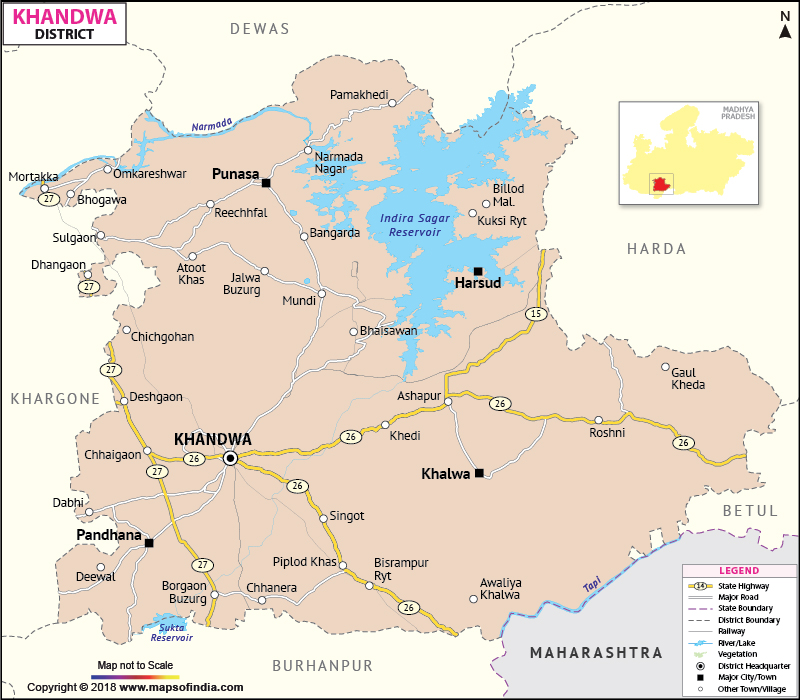
According to census 2001, the district has a total population of 17, 08, 170 of which 8, 67, 506 no. of people are literate.
East Nimar (Khandwa District) is predominantly an agricultural district and enjoys the advantage of easy access to natural resources.
The special attractions of the place include Omkareshwar Mandhata, Ghantaghar, Dada Dhuni wale Darbar, Dam at Narmada Nagar, Turja bhawani Mata temple and Gauri kunja.
| Facts of Khandwa (East Nimar) District | |
|---|---|
| State | Madhya Pradesh |
| District | Khandwa (East Nimar) |
| District HQ | Khandwa |
| Population (2011) | 1292042 |
| Growth | 21.41% |
| Sex Ratio | 952 |
| Literacy | 71.98 |
| Area (km2) | 7349 |
| Density (/km2) | 178 |
| Tehsils | Khandwa, Punasa (Mundi), Harsud, Pandhana |
| Lok Sabha Constituencies | Khandwa |
| Assembly Constituencies | Mandhata, Harsud (ST), Khandwa (SC), Pandhana (ST) |
| Languages | Hindi, Nimari, Korku, Malvi |
| Rivers | Narmada, Tapi |
| Lat-Long | 21.902278,76.639023 |
| Travel Destinations | Ghantaghar, Omkareshwar Mandhata, caves of Adi Guru Shankaracharya, Sagar Dam, Dada Dhuniwale Darbar, Turja Bhavani Mata Temple, Nav Chandi Devi Dham, Nagchun Dam, Gauri Kunja etc. |
| Government Colleges/Universities | Govt Arts & Commerce College (Harsood), Makhan Lal Chaturvedi Govt Girls PG College, Shri Nilkantheshwar Govt PG College, Govt College (Mundi) etc. |
Last Updated on : January 14, 2026
