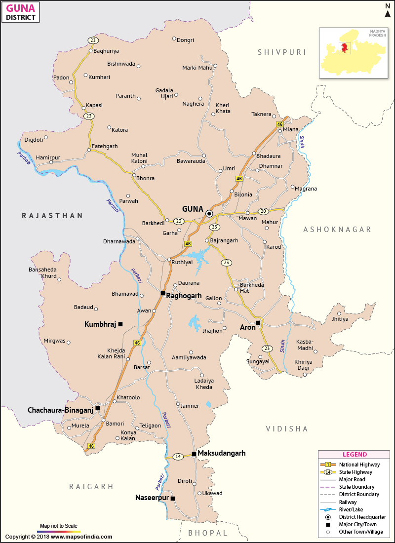
Situated on the north east region of the Malwa plateau, the Guna district covers an area of 6484.63 sq. km.
The district of Guna constitutes a total population of 8,38,926.
Guna has a perfect balance between agriculture and industrial developments. The farmers of the district produce rice, sunflower, wheat, sugarcane, oilseeds and maize. The district is industrially developed as well, with industries like National Fertilizers Limited, Gas Authority of India and Deepak Spinners within its area.
The important tourist destinations of the district are the Bisbhuji Temple, Bajrangarh, and the Fort of Bhadora.
Last Updated on : January 14, 2026
The district of Guna constitutes a total population of 8,38,926.
Guna has a perfect balance between agriculture and industrial developments. The farmers of the district produce rice, sunflower, wheat, sugarcane, oilseeds and maize. The district is industrially developed as well, with industries like National Fertilizers Limited, Gas Authority of India and Deepak Spinners within its area.
The important tourist destinations of the district are the Bisbhuji Temple, Bajrangarh, and the Fort of Bhadora.
| Facts of Guna District | |
|---|---|
| State | Madhya Pradesh |
| District | Guna |
| District HQ | Guna |
| Population (2011) | 1310061 |
| Growth | 21.50% |
| Sex Ratio | 943 |
| Literacy | 66.39 |
| Area (km2) | 6485 |
| Density (/km2) | 194 |
| Tehsils | Guna, Raghogarh, Aron, Kumbhraj, Chanchoda |
| Lok Sabha Constituencies | Guna, Rajgarh |
| Assembly Constituencies | Bamori, Guna (SC), Chachoura, Raghogarh |
| Languages | Hindi, English |
| Rivers | Parbati, Sindh, Kuno, Ghodapachad |
| Lat-Long | 24.686952,77.274627 |
| Travel Destinations | Bajrang Garh Fort, Temple of Beesbhuja Devi, Shri Hanuman Tekri Temple, Jainagarh, Christ The King Church, Panchmukhi Hanuman Ashram etc. |
| Government Colleges/Universities | Govt College (Aron), Govt Girls College (Chachora), Govt Kasturba Girls College, Govt College (Chahora-Beenaganj), Govt PG College, Govt College (Raghogarh) etc. |
Last Updated on : January 14, 2026
