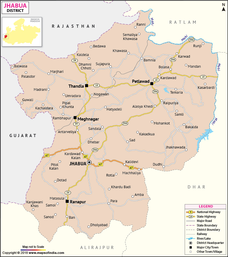
The Jhabua district encompasses a total area of 6793 sq. km. Jhabua is in the western region of the state of Madhya Pradesh
.
The district has a total population of 13,94,561 where 7,02,053 are males and 6,92,508 are females.
Jhabua's undulating and uneven surface does not support much agricultural productivity. The district is famous for the handicraft industry which is the main source of income for the local inhabitants. There are also many industries in the district.
The district has some beautiful tourist destinations. A few of them are Bhabhara, Deojhiri,and Kathiwada.
Last Updated on : January 14, 2026
The district has a total population of 13,94,561 where 7,02,053 are males and 6,92,508 are females.
Jhabua's undulating and uneven surface does not support much agricultural productivity. The district is famous for the handicraft industry which is the main source of income for the local inhabitants. There are also many industries in the district.
The district has some beautiful tourist destinations. A few of them are Bhabhara, Deojhiri,and Kathiwada.
| Facts of Jhabua District | |
|---|---|
| State | Madhya Pradesh |
| District | Jhabua |
| District HQ | Jhabua |
| Population (2011) | 2463289 |
| Growth | 14.51% |
| Sex Ratio | 929 |
| Literacy | 81.07 |
| Area (km2) | 6782 |
| Density (/km2) | 285 |
| Tehsils | Jhabua, Meghnagar, Petlawad, Ranapur, Thandla |
| Lok Sabha Constituencies | Ratlam |
| Assembly Constituencies | Jhabua (ST), Thandla (ST), Petlawad (ST) |
| Languages | Bareli Rathwi, Bhilali |
| Rivers | Mahi, Anas |
| Lat-Long | 22.922982,74.684257 |
| Travel Destinations | Temple of Lord Shiva, Rampanchayat Mandir, Rajwada, Hanuman Tekri, Anas Nursery etc. |
| Government Colleges/Universities | Shahid Chandrshekhar Azad Govt PG College, Govt Girls Degree College, Govt Mahaveer College (Petlawad), Govt College (Thandla) etc. |
Last Updated on : January 14, 2026
|
|
