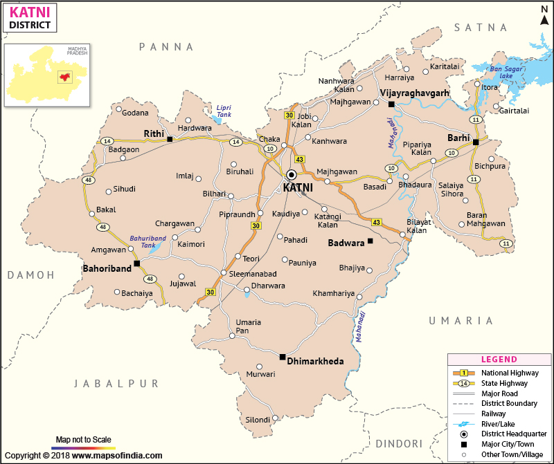
Covering a total area of 4949.59 km?, the district of Katni lies in the north eastern region of India.
The district of Katni holds a population of 8,81,925 ( as per 1991 census).
Katni has a perfect balance between agricultural productivity and industrial developments. Paddy, wheat, gram and pulses form the main crops of the district. The district also has many industries out of which the most important are the mineral based industries and the pulses mills.
Last Updated on : January 14, 2026
The district of Katni holds a population of 8,81,925 ( as per 1991 census).
Katni has a perfect balance between agricultural productivity and industrial developments. Paddy, wheat, gram and pulses form the main crops of the district. The district also has many industries out of which the most important are the mineral based industries and the pulses mills.
| Facts of Katni District | |
|---|---|
| State | Madhya Pradesh |
| District | Katni |
| District HQ | Katni |
| Population (2011) | 1025048 |
| Growth | 30.70% |
| Sex Ratio | 990 |
| Literacy | 43.3 |
| Area (km2) | 4947 |
| Density (/km2) | 261 |
| Tehsils | Katni, Rithi, Vijayraghavgarh, Bahoriband, Dheemarkheda |
| Lok Sabha Constituencies | Khajuraho |
| Assembly Constituencies | Barwara (ST), Vijayraghavgarh, Murwara, Bahoriband |
| Languages | Hindi |
| Rivers | Katni, Mahanadi |
| Lat-Long | 23.755182,80.363388 |
| Travel Destinations | Statue Of Jain Teerthankar Shantinath, Cemetery Of Oliya Peeran Peer, Roopnath Temple, Sita Kund, Laxman Kund, Vijayraghavgarh, Tigavan Temple, Varah Temple, Sungarha Vaishnav Devi Mandir etc. |
| Government Colleges/Universities | Govt Degree College (Barhi), Govt Girls College, Govt College (Vijay Raghavgar), Govt Tilak PG College, Govt Degree College (Sleemnabad), Sanjay Gandhi College (Katni), Sh Niwas Sarawgi College (Katni) etc. |
Last Updated on : January 14, 2026
