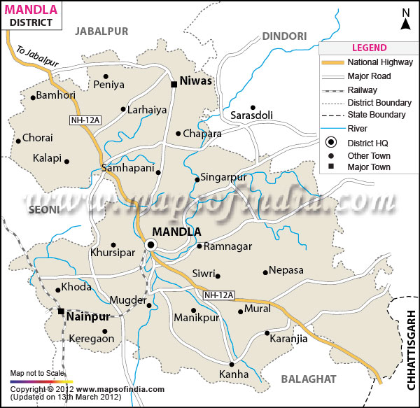
Surrounded by the holy river Narmada, the Mandla district is situated in the east central part of
Madhya Pradesh
. It is located between the latitude 22? 2' and 23? 22' north and longitude 80? 18' and 81? 50' east. The district has a total population of 12,91,263 and a total area of 13,269 square kilometers.
The economy of the district depends largely on forest and natural resources and tourism.
Mandla is a haven for tourists and wild life lovers. The world's famous tiger sanctuary - Kanha National Park is situated in this district only.
| Facts of Mandla District |
|---|
| State | Madhya Pradesh |
| District | Mandla |
| District HQ | Mandla |
| Population (2011) | 1340411 |
| Growth | 13.24% |
| Sex Ratio | 963 |
| Literacy | 71.78 |
| Area (km2) | 5805 |
| Density (/km2) | 182 |
| Tehsils | Bichhiya, Ghughari, Mandla, Nainpur, Narayanganj, Niwas |
| Lok Sabha Constituencies | Mandla |
| Assembly Constituencies | Bichhiya (ST), Niwas (ST), Mandla (ST) |
| Languages | Gondi, Agariya, Bagheli, Bharia, Hindi |
| Rivers | Narmada, Banjar |
| Lat-Long | 22.674847,80.570526 |
| Travel Destinations | Kanha Tiger Reserve etc. |
| Government Colleges/Universities | Govt ArtsCollege (Bamhanibanjar), R D Govt PG College, Govt Degree College (Nainpur), Govt Graduate College (Bhuabichhiya), J M C Girls Degree College, Govt Arts College (Niwas) etc. |
Last Updated on : February 19, 2026
