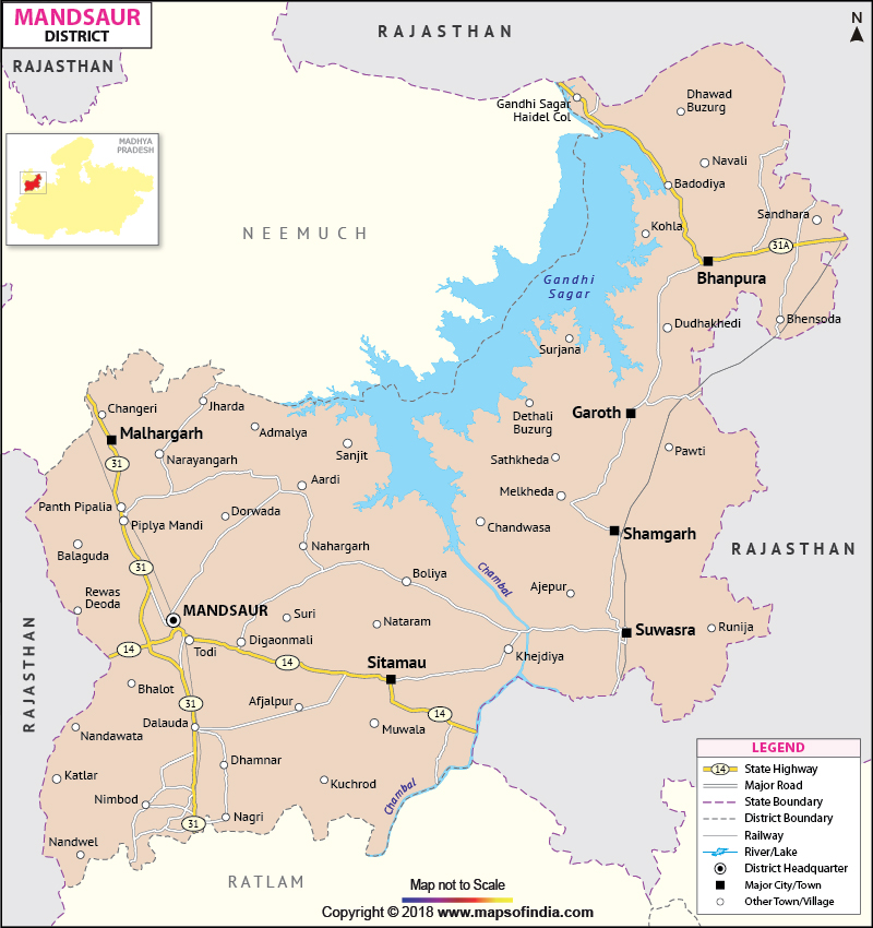
Mandsaur is world famous for its large production of opium. The main industry of the district is the slate pencil industry.
The Mandsaur district is rich in archaeological and historical heritage. Lord Pashupatinath Temple, Gandhi Sagar Dam and Hinglajgarh are some of the popular tourist destinations.
| Facts of Mandsaur District | |
|---|---|
| State | Madhya Pradesh |
| District | Mandsaur |
| District HQ | Mandsaur |
| Population (2011) | 1965970 |
| Growth | 23.44% |
| Sex Ratio | 840 |
| Literacy | 71.03 |
| Area (km2) | 5530 |
| Density (/km2) | 242 |
| Tehsils | Mandsaur, Malhargah, Garoth, Shamgarh, Dalauda, Bhanpura, Suwasra, Sitamau |
| Lok Sabha Constituencies | Mandsaur |
| Assembly Constituencies | Mandsour, Malhargarh (SC), Suwasra, Garoth |
| Languages | Malvi, Hindi |
| Rivers | ----- |
| Lat-Long | |
| Travel Destinations | Temple of Lord Pashupatinath, Nalcha Mata Temple, Gandhi Sagar Dam, Buddhist caves, Chamunda Mata Temple, Shri Yaswant Rai Kothari Ki Chattri, Shri Kaleshhwar Temple, Shri Shankhodwar, Shri Ambe Mata Temple, Shri Nilkanteshwar Mahadev , Mlkana Ashram etc. |
| Government Colleges/Universities | S N Udia PG College (Garoth), Priyadarshini Indira Gandhi Goverment Girls College, Govt College (Sitamau), Rajiv Gandhi Govt PG College, Govt College (Pipariya Mandi), Govt Music College etc. |
Last Updated on : November 13, 2025
