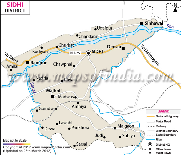
Sidhi is one of the most important districts of
Madhya Pradesh
and forms the north eastern boundary of the state. The district has a population of 18,31,152 residing over a total area of 10,536 square kilometers.
Sidhi is enriched with its forest and mineral resources. The coal mines of the district are a major source of revenue.
With the Sone River flowing through the district, Sidhi is blessed with wonderful natural landscapes. The district as whole is worth a visit.
| Facts of Sidhi District |
|---|
| State | Madhya Pradesh |
| District | Sidhi |
| District HQ | Sidhi |
| Population (2011) | 1178273 |
| Growth | 28.05% |
| Sex Ratio | 920 |
| Literacy | 60.41 |
| Area (km2) | 10520 |
| Density (/km2) | 232 |
| Tehsils | Gopadbanas, Churhat, Rampur Naikin, Majhauli, Sihawal, Kusmi |
| Lok Sabha Constituencies | Sidhi |
| Assembly Constituencies | Churhat, Sidhi, Sihawal, Dhauhani (ST) |
| Languages | Bagheli, Hindi |
| Rivers | Sone, Gopad, Banas |
| Lat-Long | 24.20689,81.802597 |
| Travel Destinations | Sanjay Gandhi National Park, Bagdara Abhyaranya etc. |
| Government Colleges/Universities | Govt Sanskrit College (Bhitari), Govt Arts and Commerce College (Majhauli), Sanjay Gandhi Smrati Govt (Autonomous) PG College, Govt College (Sihawal), Govt College (Churahat), Govt Arts Science & Commerce College (Rampurnaikin), Govt Girls College, Govt College (Kusmi) etc. |
Last Updated on : January 14, 2026
