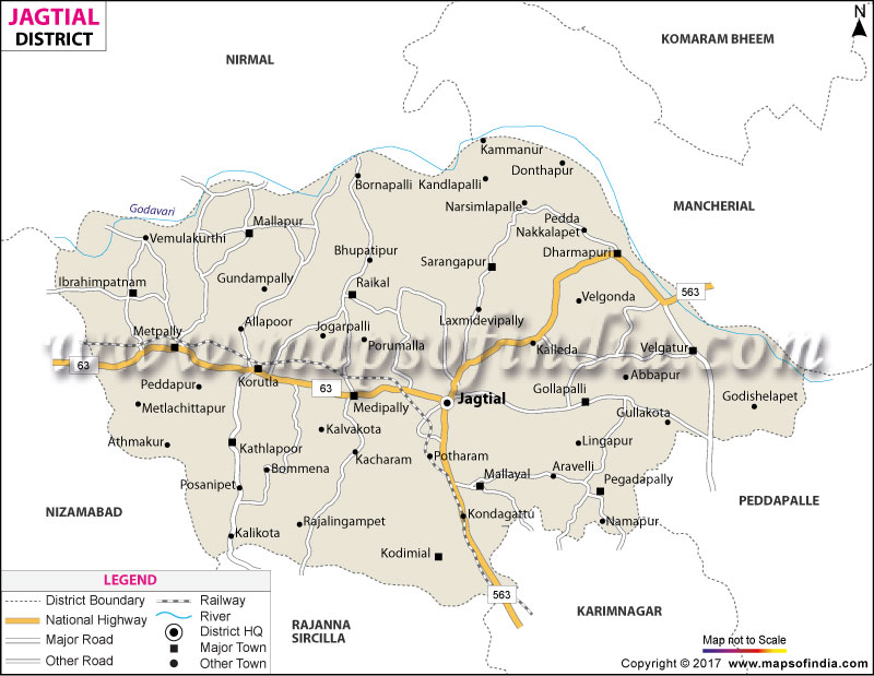
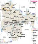
| Jagtial District Fact Sheet |
|---|
| District | Jagtial |
| Headquarters | Jagtial town |
| Population as per 2011 Census | 985417 |
| Area (Sq. Kms.) | 2419 |
| Density of Population (per Sq. Km.) | 407 |
| Literates | 60.26 |
| Forest Cover (Sq. Kms.) | 554.91 |
| Languages Official | Telugu, Urdu |
| Temple | NA |
| Mandals | Jagitial, Korutla, Jagitial Rural, Raikal, Sarangapur, Beekeeper, Dharmapuri, Buggaram, Pegadapalli, Gollapalli, Mallial, Kodimial, Velgatur, Metpalli, Mallapur, Ibrahimpatnam, Medipalli, Kathlapur |
Source:- http://ecostat.telangana.gov.in
www.trac.telangana.gov.in
About
The district of Jagtial is located in northern Telangana, along the banks of the river Godavari, and is named after the town of the same name, which is believed to be named after "Jaggadeva" who were the early rulers of the town. Covering a total area of 2419 square kilometres, Jagtial has a unique mix of fertile canal-irrigated agricultural fields, a few significant sites of pilgrimage for the nation and a rich historical presence dating back to the ancient Satavahana period when the remnants of their history can still be seen along the district's rivers' banks. The town of Jagtial, and the adjoining Korutla, are two of the main urban centres, with its other major urban area being Korulapattana, and both are surrounded by a countryside of paddy fields and rural mandals.
History & Culture
The history of Jagtial is much older than it is a district today. Kotilingala, a village on the banks of Godavari in the district is considered one of the most historic archaeological sites of Telangana with many historians considering it to be one of the early capitals of the Satavahana dynasty and the excavations at the site have uncovered ancient coins, seals and artefacts that are more than two thousand years old. The fort of the historic town of Jagtial itself is a reminder of the past importance of the district as a regional seat of power for a number of regional rulers, one by one, before it was brought under the control of the Nizami.
As part of the general reorganisation of the district of Telangana, the modern district of Karimnagar was established in 2016. The cultural identity of Jagtial is also Telugu and festivals such as Bathukamma, Bonalu and Sankranti are popularly celebrated in the rural mandals of the area. However, two special religious practices are prominent: the worship of Sri Anjaneya Swamy at the Kondagattu temple, one of the most popular Hanuman temples in the state and the annual Aalaya Jatara at the Dharmapuri temple of Sri Lakshmi Narasimha Swamy, which is an important centre of Vedic Brahmin settlement. Festivals and gatherings in the rural sector are still tied to the sowing and harvest cycle and agriculture still plays a role in people's lives in the district.
Economy
The economy of Jagtial is almost entirely dependent on agriculture, with a small government and institutional structure and a rapidly expanding trade and processing sector based on agricultural output.
Government Sector: Jagtial is the district headquarters, with some state departments and the collectorate located here, which are responsible for the 18 mandals in the district, divided into three revenue divisions. The significance of government co-ordination is particularly high in the district because of the reliance of the district on the command area of the Sri Ram Sagar Project.
Public Sector: There is substantial public investment in irrigation infrastructure and almost all mandals in the district are under the command of the canal, providing water supply to agriculture which forms the base of its agricultural production. Local credit and marketing needs of the large farming community of the district are met by the public sector banks and agricultural cooperative institutions.
Services Sector: Jagtial and Korutla towns are important trade and processing centres for the surrounding rural mandals with the presence of rice mills, cold storage facilities, and beedi-leaf processing units in the towns.
In addition the district has institutions such as the Agricultural Research Station at Polasa village and a JNTU Engineering College at Nachupalli which gives the district an education and research dimension to its otherwise agriculture-based economy. The constant stream of pilgrims to Kondagattu and Dharmapuri all year round has also fostered a small but consistent hospitality and transport-services economy around these two temple towns.
Tourism
Sri Anjaneya Swamy Temple, Kondagattu, a hilltop Hanuman temple, supposedly discovered some 300 years ago by a cowherd, and developed by local patrons. The tall old idol of Lord Anjaneya and forested hills around it make it one of the more visited pilgrimage centres in the northern parts of the state of Telangana, particularly on Tuesdays and Saturdays.
Lakshmi Narasimha Swamy Temple, Dharmapuri — a significant Vaishnavite pilgrimage centre and one of the prominent settlements of Vedic brahmins, which marks the celebration of Aalaya Jatara in March–April every year and Mokshada Ekadashi in December.
Along the banks of the Godavari, the ancient capital thought to be the site of the Satavahanas is Kotilingala, where over two thousand years of continuous occupation have been proved by coins, seals and other archaeological findings.
The Qila, Jagtial, a historic fort in Jagtial town itself, provides a glimpse of the pre-modern administrative and military history of the district.
The Godavari riverfront mandala provides scenic and less noisy riverfront environments along the bank of the Godavari river, which are attractive to visitors interested in the riverine and agricultural lifestyle of the district.
These locations combine to provide Jagtial with a unique devotional and historical tourism experience, not one centered on massive crowds. However, since the Dharmapuri temple is comparatively close to Kondagattu, many visitors also visit the temple along with their pilgrimage to Kondagattu, as part of a pilgrimage circuit in the North of Telangana that also visits Vemulawada and Kaleshwaram in adjoining districts. For history buffs, Kotilingala is an even more interesting and obscure place, with direct physical proof of the district's ancient past (Satavahana period) well before the Kakatiya and Nizami periods.
Demographics
According to the district's published statistics, Jagtial's population is 9,85,417 of which 60.26% is literate. The district has 18 mandals and the largest urban centres are Jagtial and Korutla and most people remain living in the rural, agricultural-based mandals of the district. The population of the district was at similar levels in the 2011 Census, reflecting the stability of the district's population since it was established.
The Telugu language is spoken overwhelmingly by all the people in the district and a small population of Urdu speakers is found in and around some of the towns, reflecting the historical background of administration in the district during the Nizami era. The district's religious landscape is largely Hindu, with its townships, Kondagattu and Dharmapuri being the most prominent, having a greater influence on the culture of the district than the number of pilgrims who come from outside could portray.
These figures imply a district that is still very much agricultural and that has literacy rates somewhat comparable to a number of districts in Telangana that are more rural, but also provide a clear indication of the potential for further investment in education. It is the district's consistent population distribution across its mandals, rather than a steep concentration in one or two main urban centres, that demonstrates that the district is still, for the most part, a rural place with predominantly agricultural and canal-fed irrigation economies, even if it also has a significant number of temple towns, which attract a disproportionately high number of visitors and economic activity for their size.
Administration
Jagtial district is divided into three revenue divisions with each division having 18 revenue mandals. The district has 445 villages in 445 mandals with Urban administration over 3 Municipalities, one of which is the town of Jagtial itself. There are 18 Mandal Praja Parishads to coordinate local governance at the mandal level, in addition to the Gram Panchayats at the village level.
The district collector's office is situated in Jagtial town and handles revenue administration and irrigation coordination as the district highly depends upon the Sri Ram Sagar Project command area and general governance in the mandals under the district with the support of elected representatives at the panchayat, mandal and municipal level.
Jagtial's administrative organisation is almost entirely determined by the needs of running a large farming district using canal water and is rather different from those organized around trade and industry. The three revenue divisions are under the supervision of a Revenue Divisional Officer, who are charged with supervising the mandals under his control and tahsildars at the mandal level are responsible for land records, water allocation disputes and revenue collection, areas where the importance of their functions are particularly significant here due to the reliance of agricultural production on the canal network of the Sri Ram Sagar Project.
The coordination between the District Collectors' Office and the Irrigation Authorities is also very close, because disruption of canal supply can have an undue effect on the lives of most of the district's rural population. The three municipalities with populations close to ten lakh are the only ones that have come up as urban local bodies, while governance priorities in Jagtial lie more with the Gram Panchayat and Mandal Praja Parishad, in addition to the periodic demands that come with the two pilgrimage towns of Kondagattu and Dharmapuri around major festival seasons.
| Facts of Jagital District |
|---|
| Official Name | Jagital |
| Location | Telangana |
| Area (km2) | 2419 |
| Population | 985417 |
| Language | Telugu |
FAQs
Q1: How many villages are there? The total number of villages in Jagtial district is 380. Q2: What is the population of the district? The population of the district is 9,85,417. Q3: Which is the famous district of Jagtial? Sri Anjaneya Swamy Temple at Kondagattu, the Lakshmi Narasimha Swamy Temple at Dharmapuri and the ancient archaeological site at Kotilingala. Q4: What is the literacy rate of the district? 60.26%. Q5: What languages are being used in Jagtial district? Telugu and a small Urdu-speaking population. Q6: Jagtial district has how many mandals and revenue divisions? The district is administered into 18 revenue mandals of three revenue divisions. Q7: In which year was Jagtial district established? Jagtial district was carved out from erstwhile Karimnagar district on 11 October 2016 as part of Telangana's district reorganisation. Q8: What are the key economic activities in Jagtial taluk? Agriculture, Irrigation, followed by the rice mill, cold storage and beedi-leaf processing industries.
Last Updated on : May 11, 2026