Idukki is one of the 14 districts that form the Indian state of Kerala. It is the second biggest district of Kerala. The headquarters of the Idukki district are based at Kuyilimala, Painavu. It was created on January 26, 1972. The literacy rate of the district is 92.2%.
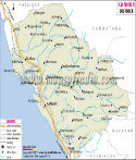
Idukki District Map |
|
||||||||||

|
||||||||||
|
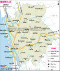
| *Map showing national highway, major roads, rivers, district headquarter, etc in Idukki District of Kerala. |
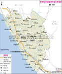
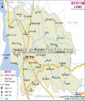
| Major Districts of Kerala |
 |
 |
 |
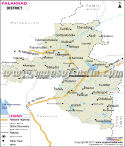 |
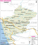
| Ernakulam District Map | Malappuram District Map | Kollam District Map | Palakkad District Map |
 |
 |
 |
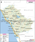 |
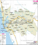
| Kannur District Map | Thiruvananthapuram District Map | Kottayam District Map | Kozhikode District Map |
| other districts of Kerala >> |
Geographical features of Idukki District
The Idukki district covers a total area of 1,971.14 sq miles or 5,105.22 km2, making it the 2nd biggest district of the state of Kerala after Palakkad. The district forms 12.9% of the total area of Kerala.
Approximately 97% of the overall area of the Idukki district is encompassed by jungles and craggy mountains. The altitude of the place is 1,200 meters or 3,900 feet above sea surface.
The district shares its boundaries with the districts of Kottayam in the southwest, Pathanamthitta in the south, Thrissur in the north, Ernakulam in the northwest and Dindigul, Coimbatore, and Theni in the east (Tamil Nadu).
The Anamudi Peak, which is the tallest peak in South India and a part of the Western Ghats Mountain Range, is situated in this district. The altitude of this peak is 8,842 feet or 2,695 meters. The major rivers of the district are the Thodupuzhayar, Periyar, and Thalayar rivers.
Population of Idukki District
According to the census conducted in 2011, the population of the district is 1,129,221. The density of population is 259 /km2 or 671 per sq mile.
Administrative divisions of Idukki District
The subdivisions or taluks in the district are Udumbanchola, Devikulam, Thodupuzha and Peerumade. There are 65 villages in these subdivisions. The district houses eight community development blocks and they are Adimali, Devikulam, Azhutha, Nedumkandom, Idukki, Kattappana, Thodupuzha and Elamdesom.
Educational institutes in Idukki District
Given below are the names of the famous educational institutes in the district:
Engineering Colleges
- University College of Engineering Thodupuzha
- Government Engineering College, Painavu
- College of Engineering Munnar
- Mar Baselios Christian College of Engineering and Technology
- Government College, Munnar
- Government College, Kattappana
- Marian College, Kuttikkanam
- M.E.S College, Nedumkandam
- Newman College, Thodupuzha
- N.S.S College, Rajakumari
- St. Joseph College Moolamattam
- Mar Baselios College Adimaly
- Pavanathma College Muricassery
Tourist attractions in Idukki District
izzled Giant Squirrel
Last Updated on : May 11, 2026