| |
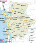
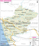
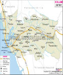
Major Districts of Kerala |
|
 |
 |
 |
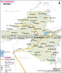 |
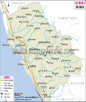
| Ernakulam District Map | Malappuram District Map | Kollam District Map | Palakkad District Map |
| | | | |
 |
 |
 |
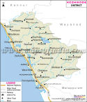 |
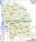
| Kannur District Map | Thiruvananthapuram District Map | Kottayam District Map | Kozhikode District Map |
| | | | other districts of Kerala >> |
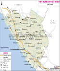
Kasaragod lies in the northern tip of the state of
Kerala. It has enchanting natural beauty to savor.
The total area of Kasaragod is 1,992 sq. km. According to the census of 2001, the total population of Kasaragod is 12,03,342 , out of which 5,87,763 comprises the male population and 6,15,579 the female population. The density of population is 604 per sq km.
The popular tourist sites in Kasaragod are
- Adoor
- Ajanoor
- Ananthapura Lake Temple
- Chandragiri Fort
- Kanwatheertha Beach Resort
- Trikkanad and Pandyan Kallu
Last Updated on : May 11, 2026
