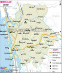
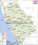
District Map of Thiruvananthapuram |
|
|

|
|
|
|
*Map showing national highway, major roads, rivers, district headquarter, etc in Thiruvananthapuram District of Kerala. |
Disclaimer: All efforts have been made to make this image accurate. However Mapping Digiworld Pvt Ltd and its directors do not own any responsibility for the correctness or authenticity of the same. |
| |
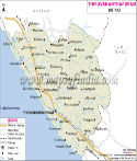
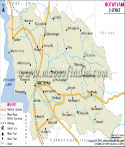
Major Districts of Kerala |
|
 |
 |
 |
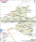 |
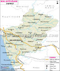
| Ernakulam District Map | Malappuram District Map | Kollam District Map | Palakkad District Map |
| | | | |
 |
 |
 |
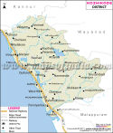 |
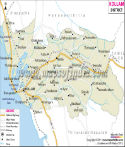
| Kannur District Map | Thiruvananthapuram District Map | Kottayam District Map | Kozhikode District Map |
| | | | other districts of Kerala >> |
Thiruvananthapuram is the state capital of
Kerala. Previously the name of the district was Trivandrum.
The district lies in the southern part of the state. The geographical location of the district is between 8
o 17" and 8
o 54" north latitudes and between 76
o 41" and 77
o 17" east longitudes.
The area of
Thiruvananthapuram is 2,192 sq km. The total population of the district is 29,38,533, as per the census of 2001.
Some of the notable tourist sites of Thiruvananthapuram are
- Sri Padmanabhaswamy Temple
- Anjengo
- Agasthyakoodam
- Neyyar Dam
- Lion Safari Park
- Neyyar Wild Life Sanctuary
Places in Thiruvananthapuram Map
Kappil, Varkkallai, Agattumuri, Vettur, Attingal, Kadakkavur, Achuthengu, Chirayinkeezhu, Vamanapuram, Palod, Venjaramudu, Vidura, Bonaccord, Kallar, Pon Mudi, Murukkumpuzha, Mangalapuram, Nedumangad, Kaniyapuram, Attipara, Kazhakuttam, Veli, Parattipalli, Aruvikkara, Thiruvananthapuram, Kovillur, Neman, Shangumugham, Kovalam, Vizhinjam, Puvar, Parassala, Neyyattinkara, Balarampur, Kovillur
Last Updated on : May 11, 2026