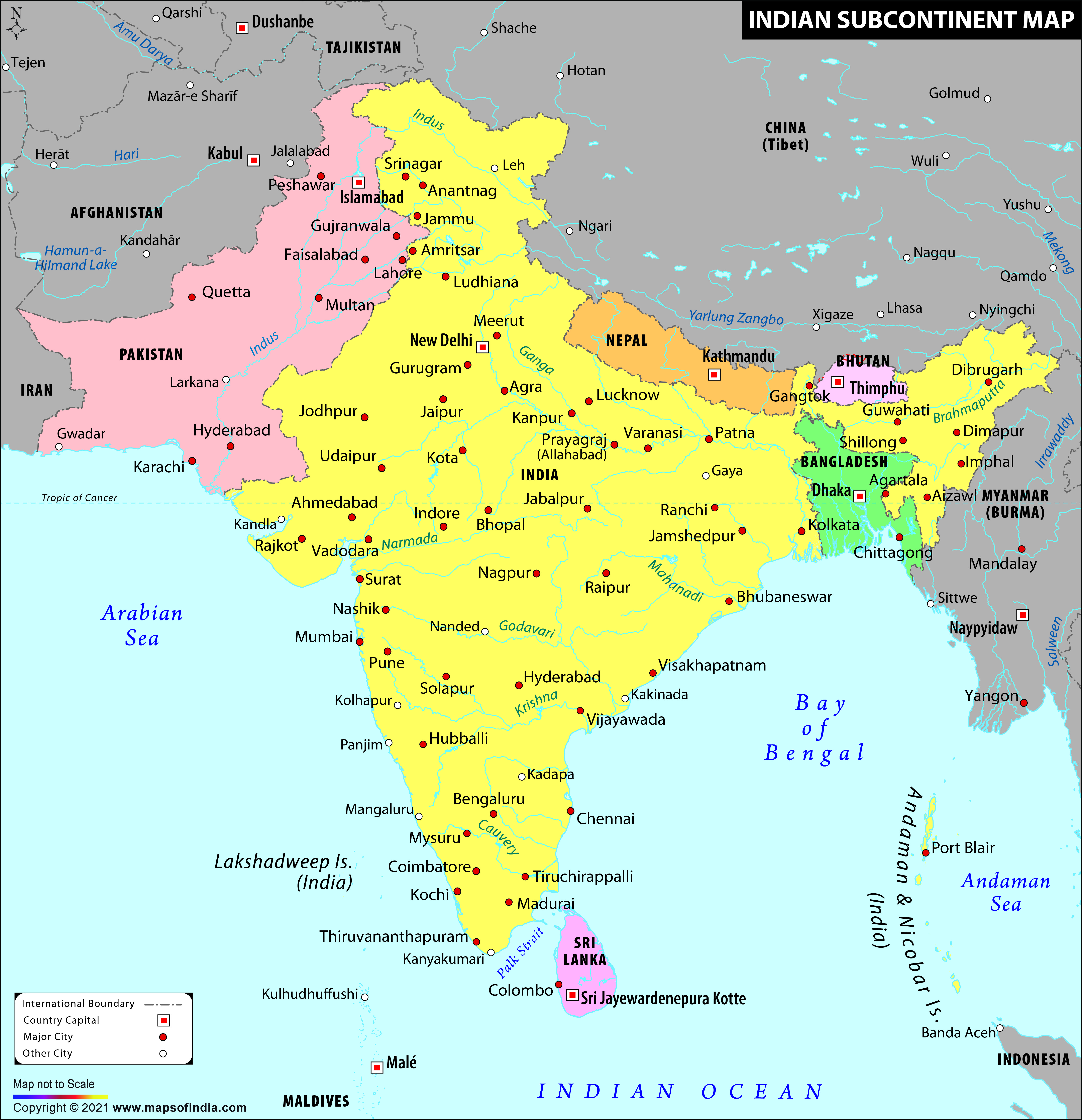
A place can be determined as a subcontinent only when it belongs to a continent, but is politically or geographically a separate entity or when it is smaller compared to a continent.
India is also referred as a subcontinent because of its distinct landmass. Even though it might have all the features required to be a continent, it cannot be called as one because it is not that big as it should be. However, originally, India was a continent with large landmass. Later after separations, it became Asia's part, but the area is separated by the Himalayan region.
India is not the only part of Indian subcontinent, but other SAARC (South Asian Association for Regional Cooperation) countries - Sri Lanka, Pakistan, Bhutan, Nepal, Bangladesh and Maldives - are also a part of the Indian subcontinent. This group, when combined together, form the Indian subcontinent. These regions were initially India's part, but were separated because of political or geographical reasons. The climatic conditions of each of these seven countries match because they are joined together geographically. The other continents of Asia have different geographical and climatic features. Afghanistan is also a part of the Indian Subcontinent. The region might also include Aksai Chin's disputed territory. This territory was once a part of Jammu and Kashmir's British Indian princely state, but is Xinjiang's Chinese autonomous regions' administered part.
The Indian subcontinent is one of Asia's regions, which is located on the Indian tectonic plate. Both the terms - 'South Asia' and 'Indian subcontinent' are used in an interchangeable manner. South Asia's religions suggest that South Asia and Indian Subcontinent is one and the same thing. It is only because of political sensitivities that some call it 'South Asian Subcontinent' or 'South Asia', some term it 'Indo-Pak Subcontinent' and some refer to it as 'Indian subcontinent'. However, when someone uses the Indian subcontinent for South Asia, small island countries of Maldives and Sri Lanka might not be included, and Nepal and Tibet might be or intermittently excluded, depending on what context they are mentioned.
As far as the geography is concerned, Indian subcontinent is south-central Asia's peninsular area. It is mostly is placed on the Indian Plate, separated from Asia. The Indian Plate has most of South Asia, extended from the Himalayan region to the Indian Ocean, which also includes some areas of Eastern Indonesia, Southern China, Karakoram and Kuen Lun ranges. However, this doesn't include Kohistan, Ladakh, Balochistan or the range of Hindu Kush. The Indian Subcontinent - with countries like India, Bangladesh, Pakistan, Nepal, Sri Lanka, Maldives and Bhutan - covers an area of about 4.4 million kilometres. This area is Asia's 10% or the world's 2.4% of the land.
Last Updated on : November 13, 2025
