What is Mangaluru famous for?
Located on the backwaters of Karnataka, Mangaluru is the major port city of the state as well as the location of Dakshina Kannada's administrative headquarters. Nestled in between the mountain ranges of the Western Ghat and the Arabian Sea, it forms one of the chief port cities of the country. The place is even frequently used for traffic staging along the Malabar coastal region. Situated at around 350 kms towards the western side of Bangalore, Karnataka's capital city, Mangaluru serves as a gateway to the state. Known for its beautiful sea beaches and historical temples, this port city is full of hills, meandering streams and coconut palms.
Where did the city derive its name from?
The city of Mangalore is named after Mangaladevi, a local Goddess of the Hindus. This trading hub of the state is even regarded locally as Kodial, Kudla, Mangalapuram, Manjarun and Mikala.
How big is this port city?
This main port city of the state of Karnataka is stretched over a total area of 132.45 sq. kms.
Which is the best time to visit Mangaluru?
Featured by hot summers, heavy monsoon and pleasant winter, this port city of southern India can be best visited in between the months of September and February.
How to reach Mangaluru?
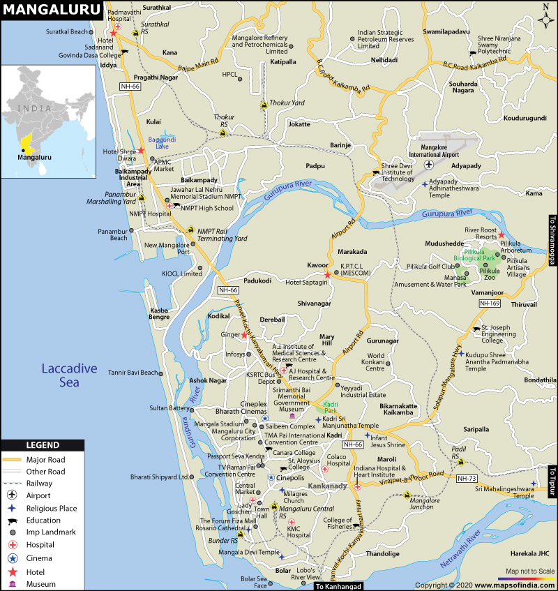
Being a port city, the place has got an added advantage of being accessible through waterways. Besides, Mangalore International Airport connects the city to several national and international destinations. Mangalore Central, Mangalore Junction and Surathkal are the main railway stations in the city. The city can even be reached from different parts of the country via the National Highways 13, 17 and 48.
. Aloysious Chapel
Last Updated on: June 18, 2026