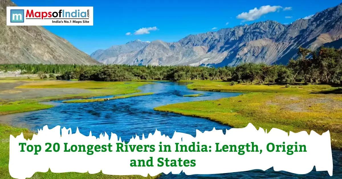
River length is not just trivia. It decides how far irrigation water can travel, how many states share a hydropower project, and how many cities can draw drinking water from a single source. In this article, you will find the full top 20 longest rivers in India, ranked by their length, origin, the states they pass through, and the basin they belong to. One thing worth flagging early: this list measures length within India, not total global length, since rivers like the Brahmaputra and the Indus actually run longer overall but spend far less of that distance inside Indian territory. That distinction matters more than most articles let on, and it is exactly where a lot of these rankings quietly diverge from each other.
How Are River Lengths Measured?
A river's total length covers its entire course, from source to sea, regardless of which countries it crosses along the way. Length within India, on the other hand, only counts the stretch that actually runs through Indian territory. The Brahmaputra, for instance, runs roughly 2,900 km in total, yet only about 916 km of that lies within India, with the rest running through Tibet and Bangladesh. The Indus tells a similar story, stretching close to 3,180 km total, but only around 1,114 km within Indian borders. This is exactly why the Ganga, at 2,525 km, almost entirely inside the country, gets called India's longest river, even though two other rivers technically run longer worldwide.
Top 20 Longest Rivers in India
Rank | River | Length (km) | Origin | States Covered | Tributary of / Basin |
| 1 | Ganga | 2,525 | Gangotri Glacier, Uttarakhand | Uttarakhand, UP, Bihar, West Bengal | Ganga Basin |
| 2 | Godavari | 1,465 | Trimbakeshwar, Maharashtra | Maharashtra, Telangana, Andhra Pradesh, Chhattisgarh, Odisha | Godavari Basin |
| 3 | Krishna | 1,400 | Mahabaleshwar, Maharashtra | Maharashtra, Karnataka, Telangana, and Andhra Pradesh | Krishna Basin |
| 4 | Yamuna | 1,376 | Yamunotri Glacier, Uttarakhand | Uttarakhand, HP, Delhi, Haryana, UP | Ganga (tributary) |
| 5 | Narmada | 1,312 | Amarkantak, Madhya Pradesh | Madhya Pradesh, Gujarat, Maharashtra | Narmada Basin |
| 6 | Indus | ~1,114 (in India) | Near Lake Mansarovar, Tibet | Jammu & Kashmir, Ladakh | Indus Basin |
| 7 | Brahmaputra | ~916 (in India) | Angsi Glacier, Tibet | Arunachal Pradesh, Assam | Brahmaputra Basin |
| 8 | Mahanadi | 858 | Sihawa, Chhattisgarh | Chhattisgarh, Odisha | Mahanadi Basin |
| 9 | Kaveri | ~800 | Talakaveri, Karnataka | Karnataka, Tamil Nadu | Kaveri Basin |
| 10 | Tapi | 724 | Satpura Range, MP | MP, Maharashtra, Gujarat | Tapi Basin |
| 11 | Ghaghara | ~1,080 | Tibetan Himalayas | Uttar Pradesh, Bihar | Ganga (tributary) |
| 12 | Sutlej | ~1,050 (in India) | Rakshastal, Tibet | Himachal Pradesh, Punjab | Indus (tributary) |
| 13 | Chambal | ~960 | Janapav Hills, MP | MP, Rajasthan, UP | Yamuna (tributary) |
| 14 | Kosi | ~730 | Nepal Himalayas | Bihar | Ganga (tributary) |
| 15 | Son | 784 | Amarkantak, MP | MP, UP, Bihar | Ganga (tributary) |
| 16 | Ravi | ~720 | Bara Bhangal, HP | Himachal Pradesh, Punjab | Indus (tributary) |
| 17 | Gandak | ~630 | Nepal Himalayas | Bihar | Ganga (tributary) |
| 18 | Betwa | ~590 | Vindhya Range, MP | MP, Uttar Pradesh | Yamuna (tributary) |
| 19 | Damodar | ~592 | Chhotanagpur Plateau, Jharkhand | Jharkhand, West Bengal | Hooghly (tributary) |
| 20 | Beas | 470 | Beas Kund, HP | Himachal Pradesh, Punjab | Sutlej (tributary) |
A quick note here, since it matters for trust: ranking from about position 11 downward genuinely varies across sources, since some treat glacier-fed tributaries separately from independent river systems. The top 10 stays fairly consistent everywhere, though.
Top 20 Longest Rivers in India
1. Ganga (Ganges)
Length: 2,525 km. It originates at the Gangotri Glacier in Uttarakhand, and is correctly formed at Devprayag, where the Bhagirathi and Alaknanda rivers converge. Passes through Uttarakhand, Uttar Pradesh, Bihar and West Bengal and finally flows into the Bay of Bengal. The Yamuna, Son, Gandak and Kosi are the major tributaries. It is declared as the National River of India and is the epicentre of the sacred cities of Varanasi and Haridwar, and holds a special significance in both religious pilgrimages and in daily life.
2. Godavari
Length: 1,465 km. It rises near Trimbakeshwar in the Nashik district of Maharashtra and runs southeastward over the Deccan Plateau. It traverses the states of Maharashtra, Telangana, Andhra Pradesh, Chhattisgarh and Odisha, ultimately reaching the Bay of Bengal. This is fed by the Purna, Manjira and Indravati rivers. It is locally known as the "Dakshin Ganges" or Ganges of the South, and it provides the water supply for one of the largest river basins in peninsular India.
3. Krishna
Length: 1,400 km. It originates at Mahabaleshwar in Maharashtra and passes through Karnataka, Telangana and Andhra Pradesh and flows into the Bay of Bengal. The Bhima, the Tungabhadra and the Koyna are the tributaries. It is the backbone of irrigation and hydropower in southern India, with the Srisailam and Nagarjuna Sagar dams on its banks.
4. Yamuna
Length: 1,376 km. It originates from the Yamunotri glacier near Banderpoonch peak in Uttarakhand, passes through Himachal, Delhi, Haryana and Uttar Pradesh, and finally joins the Ganga at Prayagraj's Triveni Sangam. It is the largest tributary of the Ganga, receiving the Chambal, Betwa and Ken rivers, and is very much part of the cultural heritage and water supply of Delhi.
5. Narmada
Length: 1,312 km. It begins at Amarkantak in Madhya Pradesh and flows westwards, an unusual course for a river in India, between the Vindhya and the Satpura ranges. It passes through Madhya Pradesh, Gujarat and Maharashtra and empties into the Arabian Sea. The Sardar Sarovar Dam lies on its path, and it is popularly known as the lifeline of central India.
6. Indus
The length in India is about 1,114 km (total length 3,180 km). It rose from the vicinity of Lake Mansarovar in Tibet and flowed through Ladakh to Pakistan. The Indian tributaries are Jhelum, Chenab, Ravi, Beas and Sutlej. The river has named the nation of India and has cradled the ancient Indus Valley Civilisation, one of the earliest civilisations of the world.
7. Brahmaputra
Length in India: approximately 916 km (total length around 2,900 km). It begins at the Angsi Glacier in Tibet, known there as the Yarlung Tsangpo, before entering India through Arunachal Pradesh and flowing through Assam. It is the only major Indian river traditionally referred to with a masculine name. The Kaziranga National Park sits along its banks, and it floods heavily during the monsoon season most years.
8. Mahanadi
Length: 858 km. It rises near Sihawa in Chhattisgarh, passes through Chhattisgarh and Odisha in its eastward direction and enters the Bay of Bengal. It is one of the longest earthen dams in the world, the Hirakud dam, which is the central feature of irrigation and flood control in Odisha.
9. Kaveri (Cauvery)
Length: approximately 800 km. It originates at Talakaveri in Karnataka's Western Ghats and flows through Karnataka and Tamil Nadu before reaching the Bay of Bengal. Often called the "Dakshin Ganga" of the south, it has supported South Indian agriculture and ancient kingdoms for centuries, and remains at the centre of long-running water-sharing disputes between the two states it flows through.
10. Tapi (Tapti)
Length: 724 km. It rises in the Satpura Range of Madhya Pradesh and flows westward through Madhya Pradesh, Maharashtra, and Gujarat, emptying into the Gulf of Khambhat. Along with the Narmada and Mahi, it is one of the few major Indian rivers that flows east to west rather than toward the Bay of Bengal.
11. Ghaghara (Karnali)
Length: approximately 1,080 km. It originates in the Tibetan Himalayas, passes through Nepal and comes into Uttar Pradesh and Bihar and merges with the Ganga. It is a very polluted river with a high load of water and sediment, and one of the main northern tributaries of the Ganga.
12. Sutlej
The length in India is: 1050 km. It originates in the Tibetan plateau close to Rakshastal and enters India through Himachal Pradesh, leading into Punjab, where it joins the Indus system. It supports Bhakra Nangal Dam, which is one of India's biggest hydropower and irrigation dams.
13. Chambal
Length: approximately 960 km. It springs from the Janapav Hills in Madhya Pradesh, passes through Madhya Pradesh, Rajasthan and Uttar Pradesh, and finally merges with the Yamuna. It is famous for its purity, ravines and the Chambal Wildlife Sanctuary, which protects gharials and river dolphins.
14. Kosi
Length: approximately 730 km. It flows from Nepal through the Nepal Himalayas and into Bihar, where it is known as the "Sorrow of Bihar" because of its tendency to change its course and cause massive floods. It finally merges into the Ganga.
15. Son (Sone)
Length: 784 km. It originates on the Amarkantak Plateau in Madhya Pradesh, close to the Narmada's own source, and flows through Madhya Pradesh, Uttar Pradesh, and Bihar before joining the Ganga near Patna. It is one of the Ganga's largest southern tributaries.
16. Ravi
Length: approximately 720 km. It rises near Bara Bhangal in Himachal Pradesh and flows through Himachal Pradesh and Punjab before entering Pakistan as part of the Indus system. It is the smallest of the six main rivers historically associated with the Punjab region.
17. Gandak
Length: approximately 630 km. It originates in the Nepal Himalayas and enters Bihar, eventually merging with the Ganga near Patna. It carries a significant seasonal flooding risk, much like its neighbouring rivers in the region.
18. Betwa
Length: approximately 590 km. It originates in the Vindhya Range of Madhya Pradesh and runs through Madhya Pradesh and Uttar Pradesh until it merges with the Yamuna. Its course is backed up by the Rajghat and Matatila dams, which provide the Bundelkhand region with irrigation.
19. Damodar
Length: approximately 592 km. It originates on the Chhotanagpur Plateau in Jharkhand and flows through Jharkhand and West Bengal before joining the Hooghly. Once nicknamed the "Sorrow of Bengal" for its historic flooding, it is now regulated through a multi-dam system modelled loosely on the Tennessee Valley Authority.
20. Beas
Length: 470 km. It rises at Beas Kund in Himachal Pradesh and flows through Himachal Pradesh and Punjab before merging into the Sutlej at Harike. It is the smallest of the five major Punjab rivers, and the Rig Veda refers to it by an older name, Vipasha.
India's Longest Rivers by Region
Himalayan Rivers
These rivers stay fed year-round, since they draw from both glacial melt and monsoon rainfall. Ganga, Yamuna, Brahmaputra, Indus, Sutlej, and Ghaghara all fall into this category, and they tend to carry far more water and sediment than their peninsular counterparts.
Peninsular Rivers
These rivers depend almost entirely on seasonal monsoon rain, since they lack glacial sources. Godavari, Krishna, Kaveri, Narmada, Tapi, and Mahanadi all belong here, and most run noticeably lower during the dry months compared to their Himalayan counterparts.
Longest River in India
- Longest river in India: Ganga, at 2,525 km.
- Longest river basin in India: Ganga Basin, covering the largest drainage area of any Indian river system.
- Longest river originating in India: Ganga, since the Indus and Brahmaputra both originate outside Indian territory.
- Longest river flowing entirely within India: Ganga, given that its course runs almost completely inside the country before reaching Bangladesh near its mouth.
Map of India's Major Rivers
Picture the Himalayan rivers fanning out across the north, Ganga and Yamuna carving through the plains, Brahmaputra sweeping in from the northeast, while the peninsular rivers, Godavari, Krishna, Kaveri, and Narmada, cut diagonal paths across the Deccan Plateau toward either coast. Together, they form a drainage network that touches nearly every state in the country in some way.
Conclusion
India's rivers do far more than fill a geography textbook. They shape where cities grow, where farmland thrives, and where hydropower gets generated. The Ganga leads this list by a wide margin, but the diversity across these 20 rivers, from Himalayan giants to fast peninsular systems, tells a much richer story about the country's water security. Bookmark this list if you're studying for exams or simply curious about the rivers running near you.
FAQs
Which is the longest river in India?
The Ganga holds that title, running approximately 2,525 km almost entirely within Indian territory.
Which is the longest river flowing entirely within India?
The Ganga again, since unlike the Indus and Brahmaputra, its course runs almost completely inside the country before it crosses into Bangladesh near its mouth.
Which is longer, the Ganga or the Brahmaputra?
The Ganga is about 2525 km long and flows almost entirely in India, while the Brahmaputra is about 2900 km long, of which only about 916 km are in Indian territory.
Which is the largest river in the Indian sub-continent in terms of basin?
The Ganga Basin is entitled to that name, having the greatest drainage area of any river system in the country.
Which state has the most rivers flowing through it?
Madhya Pradesh is one of the states with the maximum number of river headwaters and length, as many major rivers originate or flow in the state, such as Narmada, Chambal, Betwa and Son.
Is the Indus really longer than the Ganga?
Yes, in overall length. The Indus is approximately 3,180 km in length, but just 1,114 km of its length passes through India, making the Ganga India's longest river.
Which of the Indian rivers flows east to west?
The Narmada, Tapi and Mahi, the three major western-flowing rivers in India, run west into the Arabian Sea, instead of flowing east to the Bay of Bengal as most do.
Why do river length figures vary between different sources?
Because some measure total global length while others measure only the stretch within India, and survey methods can differ slightly, too, which is exactly why this article specifies both wherever it matters.