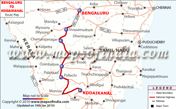
The shortest distance from
Bengaluru to Kodaikanal is around 450 km via the National Highway Number 7 and the Salem-Ernakulam Highway which passes through Bhavani, Dharapuram and Palani.
The total time to cover the distance between Bengaluru and Kodaikanal is approximately 8 to 9 hours by road.
There is also an alternate route from Bengaluru to Kodaikanal via National Highway Number 7 which passes through Namakkal, Karur and Dindigul. This route has a total distance of around 465 km and the time taken to cover the distance on this route is approximately 9 hours by road.
To travel from Bengaluru to Kodaikanal one can choose any of these two routes.
Last Updated on : June 15, 2026