 |
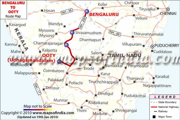
Bengaluru to Ooty Route Map |
|
 |
|
|
|
|
Close Disclaimer: All efforts have been made to make this image accurate. However Mapping Digiworld Pvt Ltd and its directors do not own any responsibility for the correctness or authenticity of the same. |
The shortest distance from Bengaluru to Ooty is around 265 km via the State Highway Number 17 which passes through Mysore.
The total time to cover the distance between Bengaluru and Ooty is approximately 6 to 7 hours by road. There is also an alternate route from Bengaluru to Ooty via State Highway Number 3, National Highway Number 209 and Coimbatore Ooty Gundelpet Highway which passes through Kanakapura, Kollegal, Mettupalayam and Coonoor.
This route has a total distance of around 336 km and the time taken to cover the distance on this route is approximately 7 to 8 hours by road. To travel from Bengaluru to Ooty one can choose any of these two routes.
Last Updated on : June 15, 2026
Places to Visit in Bangalore