
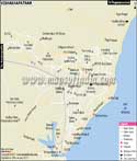
Geography
The Visakhapatnam district is geographically located at 17° 15' and 18°32' Northern latitude and 18°54' and 83°30' in Eastern longitude. As per census 2011, Visakhapatnam district has a population of 42,88,113. The official language of the city is Telugu. Hinduism is practiced by a majority of the population. A segment of population is composed of Bengalis and Oriyas.
Economy
With the passage of time, the city has developed into an economic hub. Once a small fishing village, it has now turned into one of the most promising industrial hubs in south India. It comprises all the important sectors of the economy such as pharma, IT, fishing, import and export. As fishing is the main occupation of the people, the presence of an international port has resulted in an increase in trade and commerce in the city. The ports play an important role in the economy of the city as they contribute to the development of some industries like steel, petroleum and fertilisers. Some of the renowned industries like Bharat Heavy Plate and Vessels Limited, Hindustan Petroleum Corporation Limited, Hindustan Shipyard Limited, have their industries in Vizag. India's only Pharmaceutical Special Economic Zone (SEZ), Jawaharlal Nehru Pharma is located in Vizag. The SEZ houses many notable pharmaceutical companies such as Raks Pharma Pvt. Ltd., PharmaZell, Hospira and Granules Omnichem Pvt. Ltd. to name a few.
Tourist attractions
The city is also a major tourist destination in Andhra Pradesh and has many caves, beaches, wildlife sanctuaries and the Eastern Ghats which are the places of interests in the city. Dolphin's Nose, a rocky headland is located at 358 metres above sea level in the south of the city. It is named so because it resembles a dolphin's nose. The Borra Caves have both historical and religious significance and are popular for the beautiful formations of stalagmite and stalactite. The RamaKrishna Beach is known for the crystal clear waters of the Bay of Bengal. It also has a Kali Temple, a submarine museum and VUDA Park. Visakhapatnam district houses many other tourist destinations like Araku Valley, Kailasagiri Hill and Submarine museum.
Connectivity
The Visakhapatnam airport is well-connected with many major cities of the country like Delhi, Mumbai, Hyderabad and Chennai. The Visakhapatnam railway station is a well networked link and connects it to many railheads which fall on the Delhi-Chennai route. The city is well-connected to neighbouring cities via roadways. The state owned Andhra Pradesh State Road Transport Corporation (APSRTC) runs inter-city and local buses in the city.
WBST070415
Last Updated on : May 11, 2026
| Find Distance from Visakhapatnam City Map to other Indian Cities | |||