






About
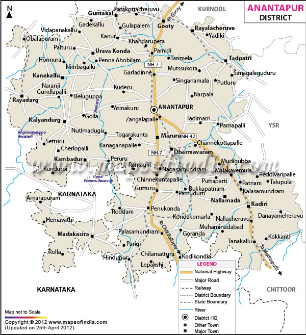
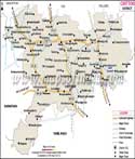
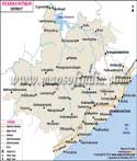
Situated in the south-western part of the state of Andhra Pradesh, Anantapuramu—known simply as Anantapur—is a fascinating example of resilience, history and geographical expanse. The name itself is a poetic one, and refers to the historic water reservoir 'Anaatasagaram', literally 'Endless Ocean'. Constructed in the heyday of the Vijayanagara Empire, this behemoth water tank was a symbol of hope and engineering excellence in an area where rain was traditionally very few. The legend of the reservoir is that it was named after Queen Ananthamma, the wife of the other co-founder of the empire, Bukka Raya I, but others say it was named after the visionary minister Anantarasa Chikkavodeya who led the way to the construction of the reservoir. Anantapur is the western gateway to the state adjacent to Kurnool district in the north, YSR Kadapa and Chittoor districts in the east, Karnataka state in south and west. The district is well in the midst of the Rayalaseema which is a semi-arid region, and moves smoothly from arid plains to rugged historic hill ranges. It is an administrative and geographical weight in Andhra Pradesh which plays a major role in providing connectivity to the southern tier of major metropolises such as Bengaluru, Hyderabad and Chennai.
History & Culture
Anantapur’s history and culture are indeed rich and diverse, as it was ruled over by some of the greatest dynasties in Indian history. The region used to be a hub for trade and commerce, as well as a center for religious activities before it became a medieval kingdom. The early rock edicts of the Ashokan inscriptions found in Gooty bear witness to the fact that parts of present-day Anantapur were once a part of the Buddhist trade routes that spanned across the Deccan region. After the collapse of the early empires, the land experienced the rise and fall of the Chalukyas and the Cholas and in the 14th century became an important powerhouse under the Vijayanagar Kings. In 1565, the capital of Hampi was lost at the tragic Battle of Talikota and the defensive epicentre of the empire was moved to Penukonda in Anantapur, the secondary capital. It then saw changing tides of power, as the Marathas, Hyder Ali and Tipu Sultan took control of the formidable hill forts before finally it was ceded to the British East India Company by the Nizam of Hyderabad in 1800. In 1882 the modern district was formed from the Bellary district. By the third century BCE, the Buddhist trading hub had flourished. In the fourteenth to the sixteenth centuries, the Vijayanagara Empire reached its height. Penukonda was made the secondary capital of the State of Travancore in 1565.
A land of art that is passed down from generation to generation. The district is famed for its weaving industry of Dharmavaram which is considered to be a universal industry, where the weavers weave intricate mythological stories directly into the border of premium quality silk sarees. The district’s cultural and spiritual strength is equally reflected in the Lepakshi school of paintings and sculpture, which depicts pictorially all the beautiful creations of art without any shadow. The major festivals celebrated in all enthusiasm are Ugadi – The Telugu New Year, when the traditional Ugadi Pachadi is prepared, Maha Shivaratri – An all-nighter festival celebrated in most of the ancient Shaivite temples in the district with great enthusiasm. Sri Venkateswara Swamy Brahmotsavams – The Brahmotsavams are celebrated in all the ancient temples with great pomp and grandeur in the district with a large scale procession of the idol in a decorated chariot.
Economy
Anantapur has a vibrant and evolving economy. It is traditionally believed to be a drought-stricken farmland area, but now, certain industrial corridors, education development, and huge foreign direct investments have significantly changed its financial situation.
Government Sector
The state government and central government have established a certain structure for their administrative systems, which can offer some level of stable employment. The government sector is also responsible for implementing significant irrigation projects (such as the high level canal projects on Tungabhadra) and large-scale social welfare programmes, agricultural extension and infrastructure development programmes that keep the rural economy going.
Public Sector
The public sector is an important part of the industrial sector in the district. Guntakal is one of the most important railway junctions in the south of India that has a huge division of the South Central Railway with several thousands of technical and administrative employees. Moreover, Anantapur is becoming a leading centre for Renewable Energy public-private partnerships. Today, there are some of India's largest solar parks and wind energy grids on these huge, sun-soaked plains, with strong backing provided by the state infrastructure boards.
Services Sector
Over the past few decades, the tertiary or services sector has seen explosive growth, underpinned primarily by two key factors: Education: The district boasts a large number of students at premier institutions like Sri Krishnadevaraya University and Jawaharlal Nehru Technological University. The services sector is important to the export of tons of sweet lime, pomegranates, banana and papaya that are transported through the intricate supply chain and logistics to international markets. The most significant industries and jobs in this region. The groundnut (peanut) crop occupies over 70% of the traditional crop area while the automobile manufacturing is the economic crown jewel of the 21st Century in Anantapur. The construction of the multi-billion dollar Kia Motors manufacturing plant in Penukonda has literally changed the nature of the area and resulted in dozens of ancillary automotive component units and tens of thousands of direct and indirect engineering jobs. Besides, the landmark industrial village of Dharmavaram Silk Sarees, is a world-famous cluster of small-scale industries and sustains several hundred master weavers and allied workers financially.
Tourism
From its ancient spiritual wonders to its modern-day oases of calm, Anantapur offers an extraordinary array of tourist hot spots.
Lepakshi Temple
The Veerabhadra Temple at Lepakshi is a masterpiece of 16th century Vijayanagara architecture, and is a treasure trove of art and engineering. It is the home of the wonder of the world, the Hanging Pillar, which is still hanging slightly above the floor of the temple, and visitors can pass a thin piece of cloth right under it. The walls are decorated with excellent frescoes of scenes from the Puranas, which are dyed with vegetable colours; the colossal Lepakshi Basaveshwara or Nandi, a monolithic bull sculpted from a single granite block, and flawlessly proportioned, is situated some distance away.
Gooty Fort
Gooty Fort is one of the oldest hill fortifications in India, majestically perched on a group of hills at more than 300m above sea level. The shell-like fortification with 15 fortified gates and cleverly arranged water tanks among the rocks. Its tough rocks guard the walls and look out on the plains and tell of those who once walked upon its walls, Vijayanagara heroes, Maratha warriors, and British soldiers.
Penukonda Fort
It is now known as the Penukonda Fort, but was originally named Ghanagiri ("The Impregnable Hill") and is a proud sentinel of the end of the Vijayanagara dynasty.
Demographics
The demographic profile of Anantapur is a lively and industrious population that is closely connected to its huge rural expanse and growing urban enclaves. Out here, 4,081,148 people call Anantapur District home. Languages SpokenThe main language of the district is Telugu, which is spoken by more than 81% of the population, and is also the official language. This language unites the people of the district as they have a rich literature in the language and a natural idiom. Historical ties with the Deccan Sultanates and the Nizam rule, Urdu is widely spoken and understood by about 10% of the population, mainly in urban areas. Further, the district borders a length of Karnataka state where Kannada is spoken fluently (roughly 5%) leading to a wonderful linguistic harmony.
Administration
The administrative setup of Anantapur is very organized and is well suited to the huge geographic area, with governance down to the grassroot level.
Administrative Subdivisions (Revenue Divisions):
The district is divided into a number of Revenue Divisions for administrative convenience, under the control of the Revenue Divisional Officer (RDO):
- Ananthapuramu District
- Anantapur Division
- Dharmavaram Division
- Kalyandurg Division
- Guntakal Division
- Mandals (Tehsils) & Local Bodies
The district is also divided into 63 Revenue Mandals (local Tehsils) as the vital point of liaison between local villages and district level administration. There is strong support for local self-governance.
Village System
Anantapur has a large number of revenue villages, totaling 961, all with an occupant population and a few historical sources accounting for up to 1681 settlement blocks and hamlets. These villages are the very heart of the social life of this district. The Village Secretariat (Grama Sachivalayam) system is an innovative administrative structure introduced to provide citizen service to citizens at their doorsteps, in Andhra Pradesh.
| Facts of Anantapur District | |
|---|---|
| Official Name | Anantapur |
| Location | Andhra Pradesh |
| Area (km2) | 105.98 |
| Population | 4,081,148 (2011 census) |
| Language | Telugu |
FAQs
Q1: What is the total number of Villages in Anantapur District?
Most of Anantapur District's 961recorded villages show up in both census and land documents.
Q2: What is the Total Population of Anantapur District?
Out here, 4,081,148 people call Anantapur District home.
Q3: What is famous about Anantpur district ?
For centuries, Anantapur has been famous for Lepakshi Temple with the legendary Hanging Pillar as one of the major tourist attractions of the city, the globally known Dharmavaram handloom silk sarees, the spiritual Ashram at Puttaparthi and today, it is the main industrial city as it is home to the large automobile manufacturing plant of Kia Motors. In addition, it is also referred to as the main fruit bowl of Andhra Pradesh due to the abundance of fruits that are produced in the region.
Last Updated on : July 22, 2026
