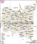
The Kurnool District is situated in the west of Andhra Pradesh, India The Boundaries of Kurnool district are Guntur and Nellore districts in the East, Ballary district in the West, Mahaboobnagar district in the North, Cuddapah and Anantapur districts in the South directions. The total area of the district is 17,658 square kilometer.
Last Updated on : May 11, 2026
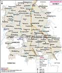
Kurnool District Map |
|
||||||||||
 | ||||||||||
|
| *Kurnool District Map highlights the National Highway, Major Roads, District Headquarter, etc in Kurnool. |
| Major Districts of Andhra Pradesh |
 |
 |
 |
 |
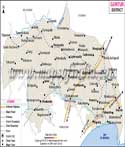
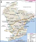
| Anantpur District Map | Guntur District Map | East Godavari District Map | Chittoor District Map |
 |
 |
 |
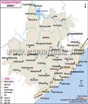 |
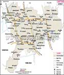
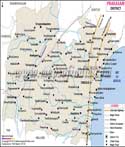
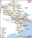
| Prakasam District Map | Krishna District Map | Kurnool District Map | Vishakhapatnam District Map |
| Other Districts of Andhra Pradesh >> | |||