






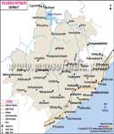
About
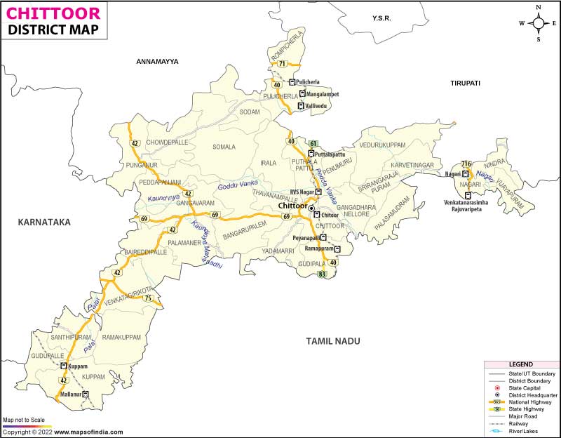
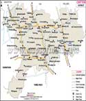
Chittoor District is one of the most unique, culturally significant, and economically important administrative districts in the southern tip of Andhra Pradesh, India. This ancient locality comes with the Eastern Ghats of the sprawling Eastern Ghats and serves as an important borderland between the socio-cultural and economic worlds of Andhra Pradesh and its neighboring industrial giants of Tamil Nadu and Karnataka. The administrative headquarters is in Chittoor City, which is a busy and historical old city in the Neeva River Valley, with an abundant commercial trade network and agro-processing industries.
Major features of Chittoor District are its centuries-old heritage of being the Mango Capital of India, the largest producer, processor, and exporter of high-grade fruit pulp in the country. It also boasts an enormous industrial heritage and is a major producer of dairy, electronic goods, and cars in the southern states. Moreover, Chittoor is known for its unrivalled ecological richness and preservation of natural forestlands and extensive natural wildlife habitats, which host rare species of plants and animals, thus serving as an important ecosystem buffer zone in the region.
History & Culture
The historical and cultural legacy of Chittoor District is extremely deep and rich, not just in terms of the number of millennia it has covered, but also as a pivotal highland zone where ancient spiritual philosophies, powerful empires, and intense colonial struggles took place. Long and detailed archaeological survey work has been carried out in the district. It has confirmed the age of the district, with the discovery of prehistoric dolmens, megalithic burial sites, and old stone implements in the Palar and Neeva river basins. In ancient times, Chittoor was an important southern part of the mighty Maurya kingdom, and then changed hands to become the frontier land of early Pallavas (Kanchi) and early Western Gangas, who constructed early rock-cut fortifications and controlled agrarian trade routes through the mountain passes.
During the medieval period, Chittoor became a coveted geopolitical prize and was fiercely fought over by the Imperial Cholas, the Rashtrakutas of Halebidu, and the Hoysalas of Halebidu. The land had an absolute golden age by the fourteenth century, when it was directly under the auspices of the glorious Vijayanagara Empire, structured, fortified, and endowed with art.
After the historic Mysore Wars, in the late eighteenth century, the Nawabs and the British East India Company took direct control of the territory, and Chittoor came under the historic Madras Presidency in 1801. The population was not prepared to be exploited, and the legendary regional chieftains, who were also proud, launched armed guerrilla attacks against the British tax oppression in the region, which resulted in the first armed resistance against the British rule in the region, a revolt that shook the colonial rule decades before the Indian Revolt of 1857. Chittoor was a base for the Indians to develop patriotic feelings in the course of the struggle for Independence in the twentieth century. It was the base of Nationalistic fervor and contributed to some leaders of a fervent patriotic attitude who mobilized the masses against colonial rule.
The District of Chittoor is a truly beautiful mosaic of culture, with a seamless combination of age-old Telugu traditions and rich cultural influences from neighbouring Tamil Nadu and Karnataka. The local form of the Telugu language is very unique and has borrowed from Tamil and Kannada as well, which are languages spoken in the neighbouring states, as there have been trade and social contacts between the states for centuries.
The festivals in Chittoor District are celebrated with great enthusiasm and grandeur among the people of the district. The celebration of harvest is celebrated with much pomp in each rural parish, and the event is marked by a special festival for cattle, Pasuvula Panduga, art of rangoli, and extensive community feasts. In addition, Maha Shivaratri and Dussehra are also spiritually significant events that attract thousands of people from the local history sites. Chittoor's culinary scene is a proud part of Southern Indian cuisine, showcasing a variety of fresh milk-based dishes, local spices, and specialty foods, such as Pindi Vantalu, savoury millets (Ragi Sangati), mango pickles, and a splendid array of traditional milk sweet delicacies that witness the district's flourishing dairy culture.
Economy
Chittoor District has an exceptionally strong economic structure, with well-established agro-processing industries, significant heavy industries, and strong inter-state trade logistics sectors. The district is a leading powerhouse in the fruit processing industry in Asia with the greatest concentration of mango pulp processing units in the world, including those in Chittoor city, which influences the export value chain to the Middle East, Europe, and North America.
The government sector is a significant employment and regulatory anchor for the operation of the district, Chittoor. Chittoor City is one of the key administrative centres in the southern part of the area and has a strong presence of state and central government services, including the extensive buildings of the Chittoor Municipal Corporation, the District Collectorate, and important courts.
The district's secondary economic tier is well-supported by the public sector and by the heavy state support of utilities. Thousands of skilled technicians and workers from the local community are employed in major public facilities like large-scale dairy processing factories under the cooperative milk unions and big technical maintenance workshops operated by the state road transport corporation.
In addition, the state-managed agricultural boards and National Dairy Development Board have established strong offices in the district that monitor trade channels, have extensive cold storage networks, and provide technical subsidies to ensure the district's multi-million dollar dairy and agricultural exports meet international standards.
The services sector in Chittoor District has grown at an explosive rate and now constitutes a significant part of the regional economy. The banking, commercial credit sector is very active throughout the district and in financing high-dollar investments in agriculture, real estate, and the huge manufacturing logistics systems that span the border. Besides, the city of Chittoor has become a key educational and healthcare services hub with modern multi-specialty hospitals, engineering colleges, and specialized research institutes for students and patients from adjoining inter-state blocks. There is also a flourishing private sector of retail, hospitality, and transport services, which continues to thrive thanks to the city's ongoing growth and the constant influx of new corporate employees, factory engineers, and interstate traders into the city's expanding high-tech envelope.
Tourism
The excellent and diverse tourist offering of Chittoor District is an ideal blend of ancient rock-cut structures, religious historic places, beautiful mountain resorts, and famous Zoos. Horsley Hills is one of the awesome places that you can visit and experience the beauty of nature and landscape, at 4312 feet above sea level. This tranquil haven is known as the Horsley Estate, after its nineteenth-century owner, W.Built by British Collector, D Horseley, it features a wealth of plantation evergreen trees, eucalypt and mahogany, picturesque viewpoints, and a very mild climate, perfect for trips to the tropical plains of Southern India.
The majestic Chandragiri Fort is a must-visit destination for those looking for a deep dive into the historical background and medieval architecture. The Raja Mahal was constructed by the rulers of the Vijayanagara Empire and serves as a perfect specimen of Indo-Saracenic architecture, featuring a museum for special exhibits, where rare stone sculptures, weapons, and coins from the golden age of the regional rule of the Vijayanagara kings are exhibited.
The district's tourism highlights are complemented by natural attractions and religious hill stations. The historic Sri Varasiddhi Vinayaka Temple with its ancient self-manifested (swayambhu) idol of Lord Ganesha on the banks of the Bahuda River is a highly venerated temple visited by millions of pilgrims every year.
Moreover, there is an incredible ecological experience in the Kaundinya Wildlife Sanctuary. It is a huge elephant reserve and sanctuary, with rugged valleys, seasonal waterfalls, and dense dry deciduous forests, a protected habitat for Asian elephants, sloth bear, and panthers, a haven for wildlife enthusiasts, trekkers, and eco-tourists from all over the world.
Demographics
Chittoor District's demographic profile is very dynamic with a highly educated, socially balanced population with satisfactory growth and advanced Socio-economic development indicators across all urban and rural blocks. The population of Chittoor District, as available in the official census data, is about 18,73,000. This great population is optimally geographically dispersed, with approximately 24.5% living in modern urban cities that are rapidly expanding within urban corporations and the rest in highly productive agrarian and industrial villages spread across the countryside, with a population density of about 273 persons per square kilometer.
It has an excellent average literacy rate of 71.60%, indicative of its region's extensive network of top-notch public schools, high-quality technical engineering colleges, and leading agricultural universities. The male and female literacy rates are 79.80% and 63.40%, respectively, and there has always been a decreasing gap between the sexes in access to education due to the state's increasing commitment to intensive welfare programs and the activities of certain local communities.
The Telugu language is the absolute primary language of the district, which is spoken by more than 84% of the population as their first language in day-to-day administration, corporate business, and household activities. Tamil and Kannada are widely used along the mandals of the border areas as they also have historical and commercial links with other states, and Urdu, Hindi, and English are widely used in higher education and business offices as well as within international fruit trading networks.
Administration
Administration in Chittoor District has been laid out with great precision, which facilitates decentralized administration, perfect collection of revenue, and quick implementation of public welfare schemes from the central collectorate to every rural hamlet. The executive head of the district is located at the Chittoor Collectorate under the District Collector and District Magistrate, who run through an organized band of civil servants, municipal commissioners, and regional development officers. The district has been divided into four main revenue divisions. Each of them are headed by a separate Sub-Collector or Revenue Divisional Officer for efficient administration and revenue governance.
- Palamaner Division: Assigns management from the high-yielding dairy belts and western farming areas.
- Kuppam Division: Controls the southern industrial roads and border industries.
- Nagari Division: Carries out control of the eastern clusters of handloom weaving and stone quarrying areas.
These four revenue divisions are further divided into 31 Tehsils (officially and locally called Mandals), which are the smallest units in the decentralized administration of public services. A Tahsildar is responsible for each mandal and is responsible for keeping land records, coordinating the public distribution system, and monitoring the development of infrastructure in the rural areas.
| Facts of Chittoor District | |
|---|---|
| Official Name | Chittoor |
| Location | Andhra Pradesh |
| Area (km2) | 6860 |
| Population | 18,73,000 |
| Language | Telugu |
FAQs
Q1: What is the population of Chittoor?
The population of the district according to the 2011 census is 18,73,000.
Q2: How many villages are there in the district?
There are 822 villages in the district.
Q3: In which way is Chittoor District renowned?
Chittoor is a renowned Mango Capital of India with its extensive production and export of the superior quality fruit pulp. It is also known for the scenic hill station of Horsley Hills, the historical Chandragiri Fort, the sacred Kanipakam Vinayaka Temple, the booming dairy industry, and the traditional local practice of food preparation using millet grain known as Ragi Sangati.
Last Updated on : July 22, 2026
