Sri Potti Sriramulu Nellore District Map


District Map of Sri Potti Sriramulu Nellore

separator Click here for Customized Maps arrow custom map
District Map of Sri Potti Sriramulu Nellore Prakasam YSR Chittoor TAMIL NADU
Print Email Save
*Sri Potti Sriramulu Nellore District Map highlights the National Highway, Major Roads, District Headquarter, etc in Sri Potti Sriramulu Nellore. Disclaimer


  Major Districts of Andhra Pradesh  
Anantpur District Map Guntur District Map East Godavari District Map Chittoor District Map
Anantpur District MapGuntur District MapEast Godavari District MapChittoor District Map
    
Prakasam District Map Krishna District Map Kurnool District Map Vishakhapatnam District Map
Prakasam District MapKrishna District MapKurnool District MapVishakhapatnam District Map
 
  Other Districts of Andhra Pradesh >>

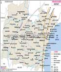
The 163 KM-long Nellore District is located in the state's southeast and is bordered on the east by the Bay of Bengal. Up to the 13th century, the area was referred to as Vikrama Simhapuri before becoming known as Nellore.

In the past, the area has been ruled by many dynasties, including the Mouryas, Sathavahanas, Pallavas, Cholas, Telugu Cholas, Kakateeyas, and Pandyans. 15 parvas of the Sanskrit Mahabharata were translated into Telugu at Nellore by the legendary Telugu poet Tikkana Somayaji.

With the emergence of the Mauryan Empire, Nellore also appears to have come under its influence and was a component of the Ashoka Empire in the third century B.C. It is said that Nellore was located in the Dandakaranya jungles, into which the Aryas first ventured as daring sages.
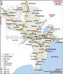
Nellore Distance Chart


Last Updated on : December 12, 2022