






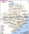
About
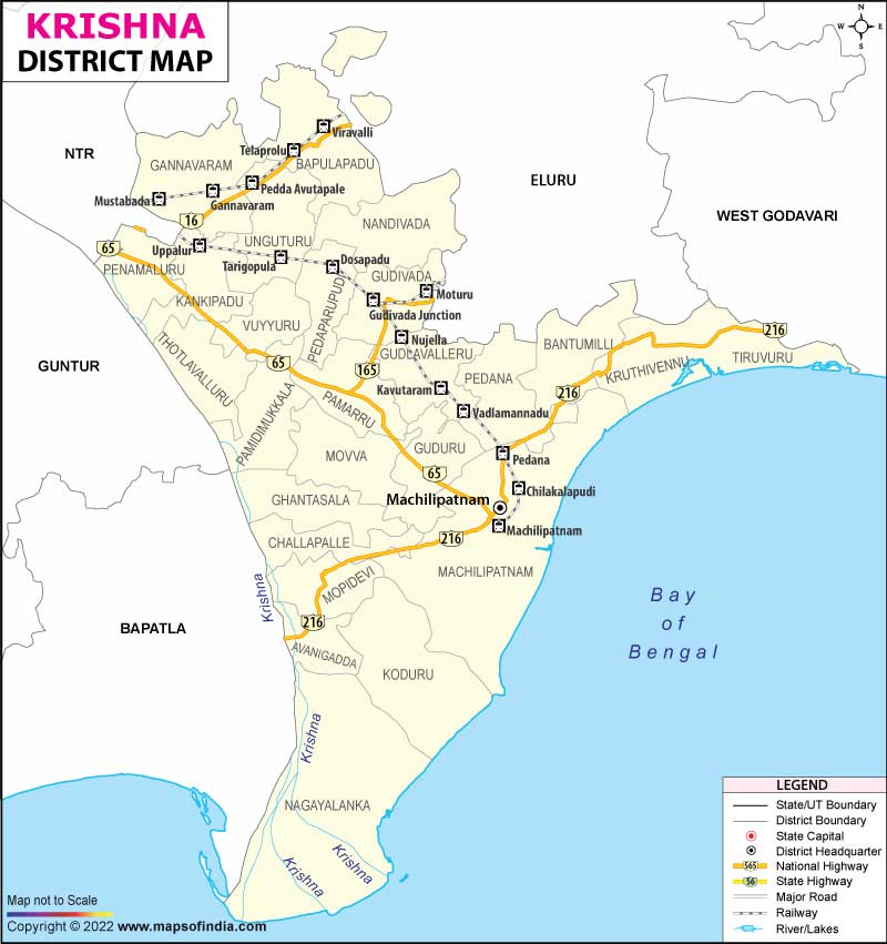
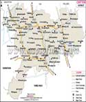
Krishna District is one of the most expansive administrative, historical and economic areas in the coastal Andhra region of Andhra Pradesh, India. The area is believed to have been the hub of maritime trade and administration in the region, with Machilipatnam as its administrative hub. The district got its name from one of the country's largest and most venerated rivers that runs through the district. The river spreads out into a vast delta before reaching the Bay of Bengal at Hamsaladeevi, where it has deposited abundant sediment in the plain. It served as a home for many societies for centuries, and they have found plenty of prosperous agricultural resources there. In 1859 the British officially renamed this district Krishna.
History & Culture
The cultural and historical development of Krishna District in its millennium-long history was highly varied. It used to be a settlement within the borders of which the cultures of the dynasty, the sea trade, and classicism were flourishing. Its ancient roots have been confirmed by numerous discoveries made by archaeologists and Puranic texts. It was once ruled over by the Satavahanas dynasty whose members took full advantage of the region’s access to the sea to develop profitable trade routes reaching the Roman Empire. After their decline, Krishna District was ruled over by several other notable dynasties such as Ikshvakus, Vishnukundinas, and the Eastern Chalukyas who all contributed to the development of the region and the flourishing of its culture.
In medieval times, the land was ruled over by the Gajapatis of Odisha, the Reddi rulers of Kondaveedu, and the Vijayanagaram Empire, under which some of the most splendid masterpieces of art, literature, and architecture were created. However, the district’s golden age was largely associated with the legendary ruler of the Vijayanagara empire Sri Krishnadevaraya. Following the fall of the Vijayanagara empire, Qutb Shahis of Golconda were the ones to rule over the region.
The colonial period of the Krishna district’s history was marked by the political and commercial rivalry between the French, Dutch, British, and the East India Companies. In Machilipatnam, the British East India Company established its first administrative offices making the city the central city of the Northern Circars. The Dutch and the French East India Companies built their trading posts in the district in order to gain access to the region’s luxury fabrics and other local products such as indigo and chintz.
One of the cultural specialties of the district is the Kuchipudi dance art created in the small village of Kuchipudi. This classical dance-drama began in the seventeenth century and was founded by the saint Siddhendra Yogi and is based on a combination of narrative, music, and gestures that act out intricate mythological tales. The tradition of Kuchipidi is currently maintained by the district’s embedded training institutions and families.
The history of the district is closely linked to the ancient architecture. The Buddhist Temple in Ghantasala played an important role for the entry of monks who were travelling east via the maritime routes of Sri Lanka and Southeast Asia.
Moreover, it is noteworthy that festivals are traditionally closely intertwined with both agriculture and religion. For example, all the villages’ inhabitants celebrate Sankranti, the harvest home holiday, with decorations, rituals, and festivities.
Economy
The agricultural strength of Krishna District lies as its backbone, with a well-established tertiary services sector and important institutional developments complementing the balance. The district's agriculture sector is the backbone of the district, as it employs over 50% of the working population in the district. The well-developed Krishna Western Delta canal network enables the cultivation of paddy as the main crop, followed by sugarcane, cotton, pulses, corn, and, in abundance, mango plantations.
Moreover, its long coastline and inland water bodies have made the district an absolute power house in aquaculture (commercial shrimp and fish farming), which provides an impetus to a huge cold storage, processing, and export market.
The secondary economic tier of the district has a strong base in public sector undertakings and heavy installations of the state. One of the major resources is the ongoing Machilipatnam Deep Water Port Project, a massive state-backed project to convert the historic coastline into a modern-day industrial maritime hub, which has provided huge jobs to the construction, engineering, and logistics sectors. Further, its prominent defense public sector undertaking, Bharat Electronics Limited, has a large manufacturing plant in Machilipatnam, which produces state-of-the-art optoelectronic products for the Indian Armed Forces.
The services sector has picked up a fast pace of growth, especially in urban areas such as Gudivada, Vuyyuru, and the suburban fringes abutting the adjoining NTR district. Banking and finance is a large sub-sector, backed by a vast network of commercial, cooperative, and regional rural banks that also make significant investments in crop loans, industrial credits, and aquaculture financing. The district is highly connected with the major national highways, such as NH-65 and NH-216, which promote logistics, warehousing, and retail trading.
Tourism
Krishna District is equipped with pristine beaches, religious sanctuaries, ecologically significant sites and historical sites which attract hundreds of thousands of tourists annually. The historic village of Kuchipudi is a must visit for travellers who are fond of history and culture. It is the birthplace of the classical dance and special training academies are also located here. Another important site is Ghantasala where one can see an ancient Buddhist Stupa and a special museum with rare sculptures, coins and relics of the Satavahana and Ikshvaku period.
Apart from that, the district is highly religious in nature, where the monuments such as the ancient Andhra Mahavishnu Temple in Srikakulam village, in Ghantasala Mandal are of great religious significance. It is an extremely old Temple and has a significant importance in the culture where the Vijayanagara Emperor Sri Krishnadevaraya received his inspiration to write his famous Telugu epic Amuktamalyada.
The district's tourism product is also enhanced by the area. It provides nature's appeal and a shoreline. Some of the most visited beaches are Manginapudi beach which is situated only a few kms away from Machilipatnam. It is a distinctive plant in terms of its black soil and shallow water. It is used as a principal area of relaxation for the locals as well as for the tourists. It is the venue for huge gatherings of people for cultural and religious purposes during auspicious festivals such as Magha Poornami.
Yet another amazing location in nature is Hamsaladeevi in the Koduru Mandal. The Krishna River joins the Bay of Bengal at this location. It is locally known as Sagara Sangam and is a popular tourist attraction. historic Venugopala Swamy Temple.
Demographics
The demography of Krishna District suggests a society that is socially progressive, educated, and culturally united, with high education indicators, gender equality, and linguistic unity. The population is well-balanced, with most of the trade centers in the urban areas, and the delta villages are quite large, giving a medium population density of approximately 460 people per sq. km.
The district has a good average literacy rate of 73.75%, higher than the national average. In terms of gender, males' literacy rate is approximately 78.30%, and females' literacy rate is around 69.18%. This high educational profile is evidenced by the district's extensive public and private school, college, and technical training institute network and the strong cultural ethos of learning and professional development.
Telugu is the language of 92 per cent of the people, who speak this language on a daily basis as well as use it in administration and education, and it is also the official language. Urdu is spoken by a significant minority, especially in urban areas, such as Machilipatnam, and Hindi and English are widely understood and used in business, in higher education, and in regional trade. The district's sex ratio is about 996 females for every 1000 males, indicating a fairly good demographic health and fairly good social indicators in general, when compared to many other regional districts.
Administration
The administrative system of Krishna District is designed in the exact manner to facilitate easy administration, smooth revenue collection, and effective implementation of schemes for the welfare of the people right at the rural level. The district is divided into three main revenue divisions, with each division being managed by a Sub-Collector or a Revenue Divisional Officer, for easy handling and effective decentralization of the district.
These three revenue divisions are further divided into 25 Tehsils, locally understood and officially called Mandals. Every mandal has a Tahsildar to oversee land administration, collecting revenue, assisting the police, and running public distribution networks. The top 25 mandals consist of the major centres in the region, including Gannavaram, Avanigadda, Challapalli, Pedana, Movva, Penamaluru, and Kankipadu, and have ensured high availability of administrative services to citizens in both coastal and inland areas.
The basic level of the rural administration of the district consists of 502 villages mapped as part of the official census system. Of these, 486 Gram Villages are fully inhabited and active with a structured network of Gram Panchayats. The other 16 villages are officially deemed uninhabitable or exclusively as agricultural and/or coastal areas. The rural communities and their local governing panchayats are the backbone of the district's agriculture and aquaculture development, generating the district's significant agricultural and aquacultural production, and their actions are synchronised well with the actions of the government.
| Official Name | Krishna |
| Location | Andhra Pradesh |
| Area | 3773 sq. km |
| Population | 1735079 |
| Language | Telugu |
FAQs
Q1: What is the number of villages in the district?
There are 502 villages in the district.
Q2: What is the population of the district?
The population of Krishna district is 1735079 according to the 2011 census.
Q3: What is the district famous for?
The classical Kuchipudi dance form is world-famous, and the birthplace of the dance form is the Krishna District. Geographically, it is known for the fertile Krishna River delta, which is the source of a large amount of paddy and commercial fish production in the region. Further, it is also renowned for its historic Machilipatnam Port and traditional Hand Block Kalamkari textiles made in Pedana, and the famous delicacy ‘Bandar Laddu’ in the locality, which is GI tagged.
Last Updated on : July 22, 2026
