






About
Great stories always begin with a landscape infused with unspoken tales from eras gone by and the stage in Vizianagaram district is one where history, nature, royalty & resilience co-exist under the same sky. A literal amalgamation of the name "Vizianagaram", which means the 'City of Victory', and its district's administrative nomenclature, this remains a polity whose mindset has cast its shadow through centuries. It is present in the north-east direction of Andhra Pradesh, bordered by Srikakulam district, Visakhapatnam and Parvathipuram Manyam district, along with the state of Odisha at its borders.
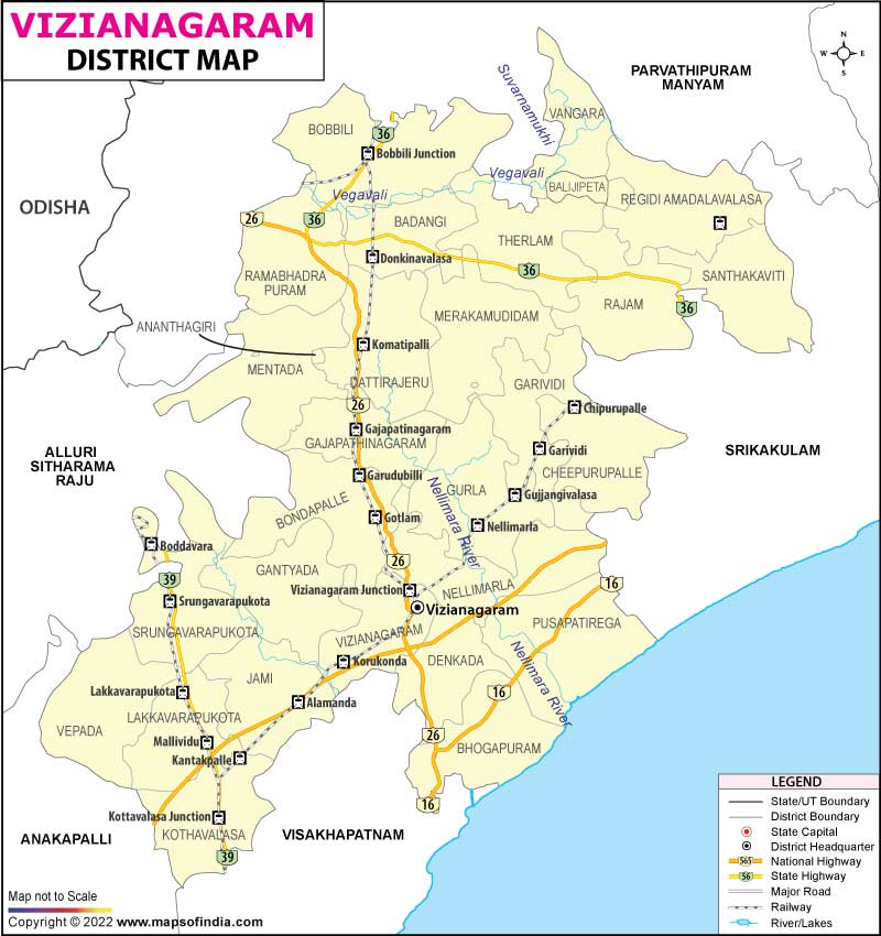
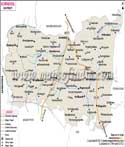
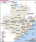
The lush agricultural plains give way to wooded crags, rivers, villages and ancient towns, all come together to create an atmosphere with a sense of being almost frozen in time. Anyone trying to get a feel of the region has probably seen that Vizianagaram district map but finds gems in every nook and corner though.
Fertile lands provide agriculture and ancient trade routes for the movement of people, languages, and traditions. A lot of the district has been rugged up with modern infrastructure, but still, the rhythms of rural life provide its character. Each marketplace, temple and village carries within itself echoes of generations that built this wondrous heritage, and so the Vizianagaram district map is more than a simple topography.
History & Culture
The city of Vizianagaram is steeped in history from ancient times down to the carpet of Kalinga, an influential state on the extensive eastern coastline of India. Subsequent rule came by various dynasties over the region including the Eastern Gangas, Cholas, Gajapati etc. and it later fell under the rule of the local rulers. Among these were the most powerful Pusapati rulers that established the Vizianagaram Samsthanam in the 18th century. Their administration made the district a big political and cultural centre.
In that group, the Battle of Padmanabham (1794) between the forces of Maharaja Pusapati Vijayarama Gajapati Raju II and British East India Company is an important event in the history of the District. One reason for this is the fact that one can see today on a map of the Vizianagaram district, places close to these developments in history.
The culture around is staged like a great play where every festival, song and ritual reverberates with memories of the past. The District also has a Tribal Composition with the Principal Language being Telugu, and some Odia and several Tribal Languages. Amongst classical music, the Vizianagaram royal family holds a premier status as they sponsored many scholars and musicians through generations. Even modern cultural activities continue to flourish alongside traditional folk dances, Harikatha performances and devotional celebrations.
There are major festivals like Sankranti, Ugadi, Vinayaka Chavithi, Dasara and Deepavali that are celebrated on a large scale: these festivals create a huge excitement while local festivals preserve a legacy of centuries-old traditions. District is believed to incorporate various communities residing within the hill areas who are known for their handicraft items, antique dresses and local practices. Above these settlements, as denoted by the Vizianagaram district map, one experiences an awe-inducing heritage that persists whilst metamorphosing itself without severing roots.
Economy
Agriculture is still the main pillar of the economy in the district and most of the population is engaged in agriculture. Rice cultivation is predominant with sugarcane, groundnut, maize, pulses, millets, along with cashew and mangoes as other commercial crops in various regions. Although rainfall still continues to play an important role in agricultural productivity, it is supplemented with irrigation from rivers, tanks and reservoirs. Many allied activities like dairy farming, poultry & fisheries are helping in supplementing rural incomes. Agriculture across the open green fields on the Vizianagaram district map is still a keystone of occupations and culture.
The Government Sector is also majorly providing through district administration, education, healthcare, as well as in the areas of irrigation projects and rural development programmes. Through offering sustained livelihoods, as well as enabling social provision, government schools, colleges, hospitals and other welfare establishments are vital sources of employment.
The Public Sector also contributes by way of public financial institutions, electricity distribution, transportation services and infrastructure projects supported by the government to propel economic growth. Industries consist of rice mills, sugar refining, cashew processing, granite cutting, food processing, some handicrafts and small manufacturing units. Even though heavy industries still remain constricted as compared to Visakhapatnam, steady industrial growth continues to improve the employment scenario. The slow process of transformation is evident from the economic corridors spread all across the Vizianagaram district map.
Over the past few years, the Services Sector has been growing at a rapid pace. The economy of the district has also become reliant on banking, retail trade, education, health care, hospitality and services such as logistics and information-based services. The Vizianagaram town serves as the major commercial hub, drawing together traders, students and professionals from nearby parts. With the development of highway as well as railway networks, the availability of connectivity boosts more investment opportunities which provide some new thrust to the economy on the Vizianagaram district map.
Tourism
Vizianagaram Fort, undoubtedly, the most distinct historic monument of the district. While the grand fort, built by Pusapati rulers as a military base and also for royal grandeur, this majestic structure is an example of impressive military architecture. The nearby heritage buildings, palaces and museums house priceless art on the royal family as well as regional history. It is hard to walk through these grand structures without the haunting feeling that you are actually walking in a drama period film, and every stone remembers all of the conversations that have ever been forgotten. Tourists usually find these attractions with a Vizianagaram district map.
Ramatheertham is among the major pilgrimage centres of the district. Beautiful hills surround the region, and Hindu temples and thousands of years old Buddhist and Jain archaeological sites are found throughout the scene—this intermingling of religions spans hundreds of years. When one adds up the memory, they can discover a spiritual ambience as they are surrounded by peaceful landscapes, seemingly unchanged over the course of centuries.
While Borra Caves may be far removed from the district, Vizianagaram has some nice natural attractions as well. Surroundings near Tatipudi Reservoir to de-stress yourself from work is something on your bucket list and dense stretches around the Eastern Ghats evoke rich biodiversity that you can experience. The tribal communities of the Hill Regions have an interesting and outstanding topography and a multi-coloured way of living yet very close to nature. The Vizianagaram district map is a great companion to those who want to explore untouched places or go on a hidden adventure by travelling to hidden valleys, streams and forests, making even a routine trip a thrilling adventure.
The district's living heritage is another draw, not one single monument. From traditional village markets to colourful festivals and local cuisine, from artisanal crafts to interesting architecture – the experiences are highly cultural and authentic in nature. Tourism has many things other than sightseeing, museums, music traditions and historic neighbourhoods. Every new destination adds a fresh memory to the storyline of this district, and every memorable trip leads back to the map of Vizianagaram district.
Demographics
As per the 2011 Census, Vizianagaram District had a population of 19.30 lakh (1,930,811). Within the present administrative boundaries, the district has a literacy rate of 53.21%, and Telugu is plainly the chief language spoken by its people. Odia is also spoken in the surrounding areas, and many tribal communities communicate using native languages as part of daily life.
The population is composed of rural agrarian communities, urban dwellers and tribal peoples to create a dense social tapestry that documents centuries of migrations and resettlements. When focused on the Vizianagaram district map, these numbers become even more interesting as its towns and villages seem surrounded by hill ranges occupied by different tribes that brings in such diversity.
Administration
Following the administrative reorganisation of Andhra Pradesh, Vizianagaram district assumed a well-structured administrative framework designed to govern its diverse landscapes. Like an unseen force directing a grand narrative, three revenue divisions and twenty-seven mandals function as the district's principal tehsil-level administrative units, ensuring the smooth implementation of governance and development initiatives. Mandals such as Vizianagaram, Gajapathinagaram, Srungavarapukota, Bhogapuram, Cheepurupalli, Nellimarla, Denkada, Bondapalle, Gurla, Garividi, Merakamudidam, Dattirajeru, Mentada, Jami, Vepada, Kothavalasa, Pusapatirega, Lakkavarapukota, Gantyada, Badangi, Therlam and Rajam form the backbone of this administrative network.
The district encompasses 982 revenue villages governed by a vast web of gram panchayats and local bodies which provide both rural governance and public services. The Vizianagaram district map helps in efficient administration, infrastructure planning and various public welfare schemes.
Vizianagaram district administration is also planning to provide effective governance in both urban and rural areas. The District collector is the chief executive officer who implements government schemes, revenue administration and is tasked with disaster management and developmental programmes. Urban centres like Vizianagaram city — which has 35 wards and a municipal body that looks after the infrastructure and services — will continue to be managed through their respective municipalities, while gram panchayats are an essential part of local governance in villages.
For the purpose of digital governance, road connectivity as well as public healthcare and educational infrastructure, have seen improvement which in turn led to better administrative efficiency across the district. These systematic arrangements have played a fundamental role in social advancement, monetary development and general improvement as reflected by the Vizianagaram district map.
FAQs
Q1: How many villages are there in Vizianagaram district?
Vizianagaram district has 982 revenue villages.
Q2: What is the population of Vizianagaram district?
According to the 2011 Census, the district has a population of about 19.30 lakh (1,930,811).
Q3: What is the Vizianagaram district famous for?
Vizianagaram district is famous for its royal heritage, the Vizianagaram Fort, rich musical traditions, historic temples and agricultural landscape showcased across the Vizianagaram district map.
Last Updated on : July 22, 2026
