Being centrally positioned and having excellent connections to the other 4 districts of Rayalaseema, YSR District (formerly known as Kadapa District) is considered to be the heart of Rayalaseema. The District has an illustrious past and a voluminous cultural legacy. Among the 26 districts in the state of Andhra Pradesh is the YSR district.
It is situated 8 kilometres south of the Penna River and 377.5 kilometres (Km) from the capital city of Amaravathi. The Nallamala and Palakonda hills border the city on three sides. Gadapa, which translates to "Threshold," is the city's moniker because it serves as the western entrance to the venerated hills of Tirumala, which are well-known for their associations with Venkateswara Swamy.
Last Updated on : April 17, 2026
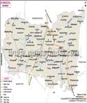
YSR District Map |
|
||||||||||
 | ||||||||||
|
| *ysr District Map highlights the National Highway, Major Roads, District Headquarter, etc in YSR. |
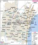
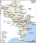
| Major Districts of Andhra Pradesh |
 |
 |
 |
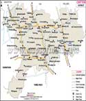 |
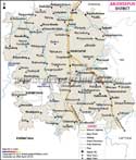
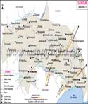
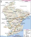
| Anantpur District Map | Guntur District Map | East Godavari District Map | Chittoor District Map |
 |
 |
 |
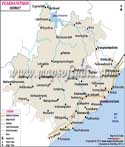 |
| Prakasam District Map | Krishna District Map | Kurnool District Map | Vishakhapatnam District Map |
| Other Districts of Andhra Pradesh >> | |||