|
|||||||||||

| |||||||||||
|
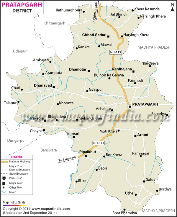
| *The Map showing National Highway, Major Roads, District Head Quarter etc in the district of Pratapgarh, Rajasthan. | Disclaimer |
| Facts of Pratapgarh District | |
|---|---|
| State | Rajasthan |
| District | Pratapgarh |
| District HQ | Pratapgarh |
| Population (2011) | 867,848 |
| Growth | 22.78% |
| Sex Ratio | 983 |
| Literacy | 55.97 |
| Area (km2) | 4112 |
| Density (/km2) | 211 |
| Tehsils | Arnod, Chhoti Sadri, Dhariawad, Peepalkhoont, Pratapgarh |
| Lok Sabha Constituencies | Chittorgarh, Udaipur |
| Assembly Constituencies | Dhariawad, Pratapgarh |
| Languages | Hindi, Rajasthani including Wagdi, Kanthhalee-Bolee |
| Rivers | Jakham, Mahi, Siwana |
| Lat-Long | 24.033922,74.690151 |
| Travel Destinations | Jakham Reservoir, Sitamata Sanctuary, Gautmashewr Temple, Devgarh, Bhanwar Mata Temple etc. |
| Government Colleges/Universities | Government P.G. College (Pratapgarh), Govt. College (Dhariyawad), Government polytechnic college etc. |
Last Updated on : January 14, 2026