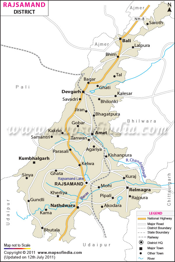
Divisions
Rajsamand comprises 4 sub-divisions, 7 tehsils and 7 blocks. There are 206 gram panchayats and 237 patwar circles. Population
According to the report of 2001 India census, Rajsamand district has a population of around 9,87,024.
Getting to
Getting to Rajsamand is easy and convenient. The nearest airport is at Udaipur, located at a distance of 67 kilometers and the nearest railway station to Rajsamand is Kankroli. Regular train services are available from Marwar Junction and Mavli Junction.
Apart from air and rail access, travelers will get frequent buses plying between Rajsamand and Jaipur, Jodhpur, Udaipur, Kota, Bhilwara, Ajmer, Beawer, Ahmedabad, Indore and New Delhi.
Historical Sites
Some of the famous historical sites in Rajsamand include:
-
Eklingji: It is famous for the Shiva temple.
- Haldighati: The site is known for the battle which was held between Rana Pratap Singh of Mewar and the Mughal emperor Akbar.
- Kumbhalgarh: There is a fortress and a wildlife sanctuary.
- Nathdwara: The temple of Lord Shrinathji in Nathdwara is one of the most eminent holy sites in India.
- Ranakpur: The place is famous for the Jain temple.
| Facts of Rajsamand District | |
|---|---|
| State | Rajasthan |
| District | Rajsamand |
| District HQ | Rajsamand |
| Population (2011) | 1,156,597 |
| Growth | 17.18% |
| Sex Ratio | 990 |
| Literacy | 63.14 |
| Area (km2) | 3853 |
| Density (/km2) | 302 |
| Tehsils | Amet, Bhim, Deogarh, Kumbhalgarh, Nathdwara, Railmagra, Rajsamand |
| Lok Sabha Constituencies | Rajsamand |
| Assembly Constituencies | Bhim, Kumbhalgarh, Nathdwara, Rajsamand |
| Languages | Hindi, Rajasthani including Mewari |
| Rivers | Banas, Ari, Gomati, Chandra, Bhoga |
| Lat-Long | 25.22482,73.75042 |
| Travel Destinations | KumbhalGarh, Haldi Ghati, Chetak Tomb, Rakam Garh, Dewair, Machind, Rajsamand lake etc. |
| Government Colleges/Universities | Government College (Bhim), Government Girls College (Nathdwara), S.H.L.D. Government College (Amet), S.M.B. Government College (Nathdwara), S.R.K. Government College (Rajsamand) etc. |
Last Updated on : January 14, 2026
