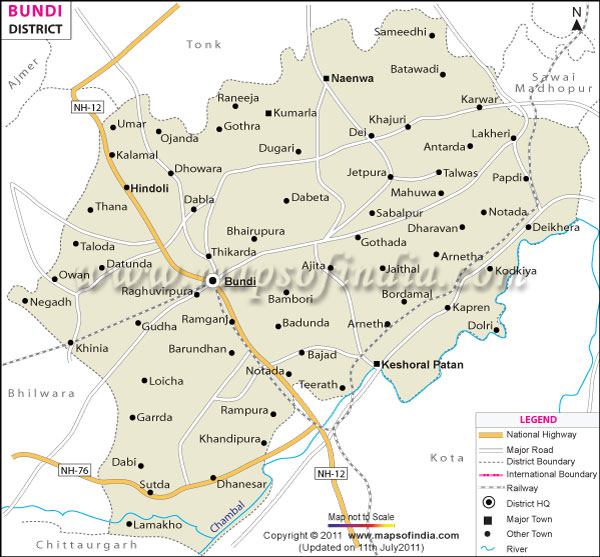
| Facts of Bundi District | |
|---|---|
| State | Rajasthan |
| District | Bundi |
| District HQ | Bundi |
| Population (2011) | 1,110,906 |
| Growth | 15.40% |
| Sex Ratio | 925 |
| Literacy | 61.52 |
| Area (km2) | 5550 |
| Density (/km2) | 193 |
| Tehsils | Bundi, Hindoli, Indragarh, Keshoraipatan, Nainwa |
| Lok Sabha Constituencies | Bhilwara, Kota |
| Assembly Constituencies | Bundi, Hindoli, Keshoraipatan |
| Languages | Hindi, Rajasthani including Hadoti |
| Rivers | Mez, Chambal |
| Lat-Long | 25.532529,75.902939 |
| Travel Destinations | Raniji Ki Bawdi, Nagar-Sagar Kund, Chitrashala, Chaursi Khambo ki Chattri, Moti Mahal Museum, Nawal Sagar Lake, Bundi Fort, Ban Ganga, Shikar Burj, Mira Sahib Ki Dargaha etc. |
| Government Colleges/Universities | Government College, Government Girls College, Government Law College etc. |
Last Updated on : January 14, 2026
