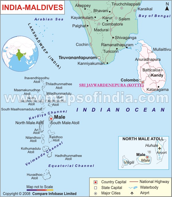
We bring to you the India- Maldives map that can be a help to understand the geographical location of the place better. The map depicts the Southern cities and states of India which are located at a convenient distance from Maldives, Sri Lanka and the country Maldives it. One can see the islands of Maldives located in the Indian Ocean. The country capitals are marked with Red Colored Square, the state capitals in white squares, the major cities in both the countries are marked in black circles while the major national highways are marked in pink lines and the water bodies are marked in blue. The cities like Coimbatore, Allepey, Kochi, Kanyakumari, Turicorin are well linked to the capital of Maldives -Male. It takes less than an hour to reach Maldives from Thiruvananthapuram. Other islands on the map are Ari Atoll, Felidhoo Atoll, Kolhumadulu Atoll, Hadhdhunmathee Atoll, Maamakunudhoo Islands and South Maalhosmadulu Atoll. The map can help you for the purpose of travel, education and business. Keep India-Maldives map handy, if you have any of the above mentioned purpose or any for any other purpose.
Last Updated on : November 13, 2025
