






About
This place holds both beauty and memory in equal measure. Many see it as the first true taste of the valley when arriving from afar. Deep in the stories of old Kashmir, "Anantnag" stirs meaning - its roots twist through time, shaped by whispered tales and ancient words that still linger today. Water rises here where rock splits open. This spot goes by a name made of two parts. One part says endless, drawn from "Anant." The other comes from local speech - Nag means spring fed by clean groundwater. Names join to speak of many flows, not just one or two. Limestone underfoot lets liquid push upward without sulfur taint. Streams appear like that, scattered across the middle of town. Not carved by hands but formed through slow seepage below.Coiled through ancient tales, Anant ties back to Ananta Shesha - a many-headed serpent sovereign drifting beyond time. This place? It hums with older echoes because legend says he rested here first, leaving quiet power behind while villages came much later.
History & Culture
Old stories about Anantnag stretch back to the earliest times people wrote things down here. Sitting on key paths where traders once moved, it became central - not just for power but also for shaping culture - under one ruling family after another. Back then, around the 700s, a leader named Lalitaditya Muktapida shaped things in that area. Ruling under the Karkota line, he brought power and attention to the land. That king built Lalitapura - his own planned town rising from vision. Grand structures went up, each stone showing how strong his realm had become. Time passed, rulers changed, yet echoes stayed. Culture shifted slowly, layer by layer, shaped by who came next. Stone buildings rose high back then. Grand temples stood across the land. Irrigation channels cut through the earth. These waters fed crops below. Early farming thrived because of it. This time shaped what came after. The valley grew strong under Hindu rule. Out of the fourteenth century came Sufi teachers, alongside rulers from the Shah Mir line. Spiritual study took root when faith and craft began to shape one another. Woodwork flourished under new beliefs. This stretch of time shifted the land into a center where thought, devotion, and carving thrived together. Water sources once wild were reshaped by Mughal officials into orderly green spaces. On routes between Delhi and Srinagar, rest points like Anantnag served royalty during long journeys. Gardens rose where springs flowed, shaped deliberately along imperial paths. Out here, traditions grow quiet like mountain mist - Anantnag gave rise to the Reshi way, a form of Sufism rooted in stillness, close listening, because every creature matters. Festivals shape the rhythm of the year across different regions. At the heart of it stands the yearly Amarnath pilgrimage - a journey that defines who people here are. Pahalgam, nestled in Anantnag, becomes ground zero for those setting off on foot toward sacred trails. Locals, Hindu or Muslim, join hands just the same, helping travelers cross rough terrain. Life changes pace when fall arrives.
Economy
Farming shapes much of Anantnag’s economy, while fruit orchards play a steady role too. Handmade crafts pass through generations here, supported quietly by local skill. When weather warms, visitors arrive - bringing work tied to months, not years. Each piece fits into daily life without fanfare.
Government Sector
Most jobs in the district come from official institutions. Being the hub for South Kashmir’s administration, Anantnag holds key government buildings - court complexes sit here, along with regional departments and the main office block. People find work in health clinics, village programs, schools, and forest areas through state-run services. On top of that, new construction projects like the long railway stretch connecting Jammu to Baramulla bring steady roles and supply deals nearby.
Public Sector
Heavy industries with big chimneys cannot operate here, because rules protect the valley's natural state. Public efforts go toward farming and handmade goods, backed by groups such as the J&K Agro Industries Development Corporation and the Handicrafts Development Department. In places like Bijbehara, industrial zones host businesses working with timber, making cricket bats, along with facilities packing local fruit for shipment beyond state borders.
Services Sector
What powers Anantnag’s economy more than anything else? The services sector, fueled by horticulture instead of factories. Tourists arriving each season add momentum here. Then there are hand-woven crafts - detailed work passed down through time - that keep things moving. Out here, growing plants means survival for many village families. Thanks to the area’s special weather patterns, crops thrive in ways you’d rarely see elsewhere
Tourism
Among pine-scented slopes, old stone temples rise quietly into view near Anantnag. High up, where thin air fills each breath, wide green meadows stretch without hurry beneath distant peaks. Pilgrims walk narrow paths toward sacred sites held dear across generations southward. Filmmakers often come here, drawn by untouched landscapes and soft light filtering through trees. Hikers find their way along these trails, passing clear streams and wide skies above. One valley nearby carries the name of a famous Indian film shot amid its green fields - Betaab Valley holds that story now. Around the foot of the Pir Panjal peaks sits Verinag Spring, its waters a vivid blue inside an eight-sided stone rim. Though Jahangir first shaped it, additions came under Shah Jahan's watch much later. Water rises here without hurry, forming what maps mark as the start of the Jhelum. A red-brick arcade leans gently around one side, steady against time. Beyond stonework, gardens step downward in careful layers, chilled flow threading between them. Achabal Garden sits quietly among Kashmir's green folds, shaped long ago under Empress Nur Jahan’s vision. From a limestone rise close by, icy water bursts forth without warning. This flow feeds carved stone channels that step gently downhill. Water tumbles through terraced drops, engineered with quiet precision centuries back. The garden breathes slowly, held together by constant cool streams rising from deep rock. High above the noise, Daksum hides in hushed woods where small bridges cross lively streams. Not far ahead, the path climbs toward Sinthan Top, sitting silent under snow nearly all year round. From there, eyes catch everything - Kashmir stretching out on one side, Jammu opening wide on the other. The air turns sharp. Views wrap around like a slow turn of the head. Few people come here. That stillness stays unbroken for long stretches of time.
Demographics
Most people in Anantnag live in villages where families stay tightly connected. Growth is visible in numbers, yet life stays rooted in local traditions. Education spreads slowly but surely through these settlements. Total District Population 1,078,692. Male Population 559,767. Female Population 518,925. Average Literacy Rate 62.69 Percent. Male Literacy Rate 72.85 Percent. Female Literacy Rate 51.99 Percent. Urban Population Share 26.23 Percent. Rural Population Share 73.77 Percent. Population Density 370 Per Square Kilometer. Sex Ratio 927 Females Per 1,000 Males. Most people here - about eight out of ten - speak Kashmiri, helping neighbors understand one another whether they live in small hamlets or larger settlements. Up in the highlands and along the southern grazing lands, voices shift toward Gojri and Pahari, carried through generations by Gujjar and Bakerwal families. Government offices stick to Urdu when handling paperwork, property matters, or courtroom talks. Schools lean on English more often these days, especially at colleges and places that welcome travelers.
Administration
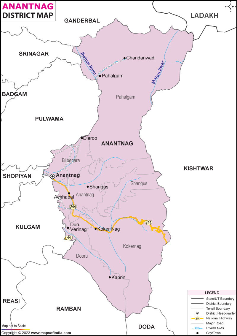
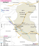
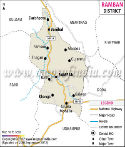
Deep inside Anantnag, local control flows across wide farming lowlands and distant hill villages using a tiered system of revenue units and growth zones. Power to act sits with the District Magistrate, while daily order depends on guidance from the Senior Superintendent of Police. Instead of broad strokes, structure shapes how tasks move from town centers up into rugged slopes. Twelve parts make up Anantnag district, each a separate tehsil meant to put governance nearer people's homes. Bustling streets define Anantnag - this is where daily trade thrives. Activity pulses through its core, forming the heartbeat of local business life. Pahalgam handles oversight across the east’s travel areas, also guiding paths long used by pilgrims. Besides farming, this town handles trade up north near the main road. Traffic flows through while fields stretch behind. South of Verinag, Dooru takes charge. Ruled zones with old roots sit here. Running things has long been its role. Past borders shape how it works today.
From deep within its hills, Kokernag shapes life across the southeast where springs rise between narrow slopes. High up near the tree line, Shangus handles what happens in the core lowlands. Beyond that ridge, oversight stretches into wooded slopes circling the basin.
| Facts of Anantnag District | |
|---|---|
| Official Name | Anantnag |
| Location | Jammu- Kashmir |
| Area (km2) | 3574 |
| Population | 1,078,692 (2011 census) |
| Language | Pahari, Hindi |
FAQs
Q1: How many villages are there in Anantnag ?
There are 395 villages in the District .
Q2: What is the Population of the District ?
The full count from government tallies shows 1,078,692 folks live in Anantnag district. Most grow crops, raise animals, stick close to land handed down generations. Life moves quiet, rooted in soil rather than city rush.
Q3: For what is the Anantnag District Known for?
Besides rolling green valleys under mountain shadows, Anantnag holds an ancient sun-worshipping stone temple from long before most modern towns rose. Hidden among slow rivers and quiet villages, cool natural springs bubble up through mossy rocks near sleepy hamlets. Not far off, skilled hands shape slender willow wood into smooth cricket bats known around distant grounds. Woven tightly on wooden frames, thick woolen Gabba rugs take form beside cottage hearths where stories pass between generations.
Last Updated on :August 06, 2026
