






About
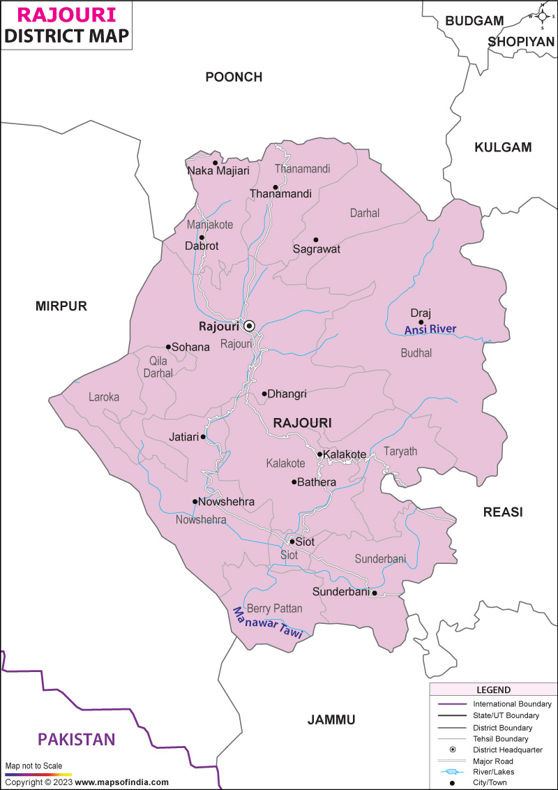
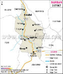
Hidden among the lower slopes of the towering Pir Panjal mountains, Rajouri tells a story shaped by wild landscapes and centuries-old roots in Jammu and Kashmir. Once called Rajapuri, meaning "Land of Kings," it links the wide stretches of Jammu to the high meadows of Kashmir - not just on maps, but through traditions that run deep. Though quiet in name, its place in history hums beneath roads, rivers, and old stone paths. West of the Line of Control lies a stretch where history hums through tense air, marked at 33.38 degrees north and 74.31 degrees east. Touching Poonch up north, then Reasi on one side, Jammu below, it holds ground in uneasy stillness.
History & Culture
Rajouri's past unfolds not as mere dates and events, but as a long thread weaving through old legends of India. Empire after empire reached for it, yet local spirit held ground. Stories from centuries ago still echo in its hills. Power shifted hands, though life here kept its rhythm. Through conquests and changes, one truth remained - this place remembers everything.
Ancient Roots and Empire Traces
Long before modern times, stories from the Mahabharata point to this land as part of old Panchal Desa, governed by Draupadi’s father. Moving ahead centuries, Rajouri took shape as its own strong kingdom during ancient rule. Through mountain passes in 632 CE came the traveler Xuanzang, recording what he saw. His notes describe Rajapura as a notable place tied to Kashmir's realm. Back then, in the 1100s, a writer named Kalhana put down stories about the Rajouri rulers - how they tangled in power moves, held sway across regions. His work, called Rajatarangini, became a lasting record. Politics shaped much of what he wrote. These kings weren’t just local figures - they mattered beyond their borders. Moments of conflict and quiet maneuvering both found space on the page. Out of nowhere, in 1194 CE, everything changed when the Jarral Rajputs took power. Because of their rule, life in Rajouri began to bloom again - art, ideas, ways of living. Though they followed Islam, these kings honored old customs while shaping something new. From stone and timber rose a redesigned core city, shaped by highland skill meeting methods from flatlands. Woven into daily life are mainly Paharis, Gujjars, and Bakerwals - each holding their own, yet fitting close. Scattered among them, smaller clusters of Dogras and Kashmiris add quiet depth to the mix. High up on mountain meadows live the Gujjars, who grow just enough food to get by while also tending buffalo herds. Instead of staying put, the Bakerwals shift camps every season, driving huge groups of sheep and goats through the rugged Pir Panjal passes. What they wear stands out sharply - long tunics in deep colors, stitched thickly with threadwork, paired with distinctive silver ornaments and elaborately wound headgear that marks their presence across the hills.
Economy
Farming shapes Rajouri’s economy, grounded in hilly terrain yet shifting slowly as shops and government spending grow. While fields still dominate, new kinds of work begin to appear alongside them.
Government Sector
Most highland regions see similar patterns where state-run jobs form the backbone of local income. Because civil offices run daily operations, they offer steady work. Public projects keep teams busy throughout the year. School systems hire teachers, support staff, and clerks - filling roles that matter. Those with degrees often land positions tied to departments managing services. Even smaller towns host branches handling regional needs. Routine bureaucratic functions sustain households across generations. With few large industries present, these posts become vital.
Public Sector
Out here, government presence shows up most in utilities run by the state, groups building roads and bridges, plus lending outfits owned by the nation. Branches of state-backed banks and insurance giants stretch far into country areas, pulling in local money while making small loans possible. Heavy industry isn’t common here, yet construction work shapes much of the region’s economic life. Thanks to dam-building studies and steady upgrades to key roads - the national route plus the old Mughal path - jobs keep flowing. These efforts hold things together, keeping workers busy maintaining bridges, tunnels, and pavement stretches year after year.
Services Sector
A wave of change sweeps through the service industry here. Rooted in learning opportunities, much of it flows from Baba Ghulam Shah Badshah University sitting in Rajouri town. From every corner of Jammu and Kashmir, students plus teaching staff arrive at its gates. Around them grows a network of rented rooms, guest houses, small shops, eateries - all feeding off steady demand. On the edge of change, retail shops along with schools have grown fast. Where steep slopes rise, small banks and tech help spots now stand - fueling what people earn across the area. These shifts ride alongside teaching jobs, shaping how money moves through town.
Tourism
Wandering through Rajouri, faith trails wind beside ancient pathways once walked by kings. Mountains rise quietly beyond temples where bells still ring at dawn. Rivers cut deep through untouched forests, drawing those who seek more than just views. Every path here tells two stories - one carved in stone, the other whispered by wind.
Spiritual Landmarks
Pulses of devotion echo through Shahdra Sharief, the sacred core of Rajouri nestled some 29 kilometers out from its main town. Honoring Baba Ghulam Shah Badshah - a mystic teacher born in the 1700s - this sanctuary radiates quiet strength across religious lines. A different key place of worship stands in Rajouri town - the old Gurudwara Chanti Padshahi. This site marks where the sixth Sikh Guru, Hargobind Sahib, once passed during his journey toward Kashmir. Built later by followers, it remembers that moment clearly. His footsteps shaped its meaning over time. Though quiet now, the building holds strong memories. Travelers arrive here not for spectacle but presence. Each stone seems placed with care long ago. The air inside feels separate from what lies outside.
Natural Retreats High Altitude Treks
Up top, where the air grows sharper, trees crowd thick along the slopes. Perched beyond six thousand five hundred feet, Dehra Ki Gali wears its forest like armor. There, cold winds linger, brushing past pines under wide skies. Views stretch far, folding into peaks much like those seen in Kashmir's hill stations. The land here stays quiet, shaped by altitude and shade. Hidden among the steep cliffs of Pir Panjal, Rajouri holds a quiet route taken by just a handful - the way opens up to seven calm mountain lakes. Sitting beyond where trees grow, perched between 13,000 and 14,500 feet, these clear pools mirror the open heavens, showing Nandan Sar at first glance, followed by Chandan Sar, ending with Sukh Sar. High above, everything shifts without warning - rock spreads turn icy in moments while sunlight bends strangely through the thin air. Summer brings no real warmth; instead, sharp peaks dusted with snow rise above quiet meadows, their long shadows stretching over ground few have ever crossed.
Demographics
A third of Rajouri's people are under twenty-five, shaping shifts in how schools fill up each year. Changes ripple through job markets as more finish higher education than before. Life moves differently now - commutes stretch longer, yet households hold tighter to old routines. Young adults balance city work with village roots, threading both worlds into daily choices. In 2011, India completed its official census. That count showed Rajouri district had 642,415 people living there. When ranked by how crowded they are, this place sits at number 518 among Indian districts. For every square kilometer, around 244 persons reside. Growth surged past 32 percent in earlier decades here. Better medical services reached more residents. Life in villages also became steadier over time. Population: 642415, with 345351 males and 297064 females. Sex ratio: 860 females per 1000 males. Literacy rate 68.17 percent urban share 8.1 percent. Most people speak Pahari here - about 55.4 percent. Stay small. Most people here follow Islam, making up about 62.71%. Nearly one in three are Hindu, at 34.54%. Sikhs have been part of life here for generations, accounting for 2.41%. Christians also add depth to daily community life.
Administration
Perched high in the hills, Rajouri splits into zones so services can reach every village. Power flows through the deputy commissioner based right in Rajouri town. From there, roads get built when crop programs launch too. Each hillside area answers to local officers who track progress on health drives and school repairs. Thirteen Tehsils shape the district's layout, keeping things running smoothly. Because of this setup, getting land records takes less effort. When people raise concerns, responses come faster from nearby offices. Out in the countryside, there are 375 populated villages spread across 19 development zones. Stretching far, this setup links every small settlement - even those hidden in the tall valleys near Pir Panjal - with local growth efforts through active participation in governance. Though distant, these spots stay connected.
| Official Name | Rajouri |
| Location | Jammu- Kashmir |
| Area | 2630 sq. km |
| Population | 642,415 (2011 census) |
| Language | Pahari, Hindi |
FAQs
Q1: What number of villages exist within Rajouri district?
Some 375 villages sit inside Rajouri district's 13 tehsils and 19 blocks, based on census figures and government income reports.
Q2: What is the Population of Rajouri?
Official records show how many people live in Rajouri. The number comes from recent government data. Counting includes every resident across its areas. Figures reflect the latest census results. Population totals are recorded without estimates. Everyone present during the survey gets counted. Data stays updated through regular checks. Back in 2011, India counted heads across its regions - Rajouri ended up with a total of 642,415 people. Males made up 345,351 of that number. Females came in slightly lower at 297,064. Numbers shifted when broken down by gender, yet the overall count stayed fixed.
Q3: What is the district of Rajouri famous for?
Deep in the hills, Rajouri draws attention with old places such as Dhanidhar Fort alongside Chingus Sarai. Not far off stands Shahdra Sharief, a place of quiet respect where many faiths gather. High slopes whisper stories through spots like Dehra Ki Gali, touched by changing seasons. Life pulses in traditions shared between Pahari people and Gujjar-Bakerwal families, shaped across generations without need for show.
Last Updated on : July 17, 2026
