India
India is a South Asian country that is also the seventh largest country in the world in terms of area. India is surrounded by water on three sides with the Indian Ocean on its south, the Arabian Sea on its southwest and the Bay of Bengal on its southeast. It shares its borders with many neighbouring countries like Pakistan, Bhutan, Burma, Nepal, China and others. Being the seventh largest economy in the world in terms of nominal GDP and the third largest economy in terms of purchasing power parity, India is one of the fastest growing economies of the world. The country is also the largest democracy of the world that is governed as per the Constitution of India.
Sri Lanka
The Democratic Socialist Republic of Sri Lanka is an island country in South Asia. It shares maritime borders with only two countries - India to the northwest and Maldives to the southwest. The country is a founding member of SAARC and is a member of the United Nations, the G77, the Commonwealth of Nations and the Non-Aligned Movement. It is a republic unitary state that is governed by a presidential system. Tourism, tea export and other agricultural activities are the major contributors to the economy of Sri Lanka.
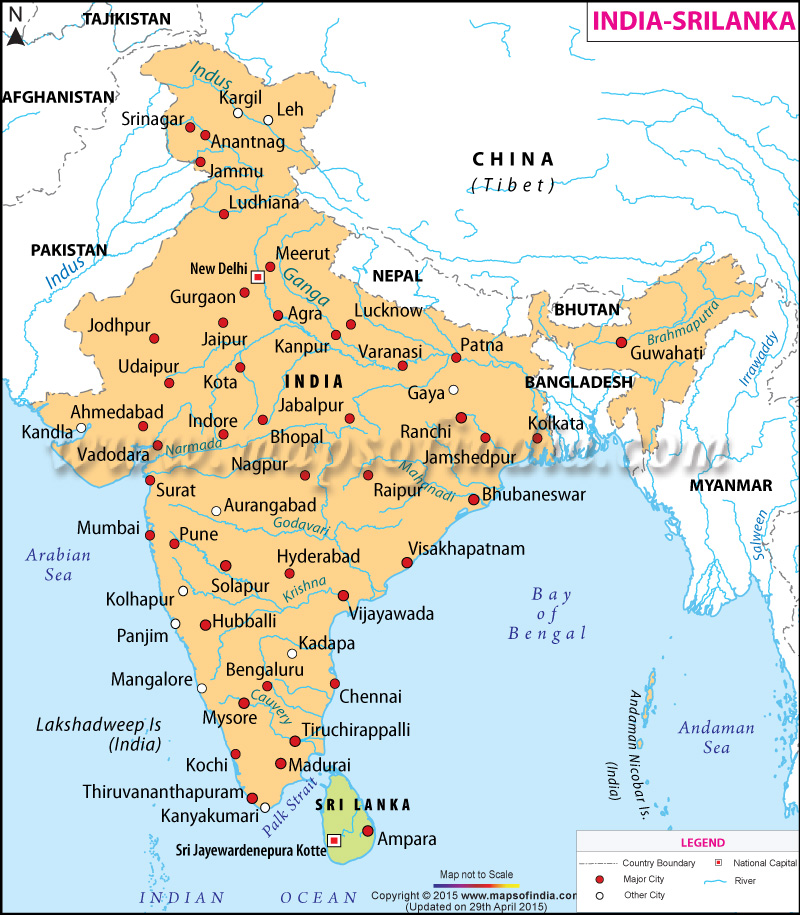
The map on the page shows the Indian subcontinent and Sri Lanka. The area covered under India is represented in orange and the area covered under Sri Lanka is highlighted in green. The neighbouring countries to both the nations such as Afghanistan, Tajikistan, China, Nepal, Bhutan and Myanmar are also shown in map. The capitals of both the countries are also marked in the map - New Delhi of India and Sri Jayawardenepura Kotte of Sri Lanka. The major cities in both the countries are marked with red dots. Some of the cities marked in India are Srinagar, Meerut, Jabalpur and Bengaluru. The blue lines shown in the map represent the rivers in the countries.
WBST270515
WBVDA
Last Updated on : November 13, 2025
