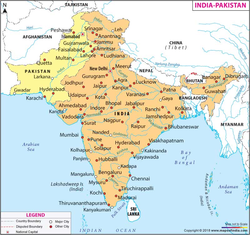
There is an international border that runs between India and Pakistan and demarcates the states of India from the four provinces of Pakistan. The Line of Control (LoC) separates Jammu and Kashmir of India from Azad Kashmir of Pakistan. The Wagha Border dissevers the Indian state of Punjab from the province of Punjab in Pakistan. The Zero Point separates India's Gujarat and Rajasthan from Pakistan's Sindh.
In total, India shares 3,323 km of its land border with Pakistan that includes the Line of Control (LoC) in Jammu and Kashmir. The border has varied lands and distinct geographical features. From 1988 to 1993, 461 km of Punjab's border that touches Pakistan was fenced and flood-lit by India. By 1999, the Rajasthan-Pakistan border was flood-lit and fenced by India. The borders on both sides are controlled by their respective security forces - Pakistan Rangers of Pakistan and the Border Security Force (BSF) of India. Although the borders of the two countries are clearly demarcated, there have been instances of attempts of smuggling and infiltration by terrorists.
Both the countries share some natural resources. There are six rivers; namely, Indus, Chenab, Beas, Ravi, Sutlej and Jhelum, that flow in both the countries. Both the countries also share the Great Himalayas; it runs from west to east from the Indus valley in northern Pakistan to the Brahmaputra valley in northern India. To know more about the boundaries of both the countries and the borders they share, you can refer to the map on this page.
This map displays both the countries: Pakistan and India. It shows the boundaries of both the countries and some of their major cities. The map of Pakistan indicates its major cities, including the capital city of Islamabad and other important cities like Multan, Karachi, Faisalabad, Hyderabad and Gujranwala. The map of India displays few of its major cities like Ahmedabad, Guwahati, Agra, Mumbai and Bengaluru. The capital of India, New Delhi, is also marked on the map of India.
The map of India and Pakistan also displays countries that border both the countries like China that borders India and Tajikistan and Afghanistan that border Pakistan. It also displays the Arabian Sea that falls on the south coast of Pakistan and the west coast of India. It also displays the River Indus, which flows through both the countries. You can also locate some important rivers of India like the Ganges, Narmada, Godavari, Krishna and Cauvery among others.
WBUBST230415
WBVDA
Last Updated on : November 13, 2025
