The Line of Actual Control (LAC) is a line that separates the Indian administrative areas of Jammu and Kashmir from Aksai Chin, which is one of the disputed border areas between India and China. Although it is not a legally recognised international boundary (the legal international boundary depicts Aksai Chin as a part of India), it is a practical border.
The McMahon Line is a borderline that was agreed by Britain and Tibet as a part of the Shimla Accord treaty in 1914. After the treaty, it was made the effective boundary between India and China; however, at present, its legal status is disputed by the Chinese government. The line is named after Sir Henry McMahon, who was the foreign secretary of the British-run Indian government and the chief negotiator of the convention of Shimla. Till now, India regards it as the legal national border; however, it is considered disputed by China.
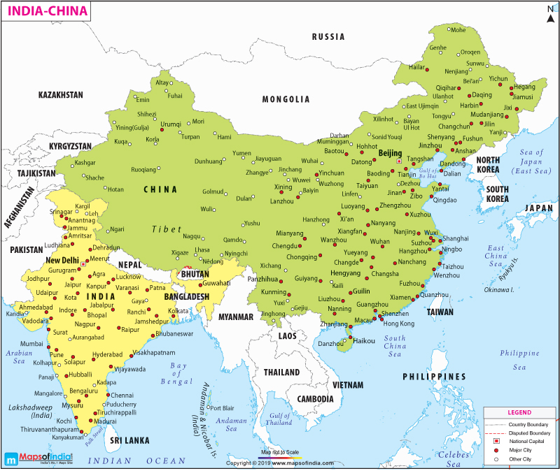
The map here shows the subcontinent of India and the Republic of China. The capitals of both the countries, New Delhi of India and Beijing of China, are marked in the map.The major cities in both the countries are marked with red dots. Some of the major cities marked in India are Jammu, Ludhiana, Pune and Hyderabad, while some of such major cities in China are Hong Kong, Nanyang, Taizhou and Urumqi. Some other cities like Gaya, Kargil and Kadapa in India and Karla, Hotan and Wuwei in China are marked with white dots.
The map also depicts the countries that border India and China, such as Pakistan, Nepal, Myanmar and Bangladesh to India and Bhutan, Myanmar, Laos and Vietnam to China. It also depicts other neighbouring countries like the Philippines, Sri Lanka, South Korea, Cambodia and Taiwan. It also shows major water bodies near the countries like the Indian Ocean, the Bay of Bengal, South China Sea and East China Sea. The rivers that flow in both the countries can also be seen. Marked with blue colour, you can check the rivers that flow in different regions of the country.
WBST270515
WBVDA
Last Updated on : November 13, 2025
