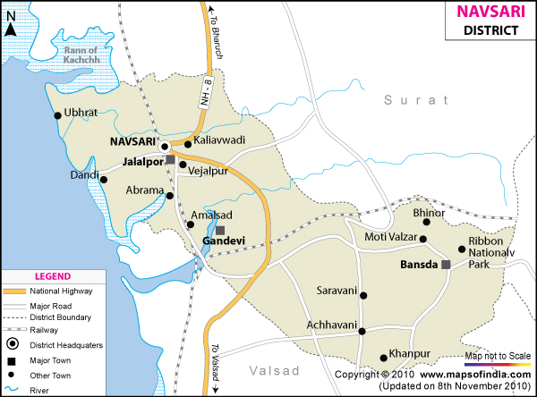
Navsari District Map


District Map of Navsari

separator Click here for Customized Maps arrow custom map
District Map of Navsari Navsari City Map Surat Districts Dangs Districts MAHARASHTRA Valsad Districts
Print Email Save
*Navsari District Map highlights the National Highways, Major Roads, District Headquarter, etc. Disclaimer


Navsari district is located in the south eastern part of Gujarat. It became a district in 1997. It covers an area of 2,211sq.km and had a population of 1,229,250 in 2001. Its main industries are diamond polishing and bakery. This district is well connected by road and railways to the rest of Gujarat.

Some of the places of interest in Navsari are the Meherji Rana Library, the Clock Tower, the Old Post Office building, the Dudhia Talao and the Ashapura Temple.


Last Updated on : 12 September 2011