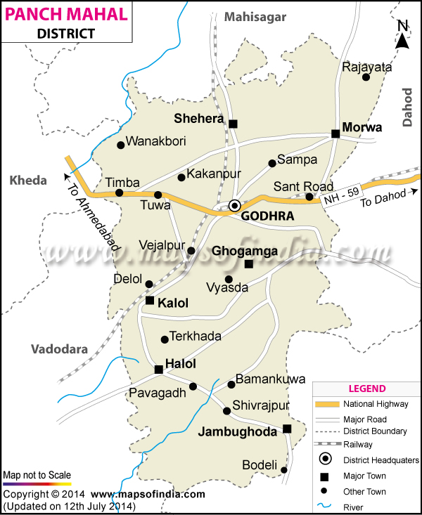
Where is Panchmahal district located?
The Panchmahal district is located in the eastern part of Gujarat. It covers an area of 8866 sq.km. It had a population of 2,025,277 as per the 2001 census record. Thirteen percent of the population is urban. Major occupations in the district are dairy farming and agriculture.
Some places of interest in Panchmahal are the temple of Mata Kalika in Pavagarh, the Jain pilgrimage center at Pavoli and the World Heritage Site at Champaner, which includes the ruins of a medieval Hindu kingdom. The fairs of Chaiti Atham and Math Kotal are also popular among tourists.
Last Updated on: January 14, 2026
