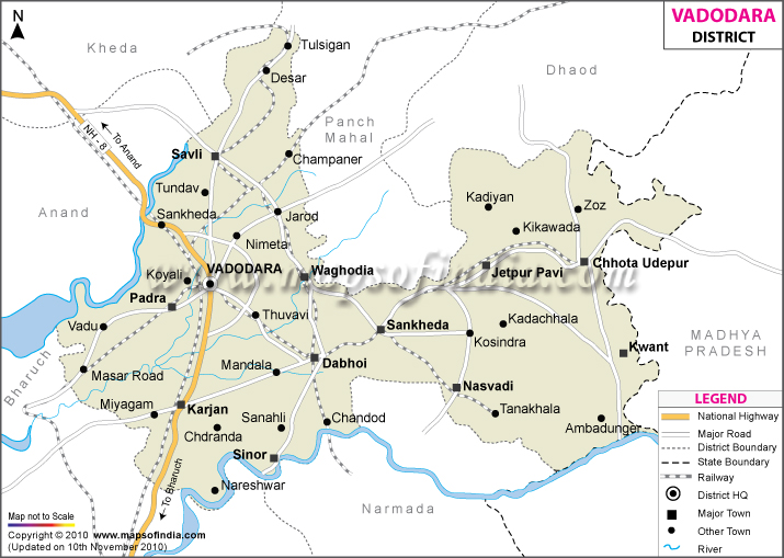
Occupying an area of 7,794 sq km. Vadodara District, in the east of
Gujarat, has a population of 36,41,802 as of 2001 census. The economic scenario is largely moulded by industries like petrochemicals, engineering, pharmaceuticals, and plastics and includes big-names like Gujarat Refinery, Indian Oil Corporation, ONGC, GAIL, GACL, and IPCL. Popularly named as Baroda, Vadodara is connected to the other parts of the state by NH-1 and NH- 8. There is also broad-gauge railway and the district's own airport.
A city of palaces and gardens popular tourist spots include-
- Laxmi Vilas Palace
- Nazar Baug Palace
- Makarpura Palace
- Pratap Vilas Palace
- Kirti Mandir (Temple of Fame)
- Maharaja Sayajirao University of Baroda
- Sayaji Baug
- Floral clock
- Dakshinamurty Temple
- Ajwa & Nimeta
Last Updated on : January 14, 2026
Places to Visit in Vadodara
