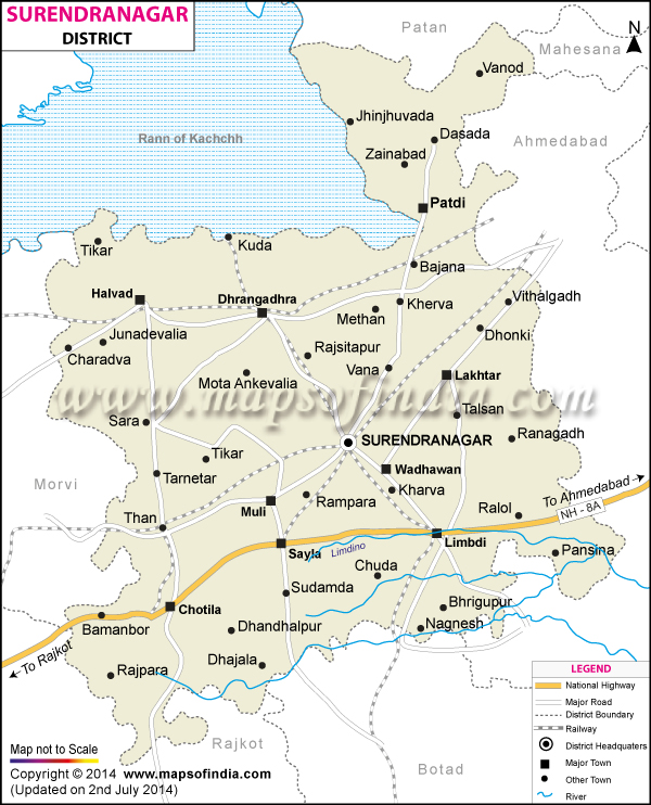
Surendranagar District Map


District Map of Surendranagar

separator Click here for Customized Maps arrow custom map
District Map of Surendranagar Surendra Nagar City Map Patan Mehsana Mehsana Ahmedabad Botad Rajkot District Kachchh Morbi
Print Email Save Buy Now 
*Surendranagar District Map highlights the National Highways, Major Roads, District Headquarter, etc. Disclaimer


Surendranagar situated between 22° 43'N Latitude and 71° 43'E Longitude can be rightly termed as gateway to Saurashtra. It is home to 15,15,147 people.

Also called the Wadhwan city, it is now a major trade and processing centre for agricultural products, soap, glass, cotton, salt, pharmaceuticals, chemicals and plastics, textile bearings, ceramics and sanitaryware.

Some of the most visited places in Surendranagar are-
  • Nalsarovar Bird Sanctuary
  • Rankdevi temple
  • Wild Ass Sanctuary
  • Tarnetar [famed for Trinetreshwar Mahadev Mela (Fair)]
  • Chotila Hill
  • Zharia Mahadev

Last Updated on : 12 September 2011