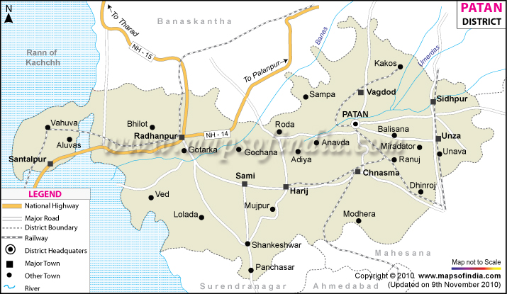
Patan District Map


District Map of Patan

separator Click here for Customized Maps arrow custom map
District Map of Patan Banas Kantha Districts Mehsana Districts Ahmedabad Districts Surendra Nagar Districts
Print Email Save Buy Now 
*Patan District Map highlights the National Highways, Major Roads, District Headquarter, etc. Disclaimer


The district of Patan is located in northern Gujarat between the Aravalli Range and the Gulf of Khambat. It was founded in 745 A.D by Vanraj Chavda a ruler of of Chavda dynasty. It was under the rule of different Rajput clans till the advent of Muslim rule in India.

Patan had a total population of 11,82,709. The main occupations of the people are agriculture and weaving. The Patola silk sari made here is quite famous. Patan is well connected to the rest of the country by road and rail links.

The places to visit in Patan are the Sahastralinga Talav, a water tank build 1000 years ago, Rani ki Bhav built by Rani Udaymati of Solanki dynasty and a number of Jain temples.


Last Updated on : 12 September 2011