
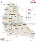

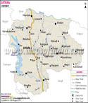
About
Jalgaon is known district of Maharashtra which is famous for its agriculture, active markets and rich local culture. In the Khandesh area which is in the north western part of the state it has won out for its banana production. Also from that fact Jalgaon has earned a name of the “Banana City of India” which it has for very large scale banana cultivation which also supports the livelihood of many farmers.
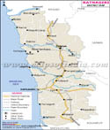
Jalgaon which is the district headquarter city also is the main hub for admin, education and commercial purposes. In the recent past the district has been seeing steady progress but it still maintains its traditional flavor and strong base in agriculture. Its location and transport infrastructure has played a key role in it becoming an active trade center which in turn has connected local business and farming communities with markets in Maharashtra and other parts of India.
The Agrarian sector is the mainstay of many families in Jalgaon. We have very fertile soil and a climate that is very favourable which in turn supports the growth of bananas, cotton, sugarcane, wheat and what not other crops. Also farming is the backbone of the district’s economy and daily life.
Jalgaon is a home to many educational institutions and commercial centers. We see in its many schools, colleges, and training centers that draw in students from all around the region. Also there has been growth in the business sector which in turn is creating jobs, and is a booster for economic development.
The district is a mix of agriculture, history, culture and modern growth. It has outposts of religion, heritage sites and natural beauty which make it a very interesting place to visit. Presently Jalgaon is a very important district in Maharashtra and also is a large contributor to the state’s economy.
History & Culture
Jalgaon has a past which is very rich and spans many centuries. That area at various points of time came under the influence of many kingdoms and ruling powers which in turn played a role in the social and cultural growth of the region. From historical accounts we see that the area was a part of ancient trade routes which in turn helped it to develop into a trade and settlement center.
The district was a part of the historic Khandesh which saw that west and central India had very important chapters of their past. At different times it was ruled by various dynasties which in turn left their mark on local traditions, architecture and administration.
During the time of Maratha rule trade and agriculture in Jalgaon saw growth. Later under the British which was to come after, we see improvement in transport and public administration that in turn promoted economic growth and urbanization.
In Jalgaon which is a reflection of Maharashtra and Khandesh cultures our present day traditions are seen. Marathi is the most common language here although Hindi and English are also very much in use.
Food in Jalgaon is a reflection of Maharashtrian culture. We see traditional dishes, snacks and sweets which are enjoyed by the residents as well as the visitors. In the local markets you will find what has been a part of the area’s food heritage for generations.
Economy
Jalgaon’s economy is a diverse mix of agriculture, trade, manufacturing, education and services. Out of which the large agricultural base has been the backbone of the district’s growth which in recent years has seen also the growth of industrial and service sectors.
Banana is the leading economic activity in Jalgaon. The district is known all over India for its banana produce which in turn greatly contributes to the country’s agricultural output. Also grown in various parts of the district are cotton, sugarcane, wheat and pulses.
Industrial development, commercial activity and educational institutions have put forth job opportunities and supported economic growth in the region.
Government Sector
We have government offices, schools, hospitals and administrative units which are also a source of employment for many.
State and at large government agencies run services in the fields of education, healthcare, agriculture, law enforcement and social welfare. We see these services as a support for both urban and rural areas.
The government put into roads, irrigation systems, water supply projects and public infrastructure which in turn fuels development across the district. Also these projects create job opportunities and better public facilities. Public institutions are still at the forefront of social and economic progress in Jalgaon.
Public Sector
The public sector is a large player in economic activity through banking, transport, communication and utility services. Public sector organizations also play a support role for businesses, farmers and households in the district.
Public sector banks provide financial products which include loans, savings accounts and agricultural credit. They play a role in supporting farm activities and local businesses.
Transport services improve connection between towns, villages and urban centers. Utility providers which include power and water companies support residential areas, agriculture and industrial operations.
Public and private organizations also take part in development programs which contribute to the district’s growth.
Services Sector
The service sector has grown to become a key player in Jalgaon’s economy. In education, healthcare, retail trade, hospitality and financial services we see large scale employment and support to local businesses.
Educational institutions in the state of Maharashtra and from neighboring states see high enrollment. From basic schools to advanced colleges and vocational training centers we see a wide range of educational growth.
Retailers, markets and commercial enterprises are seeing growth which in turn fuels economic activity. Also we see that hotels, restaurants and tourism based businesses are a large part of the job market and local economy.
Financial sectors, professional services and small enterprises also support the district’s economy.
Tourism
Tourism is a contributor to the economy of Jalgaon and we see in it a draw for people interested in history, religion and culture. The district puts forth many sites which in turn reflect its heritage and traditions.
In the area around Jalgaon is the site of the Ajanta Caves which are very popular. These are ancient rock cut caves which have been named a UNESCO World Heritage Site and are home to great works of art and sculpture and which also play a role in history. From all over India and the world visitors come to see the sites artistic and cultural value.
In Jalgaon city, Mehrun Lake is a very popular spot for recreation. It provides a beautiful setting which is great for residents and visitors to spend time in and enjoy the natural setting.
The Gandhi Research Foundation is also an important point of interest. It puts forth the teachings and values of Mahatma Gandhi and also functions as a resource for education and research.
Religious locations in the district see a continuous flow of pilgrims all year round. Also many temples and places of worship play a large role in community’s culture and spirit.
Local cultural events, festivals and fairs which also draw in visitors and which give a look into the culture and way of life of the region. Tourism is a supporter of hotels, restaurants, transport services and local businesses which in turn see growth in employment and economic activity.
Demographics
According to the 2011 Census of India Jalgaon district reports a population of about 4.23 million. Also it is seen that the population has been growing due to urban development and economic opportunities.
The district is home to a mix of urban and rural communities. In Jalgaon we see the primary urban center, also many of the district’s residents live in villages and out in the smaller towns.
The literacy level is on the rise because of our growing number of educational institutions which in turn is a result of increasing interest in education. Also we see that schools and colleges are playing a large role in the development of skills.
Marathi is the main and most used language in Jalgaon. In education, administration and business also you will find Hindi and English very much present.
The district is a home to many communities from different social, cultural and religious groups. Out of that diversity we see very rich and active community life and tradition.
Urban development has fueled the growth of residential areas, commercial centers and public infrastructure which in turn has shaped the district’s demographic profile.
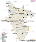
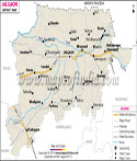
Administration
Jalgaon district is headed by the District Collector and also has a set of government departments which are into governance and development.
In order to run things efficiently the district is divided into several tehsils. Also these divisions which may be into tehsils see to it that public services are delivered, land records are updated and that we have support for development in all areas of the district.
Government agencies run key sectors like education, healthcare, agriculture, public works, law enforcement and social welfare. They put in work which improves living standards and supports community development.
Municipal governments run civic services in urban areas which they are responsible for such as maintenance of roads, sanitation, water supply, waste management and public infrastructure.
In cities and rural areas local authorities are the ones that put development programs into action and also put government services in the hands of the people. Also they play a key role in stimulating growth and in turn improve quality of life.
The government is putting out effort in infrastructure development, public welfare and environmental conservation to meet the needs of the growing population.
| Official Name | Jalgaon |
| Location | Maharashtra |
| Area | 11,765 sq. km |
| Population | 4,229,917 |
| Language | Marathi, Hindi, Ahirani |
FAQs
Q1: Which are the top tourist attractions in Jalgaon?
Some to visit are the Ajanta Caves, Mehrun Lake, Gandhi Research Foundation and also various temples and religious sites. These spots draw in guests from all over India and the world.
Q2: Which industries do we have in Jalgaon?
Agriculture and agro based industries are the backbones of the district’s economy. Also included in the economic activity are food processing, trade, textiles, education and health care and service based businesses.
Q3: Why is Jalgaon important to Maharashtra?
Jalgaon is known for its role in agriculture which includes large scale production of bananas. Also the district is a business center for trade, education, industry and tourism which in turn is very much a part of Maharashtra's economy.
Last Updated on : July 17, 2026