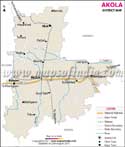
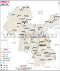
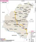
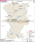
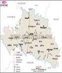
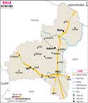


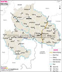
| Click on the Map to Get Clickable District Map |
 |
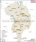
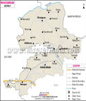
Maharashtra, one of India's largest states, spread over 3, 07,713 square kilometres, is located between latitude 20°N and longitude 76°E.
Maharashtra is bounded by the Arabian Sea in the west, making it a state with a long coastline. It touches Gujarat and the Union territory of Dadra and Nagar Haveli in the north-west, Madhya Pradesh in the north, Chhattisgarh in the east, and Karnataka, Andhra Pradesh, and Goa in the south.
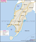
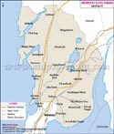
The state is divided into thirty-four districts, each with a district headquarter. Mumbai, the state capital and a port city, is one of the country's largest cities as well as an important financial hub. Other important cities are Pune, Nagpur, and Nashik.
The Western Ghats or Sahyadris lies in the west of the state. The terrain here is hilly and south flowing rivers such as Godavari originate from the hills. The Konkan coastal plains lie to the west of the Sahyadris. The eastern part of the state is part of the Deccan Plateau.
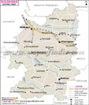
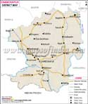
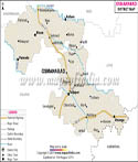
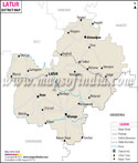
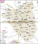
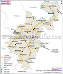
Geographically and culturally Maharashtra is divided into five regions. The Vidarbha region includes the eastern districts such as Nagpur, Chandrapur, Wardha, Amravati, Akola, Buldhana, and Yavatmal. The area here is forested and many wildlife sanctuaries are located here. Central districts such as Aurangabad, Latur, Nanded, Jalna, Beed, Osmanabad, Hingoli are part of Marathwada region. Some districts such as Mumbai City, Raigad, Ratnagiri, Thane, and Sindhudurg are part of the Konkan region. Districts such as Nasik, Jalgaon, Ahmednagar, Dhule, and Nandurbar are part of the Khandesh region. Pune, Satara, Kohlapur, Sangli, and Solapur come in the Desh region.
List of Districts in Maharashtra
| Sr. No. | District | District HQ | Population (2011) | Growth | Sex Ratio | Literacy | Area (km2) | Density (/km2) |
|---|---|---|---|---|---|---|---|---|
| 1 | Ahmadnagar | Ahmednagar | 4543159 | 12.44% | 939 | 79.05 | 17048 | 266 |
| 2 | Akola | Akola | 1813906 | 11.27% | 946 | 88.05 | 5429 | 321 |
| 3 | Amravati | Amravati | 2888445 | 10.79% | 951 | 87.38 | 12235 | 237 |
| 4 | Aurangabad | Aurangabad | 3701282 | 27.76% | 923 | 79.02 | 10107 | 365 |
| 5 | Bhandara | Beed | 1200334 | 5.65% | 982 | 83.76 | 10693 | 242 |
| 6 | Bid | Bhandara | 2585049 | 19.61% | 916 | 76.99 | 3890 | 293 |
| 7 | Buldana | Buldhana | 2586258 | 15.85% | 934 | 83.4 | 9661 | 268 |
| 8 | Chandrapur | Chandrapur | 2204307 | 6.43% | 961 | 80.01 | 11443 | 192 |
| 9 | Dhule | Dhule | 2050862 | 20.08% | 946 | 72.8 | 8095 | 285 |
| 10 | Gadchiroli | Gadchiroli | 1072942 | 10.58% | 982 | 74.36 | 14412 | 74 |
| 11 | Gondiya | Gondia | 1322507 | 10.14% | 999 | 84.95 | 5431 | 253 |
| 12 | Hingoli | Hingoli | 1177345 | 19.27% | 942 | 78.17 | 4526 | 244 |
| 13 | Jalgaon | Jalgaon | 4229917 | 14.86% | 925 | 78.2 | 11765 | 359 |
| 14 | Jalna | Jalna | 1959046 | 21.46% | 937 | 71.52 | 7718 | 255 |
| 15 | Kolhapur | Kolhapur | 3876001 | 10.01% | 957 | 81.51 | 7685 | 504 |
| 16 | Latur | Latur | 2454196 | 17.97% | 928 | 77.26 | 7157 | 343 |
| 17 | Mumbai City | * | 3085411 | -7.57% | 832 | 89.21 | 69 | 20038 |
| 18 | Mumbai Suburban | Bandra(East) | 9356962 | 8.29% | 860 | 89.91 | 369 | 20925 |
| 19 | Nagpur | Nanded | 4653570 | 14.40% | 951 | 88.39 | 10528 | 319 |
| 20 | Nanded | Nandurbar | 3361292 | 16.86% | 943 | 75.45 | 5055 | 276 |
| 21 | Nandurbar | Nagpur | 1648295 | 25.66% | 978 | 64.38 | 9892 | 470 |
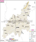
| 22 | Nashik | Nashik | 6107187 | 22.30% | 934 | 82.31 | 15539 | 393 |
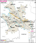
| 23 | Osmanabad | Osmanabad | 1657576 | 11.50% | 924 | 78.44 | 7569 | 219 |
| 24 | Palghar | Palghar | * | * | * | * | * | * |
| 25 | Parbhani | Parbhani | 1836086 | 20.19% | 947 | 73.34 | 6511 | 295 |
| 26 | Pune | Pune | 9429408 | 30.37% | 915 | 86.15 | 15643 | 603 |
| 27 | Raigarh | Alibag | 2634200 | 19.31% | 959 | 83.14 | 7152 | 368 |
| 28 | Ratnagiri | Ratnagiri | 1615069 | -4.82% | 1122 | 82.18 | 8208 | 196 |
| 29 | Sangli | Sangli | 2822143 | 9.24% | 966 | 81.48 | 8572 | 329 |
| 30 | Satara | Satara | 3003741 | 6.93% | 988 | 82.87 | 10475 | 287 |
| 31 | Sindhudurg | Oros | 849651 | -2.21% | 1036 | 85.56 | 5207 | 163 |
| 32 | Solapur | Solapur | 4317756 | 12.16% | 938 | 77.02 | 14895 | 290 |
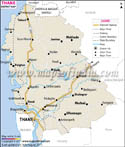
| 33 | Thane | Thane | 11060148 | 36.01% | 886 | 84.53 | 9558 | 1157 |
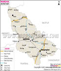
| 34 | Wardha | Wardha | 1300774 | 5.18% | 946 | 86.99 | 6309 | 205 |
| 35 | Washim | Washim | 1197160 | 17.34% | 930 | 83.25 | 5155 | 244 |
| 36 | Yavatmal | Yavatmal | 2772348 | 12.78% | 952 | 82.82 | 13582 | 204 |
Last Updated on : May 12, 2026