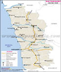
This was once the center of Maratha Empire but, later it came under Maharashtra state. The founder of Maratha Empire, Chhatrapati Shivaji Maharaj was from Pune and this is the reason it has rich historical and cultural significance. Presently, Pune is the educational hub and center of industrial growth.
Geography of Pune
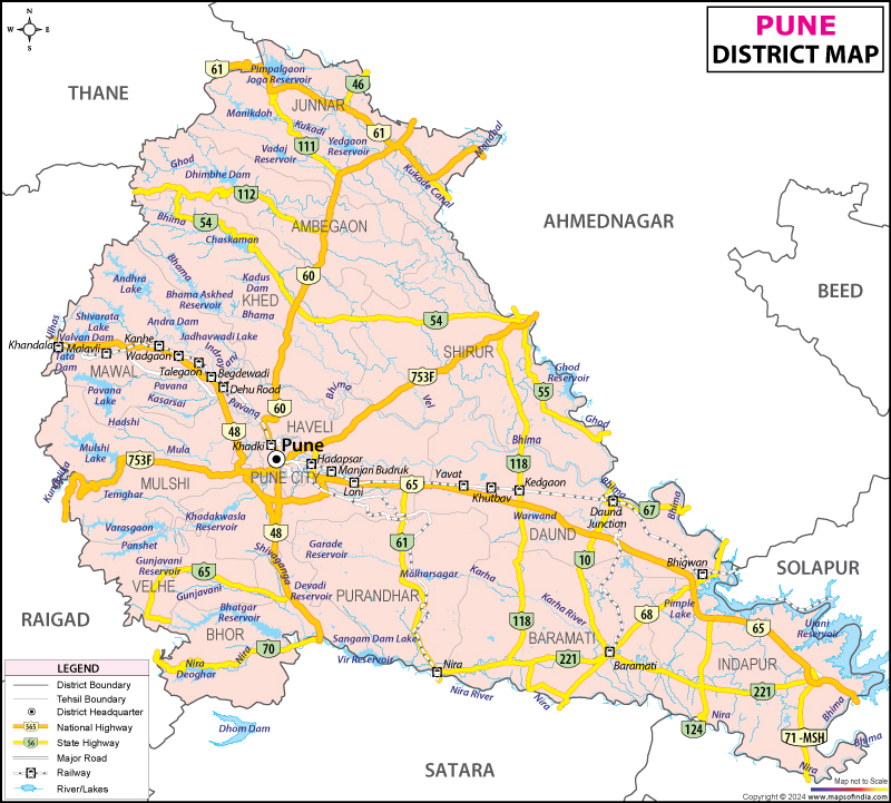
Pune district is located 560 m above sea level on the western margin of the Deccan plateau. It is very hilly and raised area with lots of hill stations for tourist attractions. Pune is located very near to the Koyna Dam is rated as Zone 4 by the India Meteorological Department. This makes it highly earthquake prone city.
Pune climate
Pune has dry and tropical wet climate. The average temperature ranges between 20 to 28o C. The district of Pune is affected by three seasons - monsoon, summer and winter. The summers are from March to May and the temperature varies from 30 to 38o C. The monsoon starts from June and is till October with moderate rainfall. Overall the weather in Pune is very pleasant through the year. Winter is expected from November which continues to lower the temperature till January.
Administration in Pune
The Pune district is under Pune Municipal Corpoation (PMC). There are total 149 elected councilors headed by the Mayor. Apart from PMC there are four more administrative bodies that are active with Pune Metropolitan Area -
- Pimpri-Chinchwad Municipal Corporation (PCMC) - Pimpri-Chinchwad and its surroundings
- Khadki Cantonment Board (KCB) - Khadki
- Pune Cantonment Board (PCB) - Pune Cantonment
- Dehu Road Cantonment Board - Dehu Road area
Pune international airport is well connected to all the major cities of India. It also has Indian Air Force Base. This is because Pune has military cantonment. Railways are also well linked but, it is better to opt for roadways.
Buses and private shuttle are one of the very popular conveyance opted by the local residents. Pune is very well linked to National Highways and state highways. The NH4 connects it to Mumbai, Bangluru, Sangli and Kolhapur. NH9 connects to Hyderabad, Solapur and NH50 to Nashik. The Mumbai Pune Expressway which India's first six lane high speed expressway is well known. It was built in 2002. The intra city highways - Old Pune Mumbai Highway and Katraj Dehu Road Bypass has made traveling very comfortable.
Places to visit in Pune
- Shaniwarwada
- Aga Khan Palace
- Pataleshwar Cave Temple
- Chaturshringi Temple
- Shinde Chhatri
- Saras Baug
- Rajiv Gandhi Zoological Park
- Raja Dinkar Kelkar Museum
- National War Memorial Southern Command
- Pu La Deshpande Garden
- Dashabhuja Ganapati Temple
- Vishrambaug Wada
- Peshwe Park
- Sinhagad Fort
- Empress Garden
- Budhwar Peth
- Sinhagad Fort
- Baneshwar
- Khadakwasla
- Mahabaleswar
- Balaji Mandir Ketkawla
- Khatgun(satara)
Last Updated on : February 19, 2026
Places to Visit in Pune
