


Madhya Pradesh is divided into fifty one districts, each with a district headquarters. River Narmada runs through center of the state. Northern and Western districts have urban areas. Eastern and southern districts have a large forest cover.
The state is the sixth largest by population in the country. Indore district is the most populous. Shahdol, Sidhi, Chhindwara, Khargone, Mandla, Dhar and Jhabua districts have a large tribal population.
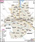
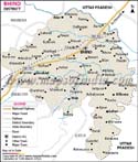
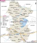
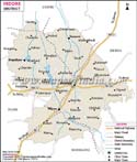
Bhopal is the capital of the state. Some of the important towns are Indore, Gwalior, and Jabalpur. Jabalpur is the headquarters of the Western central Railways Zone of the Indian railways. Inter-State bus terminals are located at Bhopal, Indore and Jabalpur.
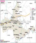
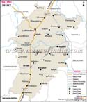
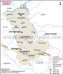
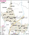
List of Districts in Madhya Pradesh
| Sr. No. | District | District HQ | Population (2011) | Growth | Sex Ratio | Literacy | Area (km2) | Density (/km2) |
|---|---|---|---|---|---|---|---|---|
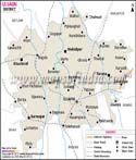
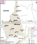
| 1 | Agar | Agar | * | * | * | * | * | * |
| 2 | Alirajpur | Alirajpur | 728999 | 19.45% | 1011 | 36.1 | 3182 | 229 |
| 3 | Anuppur | Anuppur | 749237 | 12.30% | 976 | 67.88 | 3747 | 200 |
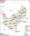
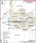
| 4 | Ashok Nagar | Ashok Nagar | 845071 | 22.66% | 904 | 66.42 | 4674 | 181 |
| 5 | Balaghat | Balaghat | 1701698 | 13.60% | 1021 | 77.09 | 9229 | 184 |
| 6 | Barwani | Barwani | 1385881 | 27.57% | 982 | 49.08 | 5432 | 256 |
| 7 | Betul | Betul | 1575362 | 12.92% | 971 | 68.9 | 10043 | 157 |
| 8 | Bhind | Bhind | 1703005 | 19.21% | 837 | 75.26 | 4459 | 382 |
| 9 | Bhopal | Bhopal | 2371061 | 28.62% | 918 | 80.37 | 2772 | 854 |
| 10 | Burhanpur | Burhanpur | 757847 | 19.37% | 951 | 64.36 | 3427 | 221 |
| 11 | Chhatarpur | Chhatarpur | 1762375 | 19.51% | 883 | 63.74 | 8687 | 203 |
| 12 | Chhindwara | Chhindwara | 2090922 | 13.07% | 964 | 71.16 | 11815 | 177 |
| 13 | Damoh | Damoh | 1264219 | 16.63% | 910 | 69.73 | 7306 | 173 |
| 14 | Datia | Datia | 786754 | 18.46% | 873 | 72.63 | 2694 | 292 |
| 15 | Dewas | Dewas | 1563715 | 19.53% | 942 | 69.35 | 7020 | 223 |
| 16 | Dhar | Dhar | 2185793 | 25.60% | 964 | 59 | 8153 | 268 |
| 17 | Dindori | Dindori | 704524 | 21.32% | 1002 | 63.9 | 7427 | 94 |
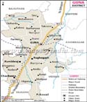
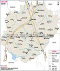
| 18 | Guna | Guna | 1310061 | 21.50% | 943 | 66.39 | 6485 | 194 |
| 19 | Gwalior | Gwalior | 1241519 | 26.97% | 912 | 63.23 | 5465 | 445 |
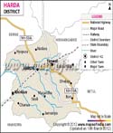
| 20 | Harda | Harda | 2032036 | 24.50% | 864 | 76.65 | 3339 | 171 |
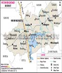
| 21 | Hoshangabad | Hoshangabad | 570465 | 20.25% | 935 | 72.5 | 6698 | 185 |
| 22 | Indore | Indore | 1241350 | 14.49% | 914 | 75.29 | 3898 | 839 |
| 23 | Jabalpur | Jabalpur | 3276697 | 32.88% | 928 | 80.87 | 5210 | 472 |
| 24 | Jhabua | Jhabua | 2463289 | 14.51% | 929 | 81.07 | 6782 | 285 |
| 25 | Katni | Katni | 1025048 | 30.70% | 990 | 43.3 | 4947 | 261 |
| 26 | Khandwa�(East Nimar) | Khandwa | 1292042 | 21.41% | 952 | 71.98 | 7349 | 178 |
| 27 | Khargone�(West Nimar) | Khargone | 1054905 | 17.97% | 1008 | 66.87 | 8010 | 233 |
| 28 | Mandla | Mandla | 1340411 | 13.24% | 963 | 71.78 | 5805 | 182 |
| 29 | Mandsaur | Mandsaur | 1965970 | 23.44% | 840 | 71.03 | 5530 | 242 |
| 30 | Morena | Morena | 1091854 | 14.01% | 920 | 75.69 | 4991 | 394 |
| 31 | Narsinghpur | Narsinghpur | 826067 | 13.77% | 954 | 70.8 | 5133 | 213 |
| 32 | Neemuch | Neemuch | 1016520 | 18.67% | 905 | 64.79 | 4267 | 194 |
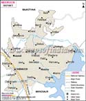
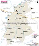
| 33 | Panna | Panna | 1331597 | 18.35% | 901 | 72.98 | 7135 | 142 |
| 34 | Raisen | Raisen | 1545814 | 23.26% | 956 | 61.21 | 8466 | 157 |
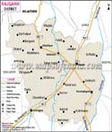
| 35 | Rajgarh | Rajgarh | 1455069 | 19.72% | 971 | 66.78 | 6143 | 251 |
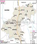
| 36 | Ratlam | Ratlam | 2365106 | 19.86% | 931 | 71.62 | 4861 | 299 |
| 37 | Rewa | Rewa | 2378458 | 17.63% | 893 | 76.46 | 6314 | 374 |
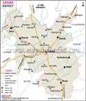
| 38 | Sagar | Sagar | 2228935 | 19.19% | 926 | 72.26 | 10252 | 272 |
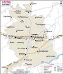
| 39 | Satna | Satna | 1311332 | 21.54% | 918 | 70.06 | 7502 | 297 |
| 40 | Sehore | Sehore | 1379131 | 18.22% | 982 | 72.12 | 6578 | 199 |
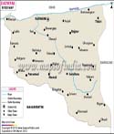
| 41 | Seoni | Seoni | 1066063 | 17.39% | 974 | 66.67 | 8758 | 157 |
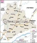
| 42 | Shahdol | Shahdol | 1512681 | 17.20% | 938 | 69.09 | 6205 | 172 |
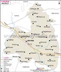
| 43 | Shajapur | Shajapur | 687861 | 22.94% | 901 | 57.43 | 6196 | 244 |
| 44 | Sheopur | Sheopur | 1726050 | 22.76% | 877 | 62.55 | 6585 | 104 |
| 45 | Shivpuri | Shivpuri | 1127033 | 23.72% | 957 | 64.43 | 10290 | 168 |
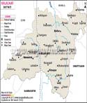
| 46 | Sidhi | Sidhi | 1178273 | 28.05% | 920 | 60.41 | 10520 | 232 |
| 47 | Singrauli | Singrauli | 1445166 | 20.13% | 901 | 61.43 | 5672 | 208 |
| 48 | Tikamgarh | Tikamgarh | 1986864 | 16.12% | 955 | 72.34 | 5055 | 286 |
| 49 | Ujjain | Ujjain | 644758 | 24.96% | 950 | 65.89 | 6091 | 356 |
| 50 | Umaria | Umaria | 1458875 | 20.09% | 896 | 70.53 | 4062 | 158 |
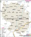
| 51 | Vidisha | Vidisha | 1873046 | 22.85% | 965 | 62.7 | 7362 | 198 |
Last Updated on : June 25, 2025